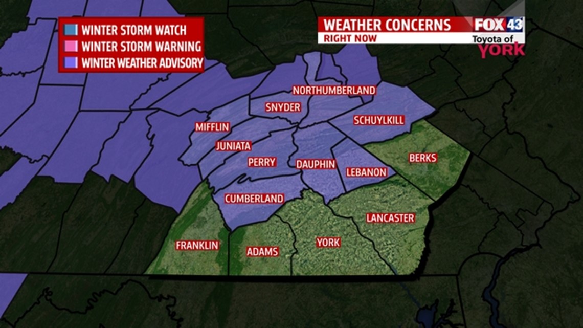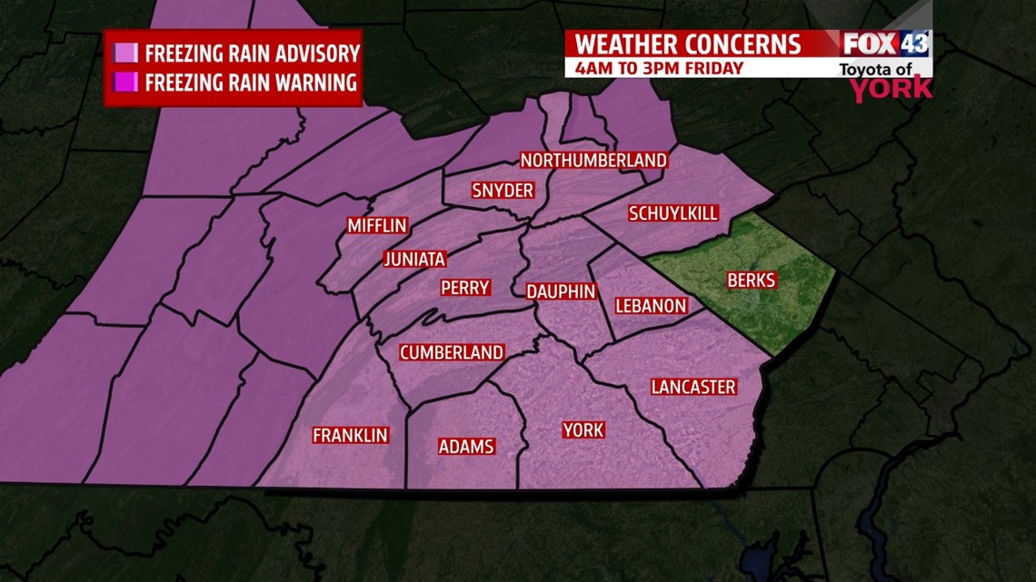

The NATIONAL WEATHER SERVICE has issued a FREEZING RAIN ADVISORY for the area tomorrow morning from 4am to 3pm. A storm system moving in from the southwest will likely start as snow but as warmer air in the upper levels streams in and surface temps remain at or below freezing, there is a concern for a period of freezing rain which may cause a glaze resulting in slick conditions. This is a fast moving system and should exit quickly leaving very little in the way of accumulations.
This will impact traveling, roads that are untreated as well as highways.


LIGHT SNOW FOR AM COMMUTE
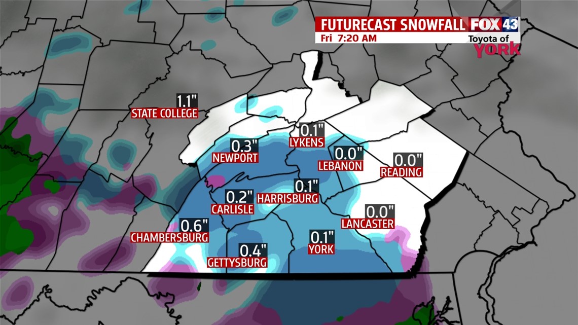
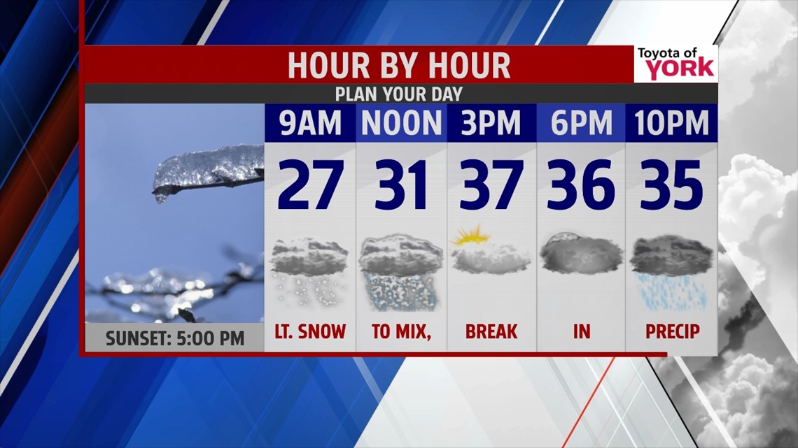
After a beautiful day courtesy of high pressure, the clouds are rolling back in ahead of the next system. The clouds will slow temperatures from falling and lows will be better than they have been all week anywhere from 22° to 27°. Light snow will develop towards morning and as warmer air rides in above the surface, we may see a change to freezing rain then briefly rain as surface temps rise above freezing before we get a break in the precipitation after lunch time. A coating to an inch at most is possible of snow, very little ice is expected but it could be enough to cause a glaze and slick conditions briefly during the late morning hours.


BREAK IN PRECIPITATION
We get a break between systems for the afternoon Friday. Mostly cloudy skies and highs in the upper 30s with a light southerly breeze will end the week. Showers return in the evening and overnight period and will stay with us on and off through the day Saturday. Highs Saturday will range from the upper 40s to low 50s but a cold front crossing the area in the evening will bring our temperatures down a bit for Sunday. It looks as if we dry out for the second half of the weekend with highs still above average in the middle 40s.


COLDER AIR RETURNS
It looks like above average temperatures continue into Tuesday at which time a digging trough brings colder air to the east coast. There may be a few rain or snow showers during the day as temperatures fall through the afternoon. We are back to the 30s by Wednesday and Thursday.
MaryEllen Pann, Chief Meteorologist
Like me on Facebook: maryellenpannfox43
Follow me on Twitter: @MaryEllenFox43
