
We’re entering the twilight of the winter season, so I thought, “hey even though we’re almost done with these, I need a blog topic. So, let’s talk about ranges.” Snow ranges! Why do we use a range of inches to talk about snowfall?
Maybe a better question is, why do you all jump on the highest number of a range?
So, let’s go: Why do we use ranges?
Snow is made up of liquid. The more liquid, the more snow. Moisture for snow… good. More moisture does often bring warmer temperatures, though. Warmer temperatures… bad for snow.

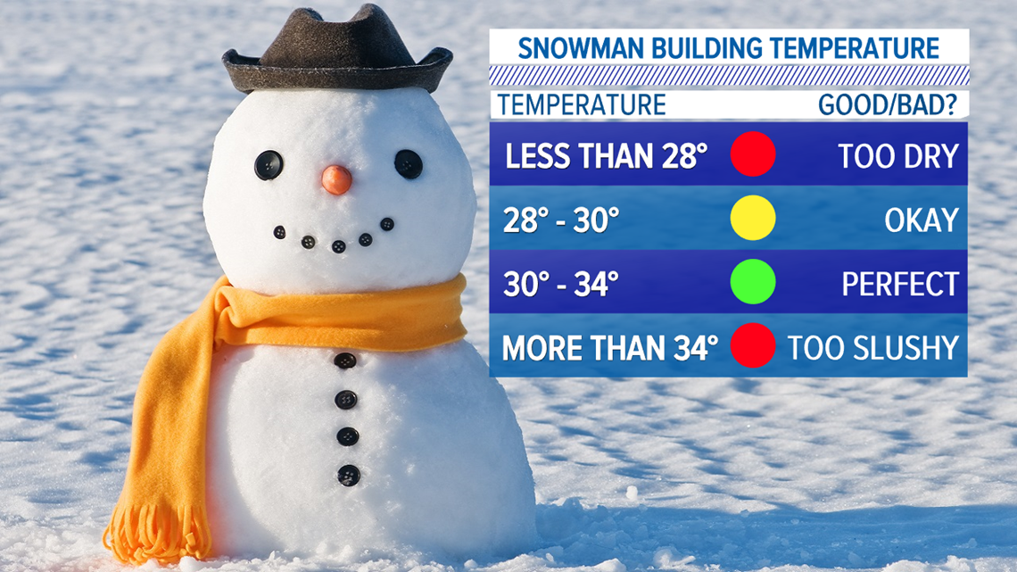
You know how we talk about a “dry snow” and a “wet snow?”
"Wet" snow = "Good for snowmen!"
"Dry" snow = "I can't do anything with this."

The words “dry” and “wet” are key here. It’s all about water content.
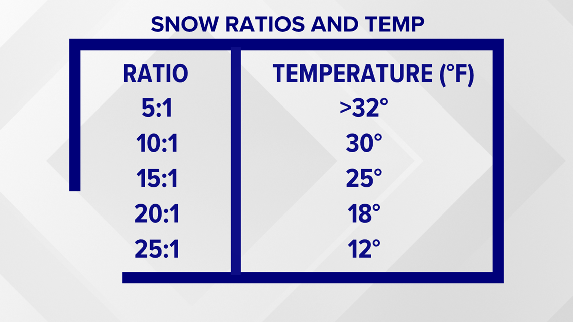
First of all, all of this is moot if the temperature isn’t below 32 degrees. But it’s the amount of water and the temperature that make a snow ratio. That ratio then helps determine accumulation.
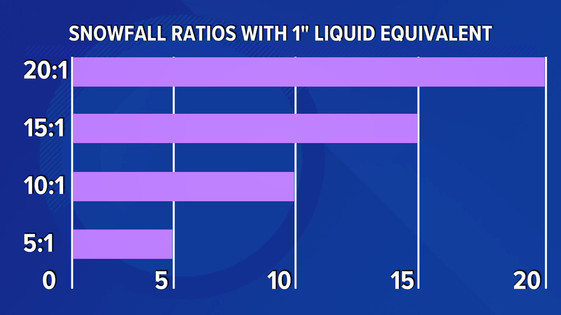
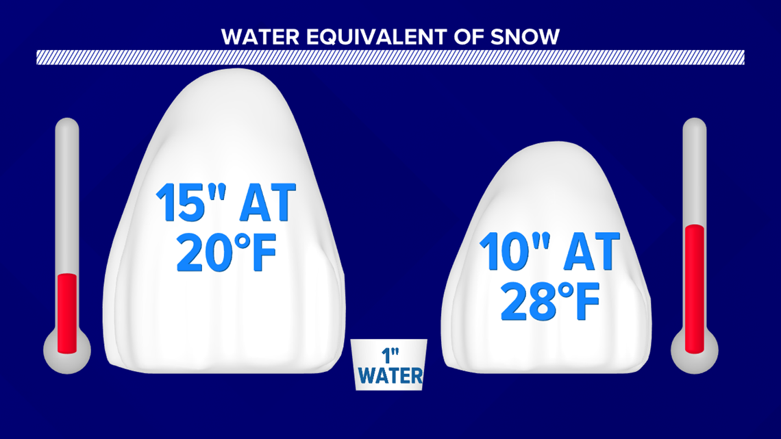
A snow ratio is simply how much liquid would come out if you melted the snow.
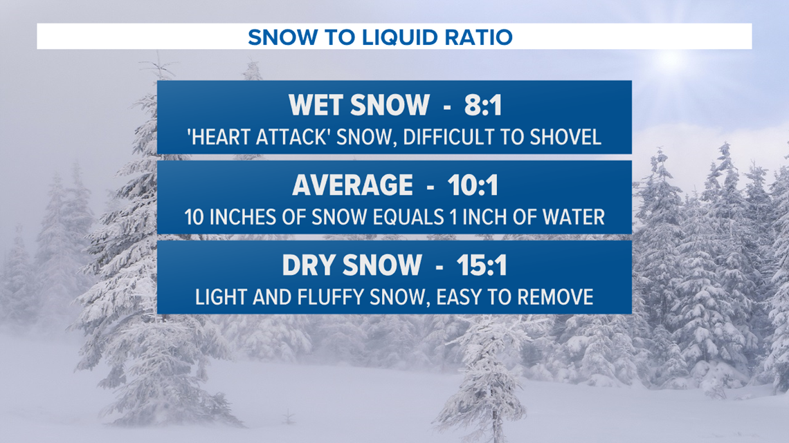
The industry standard is 10:1 (10 inches of snow for every one inch of liquid water). But these ratios can change. They could be 7:1 if temperatures are warmer or 20:1 if temperatures are in the teens!
Back to the dry snow. Dry means lower water content, but drivehigher snow ratios. Drier snow means the snow crystals have a lower likelihood of sticking together. The air tends to be drier when the temperatures are colder. That's when we get those 15:1 or 20:1 ratios.
A wet snow is the opposite. More moisture, flakes stick together, we get 10:1 or lower ratios. That tends to happen with warmer temperatures. This density, though, tends to make conditions a bit more dangerous for travel and such.

What does this mean for our ranges?
Well, we have to factor in that temperature profile and examine what’s called a Quantitative Precipitation Forecast (QPF) -- essentially, how much snow.
That temperature profile helps determine the snow ratio. Say we call for a 10-inch snowfall amount because we think the snow ratio is going to be 15:1. But it turns out that the snow ratio is closer to 10:1. All of a sudden, you’re getting six inches or more just based on that alone.

It’s this uncertainty that causes us to use ranges. It takes very little liquid in the atmosphere to change snowfall totals by a matter of inches. We also have to factor in if the snow will melt on contact with the ground-based on previous soil temperature and soil moisture.
And don’t get me started on mixing, how close the “Battle Zone” of the mixing line shows up, and more.
Even with a range, we can miss the snowfall totals. That’s because it’s complicated. Meteorology is one of the youngest, most dynamic sciences around. Particles don’t always react like we expect them to, and they certainly have more variability than in some other sciences. The more research, the more funding into modeling *cough cough*, the more we learn about how to better predict our atmosphere.

Hope this helps you better understand the dynamics of all things snow!
Until next time,
-Chief Meteorologist Bradon Long