PENNSYLVANIA, USA — Of all of the different types of weather that Mother Nature can throw at us, from hurricanes to severe thunderstorms and more, winter storms are more often than not the most complicated, large, and widespread storms.
Why?
I spoke with a Warning Coordination Meteorologist at the National Weather Service in State College about it.

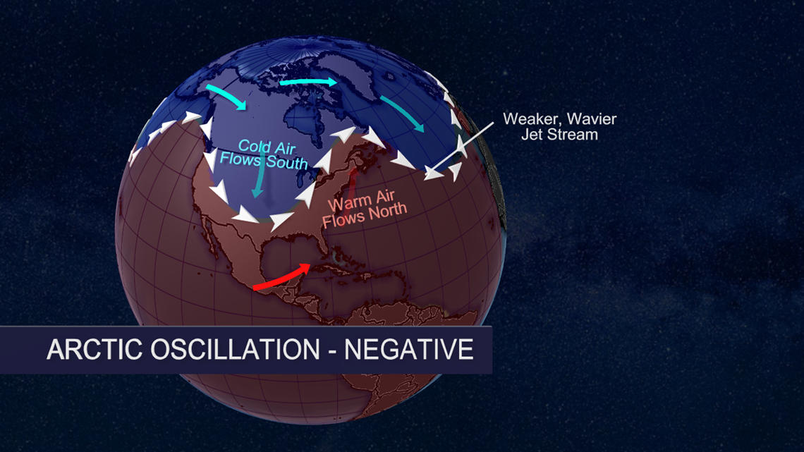
Short answer: It’s all about temperature.
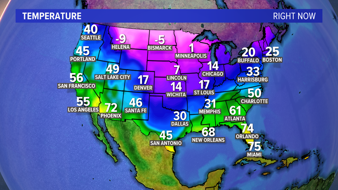
During the summer months, temperatures in the south may be in the 80s-90s-100s, but up toward the northern tier of the U.S., we still hold up in the 60s and 70s.
But the winter months?
“Florida may stay in the 70s. The Dakotas or even in Maine, we’re talking negative temperatures,” Jonathan Guseman said.

You can find more of my conversation with Jonathan up above in the video.
Think of it like this, though. Temperature can help affect everything, from moisture content to pressure, which in turn affects winds and more. It’s the butterfly effect-like thing again: one thing affects the next, which affects the next.
And if temperature affects pressure, the air from an area of higher pressure wants to, for lack of a better term, relieve itself. Like a stubborn mother or father, it wants that pressure off of its back! So, it seeks that area of low pressure. The bigger the difference, the quicker that air rushes to low pressure to fill the gap.

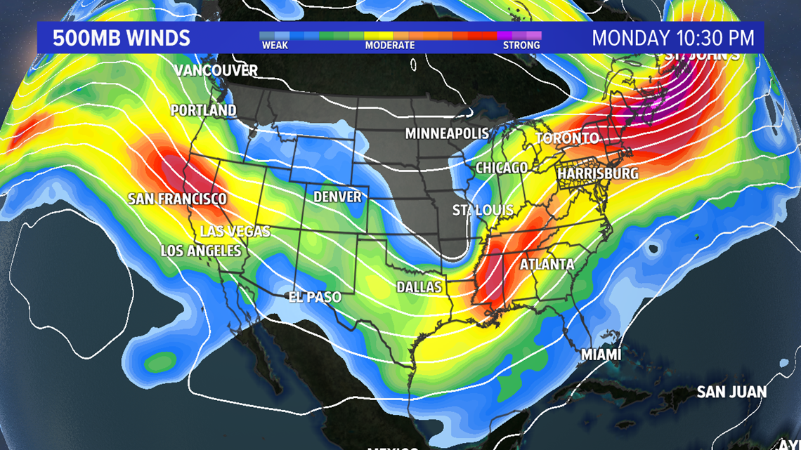
The bigger difference in temperature, the bigger difference in pressure, which leads to a bigger difference in winds. The more instability caused by those differences, the stronger the complex of storms overall – and not just locally, like in severe thunderstorm setups.
And that brings us to our more active late January-February setup so far this year. The coldest air of the year moving in just after Valentine’s Day caused by a breakoff of the Polar Vortex. Yes, that Polar Vortex.
“Polar Vortex has always been there. What happens in the summertime, it’s weaker overall,” Guseman said.

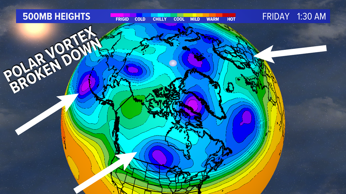
By weaker, he means that the pressure differences and winds are weaker. So, the vortex is more confined to the north. It relies on higher winds, more of a stirpot mess of an atmosphere, where a chunk can break off and dive south. That’s happening right now across the Midwest, and it will hit us with a glancing blow after Valentine’s Day on Sunday.
The dip in the Polar Vortex also dips the northern branch of the Jetstream. The jet is divided into branches itself. Usually, we’re dealing with the southern branch when we have storms hit us. It pulls moisture from the Gulf or Atlantic, brings it up to us when the jet is overhead, and gives us a more active pattern.
But as the northern jet pulls that cold air down, it usually brings bitter cold, windy, dry air into our region. That when we usually get those -10° dangerously cold wind chills.

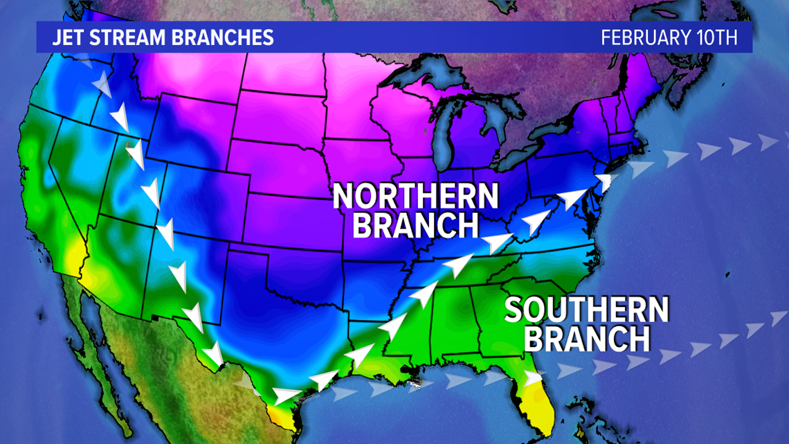
This next setup, though, is a bit different. The southern jet is still nearby for our area as well. We’re caught in that pattern through next week, which means cold air and moisture both will be nearby.
That’s why we’ve seen a more active pattern in the past couple of weeks, and why we’ll see several more storms before the month is up.
Stay warm! Find the latest information to the Weather Smart Forecast and the FOX43 app.
-Chief Meteorologist Bradon Long

