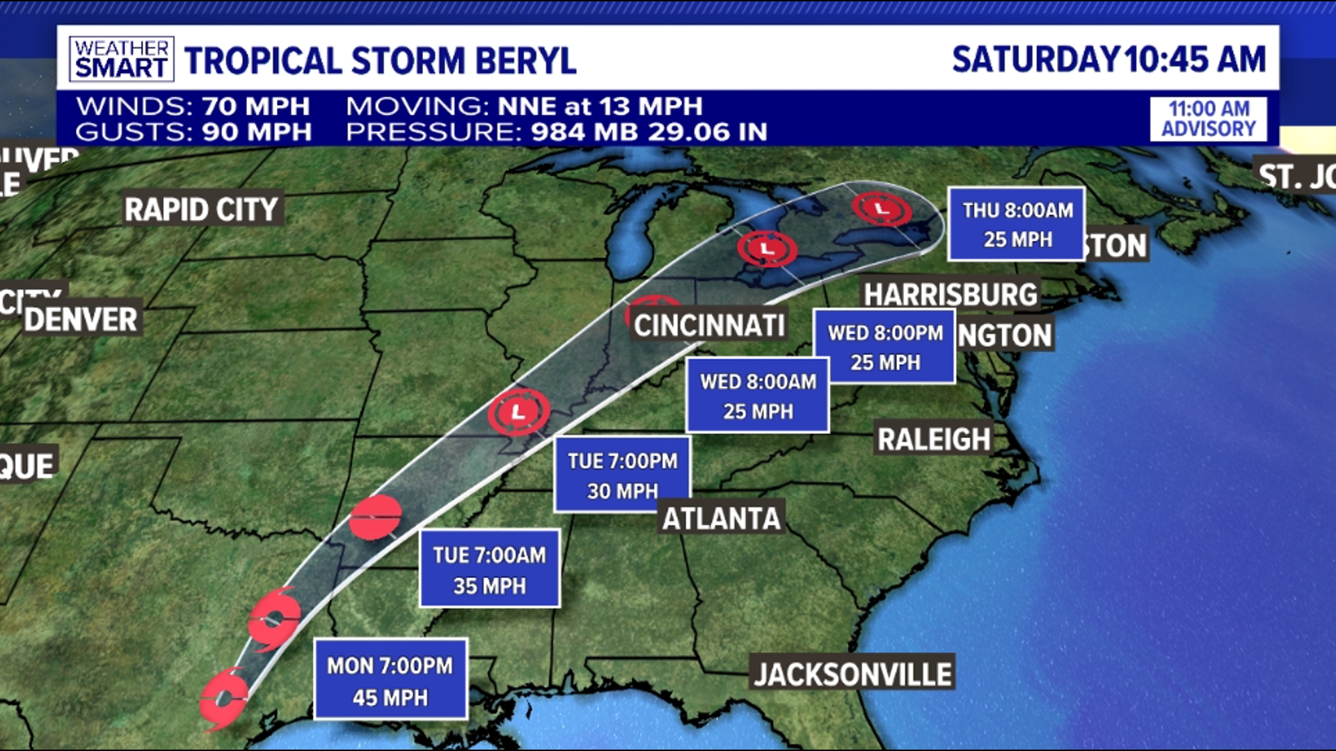
PENNSYLVANIA, USA — Beryl made landfall as a Category 1 Hurricane along Texas' Gulf Coast early Monday morning.
While the tropical characteristics of this storm will weaken as it lifts north across the country, the remnants of Beryl will continue to bring tropical moisture to the central and northeastern United States.
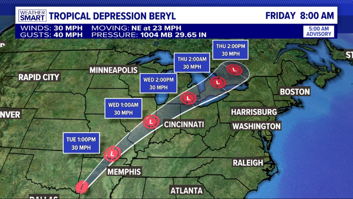
The latest forecast track as of 5 a.m. Tuesday from the National Hurricane Center has now Tropical Depression Beryl continuing to weaken into a post-tropical storm through the afternoon. The remnants of this storm will get picked up by an incoming cold front and will lift northeast through the Ohio Valley and north of Pennsylvania through the end of the week.


While the center of low pressure will stay to our northwest, we are expecting storms in association with this system Wednesday afternoon and overnight that will be enhanced by this tropical moisture.


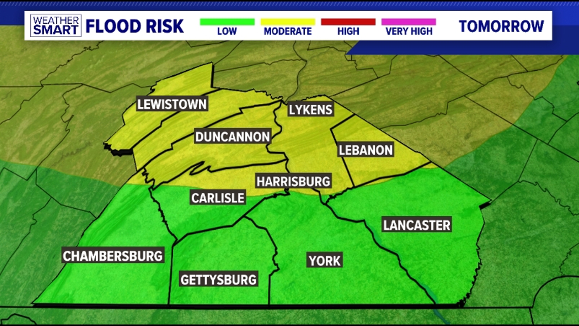
Storms could bring heavy rainfall that leads to some flooding concerned. Areas around Harrisburg and north are under a moderate risk for flooding, while points south of the Turnpike are under a low risk for flooding. We could see isolated areas pick up an inch of rain or more with heavier storms.


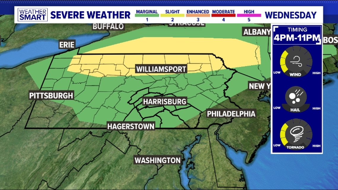
When it comes to any thunderstorm activity, the Storm Prediction Center (SPC) has outlooked northern Pennsylvania under a level 2 risk for severe weather. Almost all of South central Pennsylvania is under a level 1 risk for severe weather. Wednesday will start off dry, but between 4 pm and 11 pm we're expecting a line of storms to move west to east through the area. The biggest concern with storms as they push through is damaging wind gusts as well as a spin up tornado risk.

