x
Breaking News
More () »

Hurricane Tracker: Radar, spaghetti models, forecast cone, timeline and more

Milton is expected to hit Florida as a major hurricane.

JACKSONVILLE, Fla. — Here are the latest tropical track and satellite radar associated with Milton. For the latest analysis and forecast from First Coast's Most Accurate Weather Team, click here.

Tropical Track

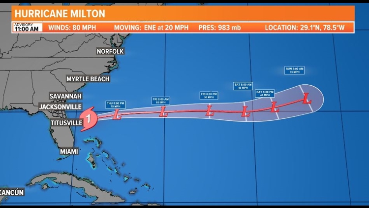
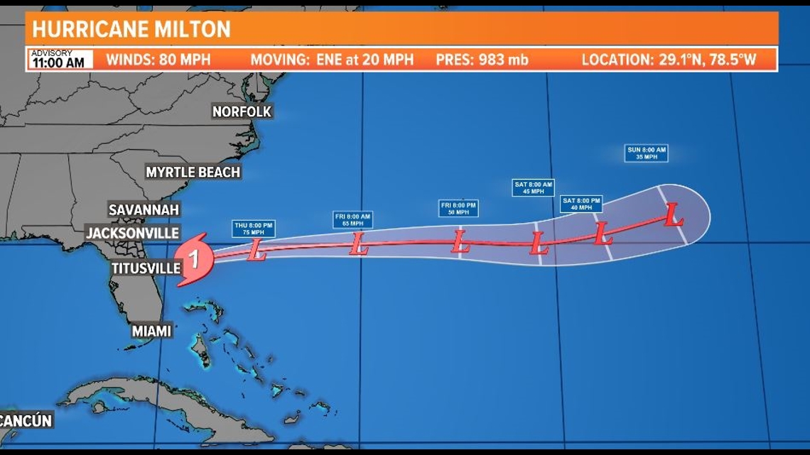
This is the latest forecast cone, which shows an area where the center of the storm could go, when and how strong it might be at the given time.

Credit: WTLV
Credit: WTLV

Interactive Radar

The latest satellite and radar image for the Gulf of Mexico, the Caribbean Sea and the Atlantic Ocean. 
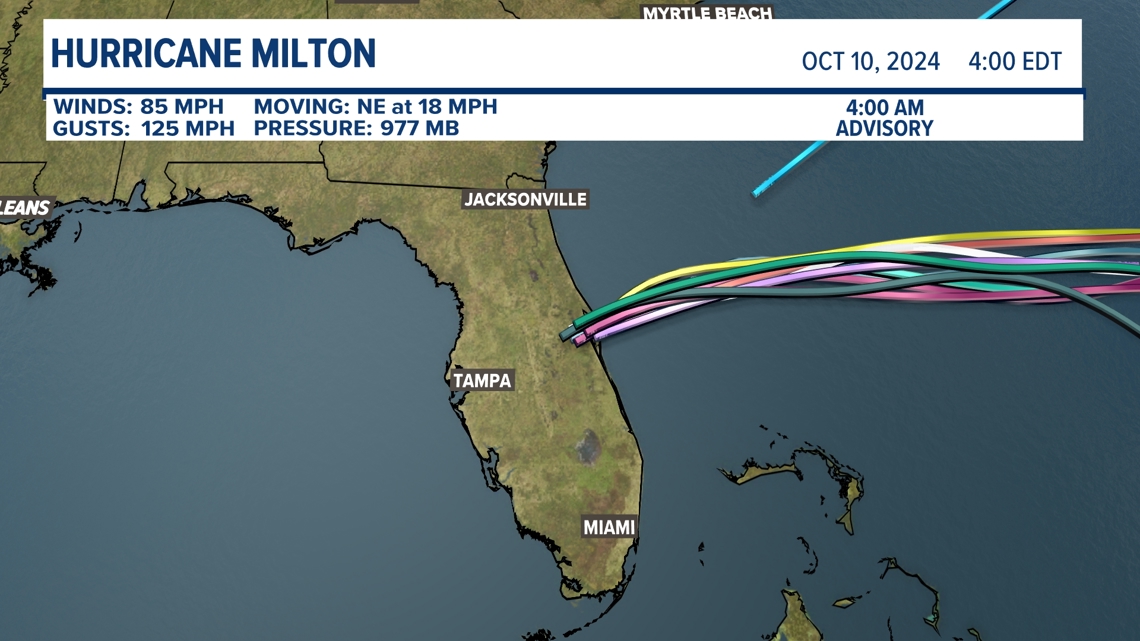
Spaghetti Models

Each line represents a computer model's best "guess" of where the center of the storm will go. Together, they resemble spaghetti.

Credit: First Coast News

Current thinking on timing

Milton is expected to make landfall Wednesday night, then move across the state and exit into the Atlantic by Thursday evening. 

The weather will go downhill for the First Coast Wednesday evening. The worst hours for our area right now look like 7pm Wednesday to 7am Thursday. This timing is subject to change with any speed or track shifts from Milton, so please check back in on this.

Credit: WTLV

Before You Leave, Check This Out