PENNSYLVANIA, USA — Editor's note: The above video is from Aug. 15.
The latest projections from NOAA’s Climate Prediction Center show a La Niña pattern is projected to return to the United States, potentially impacting central Pennsylvania's 2024-2025 winter weather pattern.
Though ENSO-Neutral conditions continued during the month of August, the Climate Prediction Center has forecast a gradual transition to La Niña conditions through November, which will continue through early 2025.
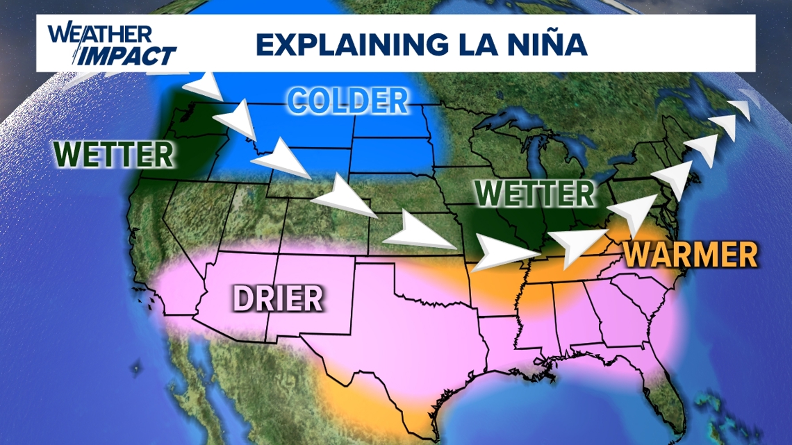
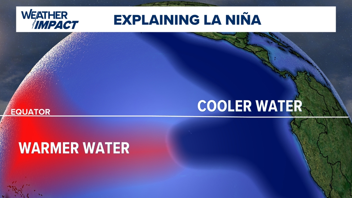
ENSO-Neutral indicates near-average sea surface temperatures observed across most of the equatorial Pacific Ocean. A La Niña pattern differs in that the trade winds along the equator will strengthen, pushing warmer ocean waters west towards Asia. This allows cooler than average temperatures to rise to the surface along the west coast of North and South America.

This change then shifts the jet stream northward, leading to the potential for wetter than normal winters around the Great Lakes Region, and warmer and drier than normal winters along the south and southeast. This same setup could lead to colder and wetter conditions along the United State’s northwestern tier and Pacific Northwest as well.
The Climate Prediction Center has noted that this La Niña may be weaker than La Niñas in the past and could lessen the overall impacts mentioned as a result.
There are no guarantees, though, and plenty that could change throughout the season based off of different atmospheric patterns that develop, especially for our area. Stay in the know with your FOX43 Weather Impact Team as they track what’s to come this winter.