UNITED STATES, — The National Oceanic and Atmospheric Administration (NOAA) released the Climate Prediction Center's U.S. Winter Outlook for the 2024-2025 Winter Season.
A La Niña pattern is expected to slowly emerge in the Pacific Ocean through the rest of fall, and that's expected to play a prominent role, especially with the precipitation that is forecast.

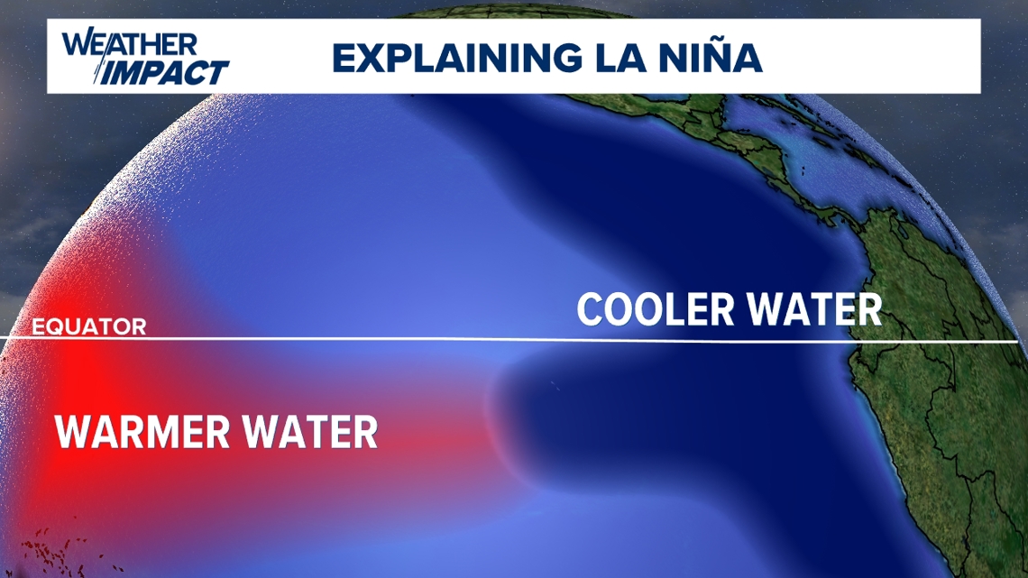
Cooler-than-average sea surface temperatures along the equatorial waters of the Eastern Pacific mark a La Niña pattern. This has global impacts, especially here in the U.S. You may be familiar with its counterpart, El Niño, another pattern that heavily impacts the nation's seasonal forecasts.
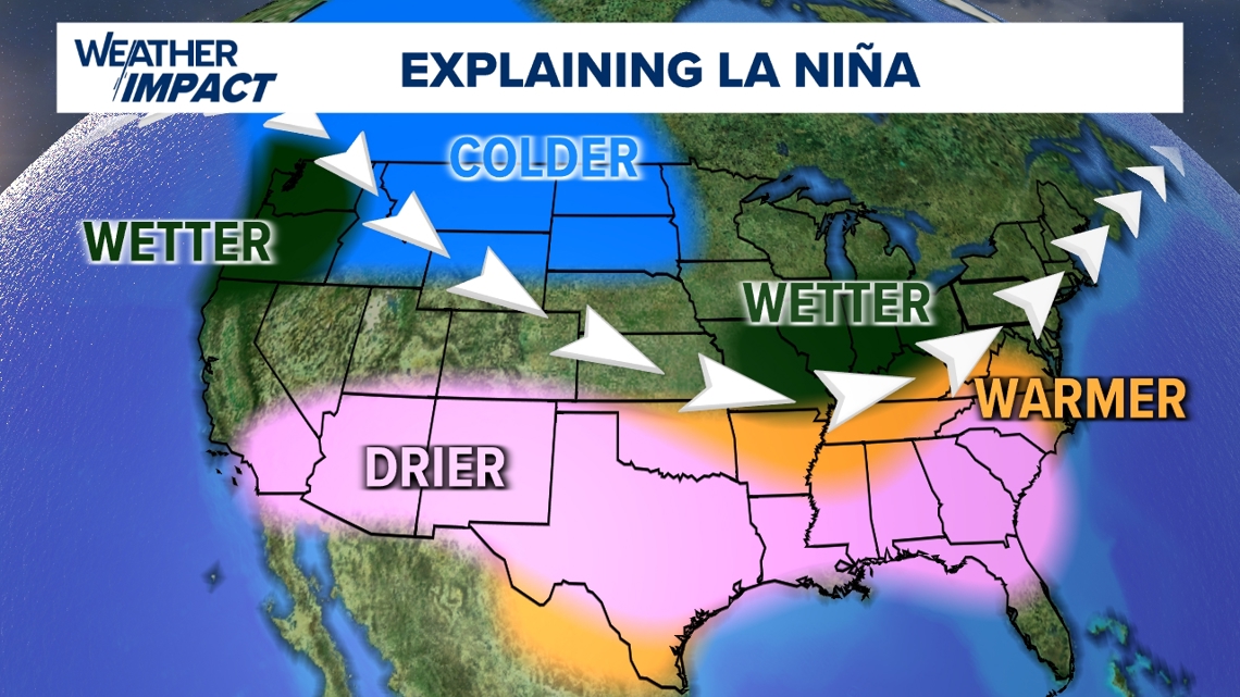
La Niña winters favor drier and warmer conditions across much of the Southern U.S. The storm tracks tend to favor the northern half of the nation. This usually brings more precipitation to the Pacific Northwest, Great Lakes, and the Ohio Valley. Colder-than-average temperatures will prevail in the Northern Rockies and the Northern Plains.

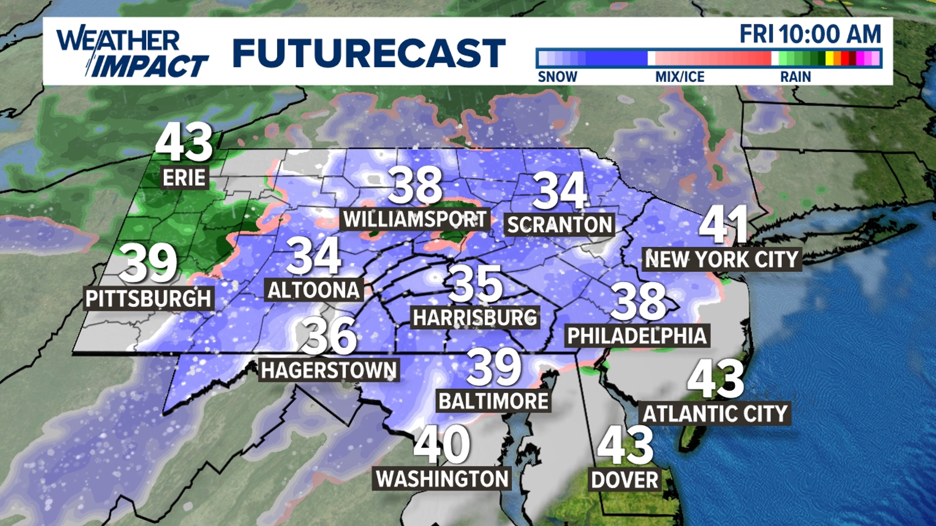
Here in Central Pa., the storm track is usually to the west and north, and this can lead to storms that produce primarily rain or mixed precipitation (snow, sleet, freezing rain, and rain) instead of all snow. Temperatures usually lean milder too. Brief, potent bursts of arctic air are still possible, but have a more difficult time settling into the Commonwealth.
NOAA's temperature outlook reflects the classic La Nina expectations. It calls for below-average temperatures from the Pacific Northwest through the Northern Plains. Above-average temperatures are favored from the Desert Southwest through the Deep South, and up the East Coast too.

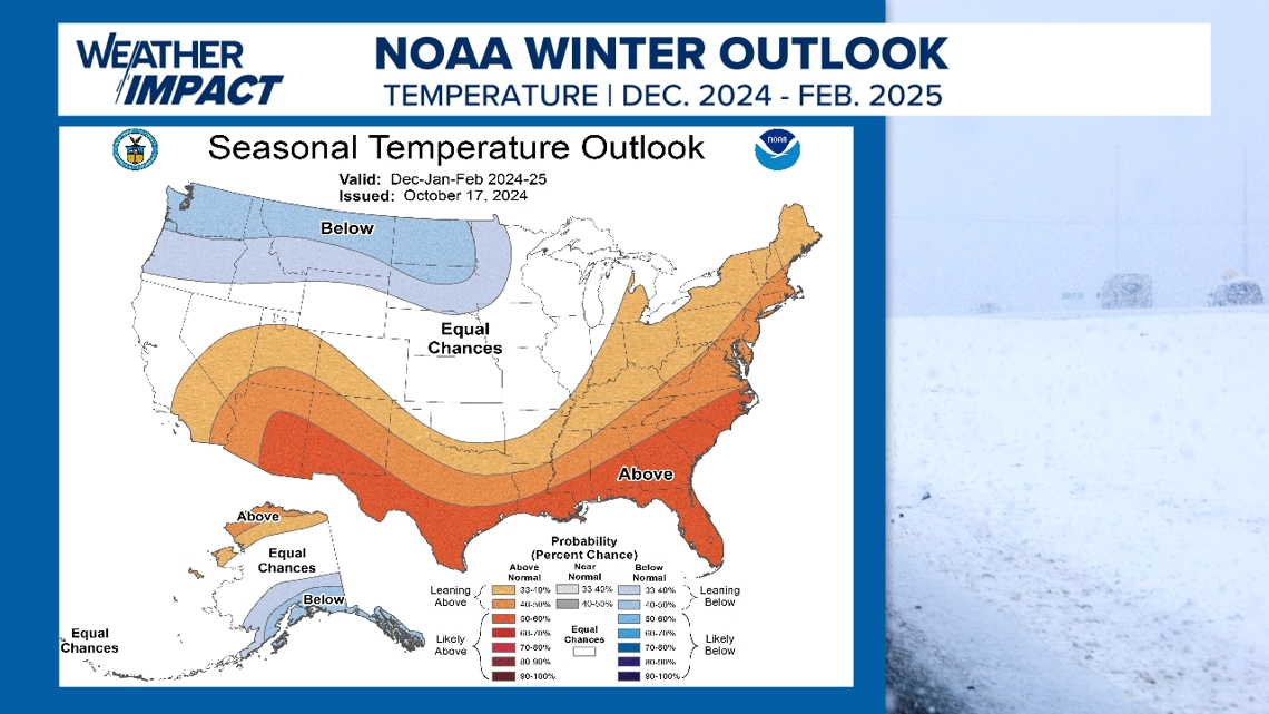
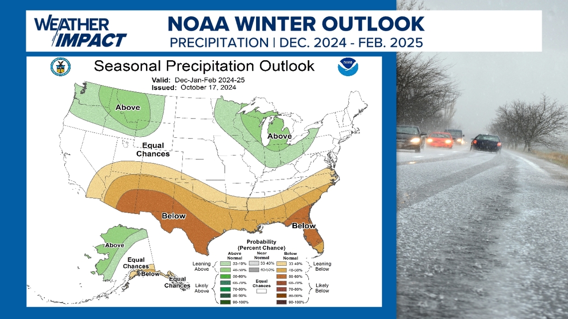
NOAA's Winter Precipitation Outlook leans on the wetter side from the Pacific Northwest to the Northern Rockies, much like typical La Niña expectations. Above-average precipitation is also anticipated in the Great Lakes Region and the northern Ohio Valley. This could help alleviate drought conditions in all of those regions.
Drier-than-average conditions accompany the warmer outlook along the Desert Southwest and the Deep South. Drought conditions in the Southern Plains are expected to continue or worsen in those parts.

What does this mean for how much snow Central Pa. can expect this season? Stay tuned!
The FOX43 Weather Impact team will be crunching through the data in the weeks to come and have a more personalized, detailed forecast for the area! Expect it by mid-November!