YORK, Pa. — This week marks Severe Weather Awareness Week in Pennsylvania. Acknowledged by the National Weather Service (NWS) and the Pennsylvania Emergency Management Agency (PEMA), the week aims to help Commonwealth residents prepare for severe weather as they enter the spring and summer seasons.
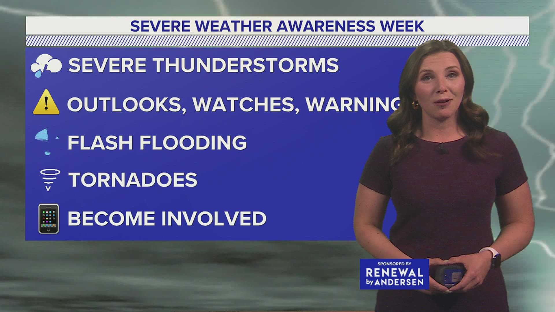
Severe Weather Awareness Week is broken down into five different topics:
1. Severe thunderstorms
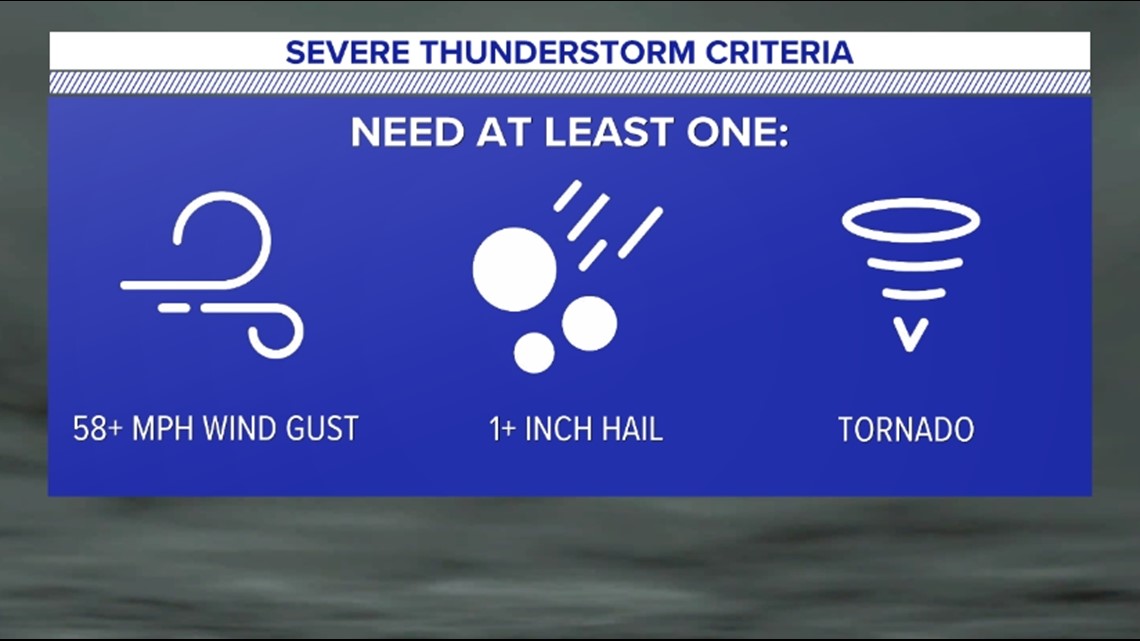
Thunderstorms can always be strong and destructive, but they do not receive a "severe" label until they meet one of three different criteria. A severe thunderstorm has either 58 mph wind gusts or higher, hail of 1 inch diameter or greater, or a tornado.


2. Outlooks, watches and warnings
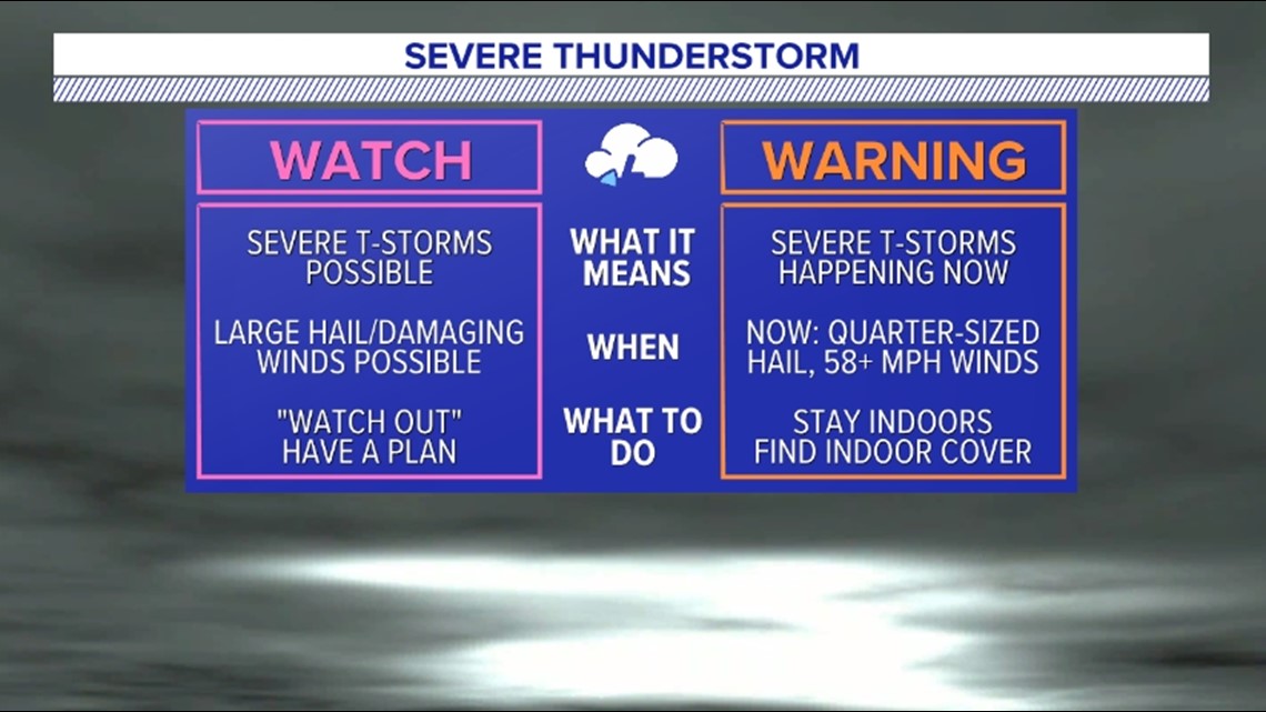
Another key to being safe during severe weather situations is understanding the meaning behind different outlooks, watches and warnings that are issued.
When severe weather is in the forecast, the Storm Prediction Center will issue different weather outlooks up to three days in advance. The scale goes from a marginal risk (1 out of 5 risk, isolated severe weather expected) to a high risk (5 out of 5 risk, widespread severe weather expected.)
Once severe weather is more imminent, the National Weather Service in State College will begin issuing severe weather watches and warnings. A watch is when the ingredients are in place and severe weather is expected soon. A warning means that the severe weather is either taking place or about to happen.


3. Flash flooding
According to the NWS, more people are killed by flash floods than by any other storm-related weather risk. Most of these deaths are from people driving their vehicles into flooded roadways. If you are out and about during bad weather and come across a flooded roadway, the advice is always to turn around, don't drown.
The National Weather Service even made a music video with the slogan if you need another way to remember!
4. Tornadoes
Pennsylvania is no stranger when it comes to tornadoes. In fact, the NWS says Pa. ranks in the top 25 for tornado occurrence in the United States, averaging sixteen tornadoes per year.
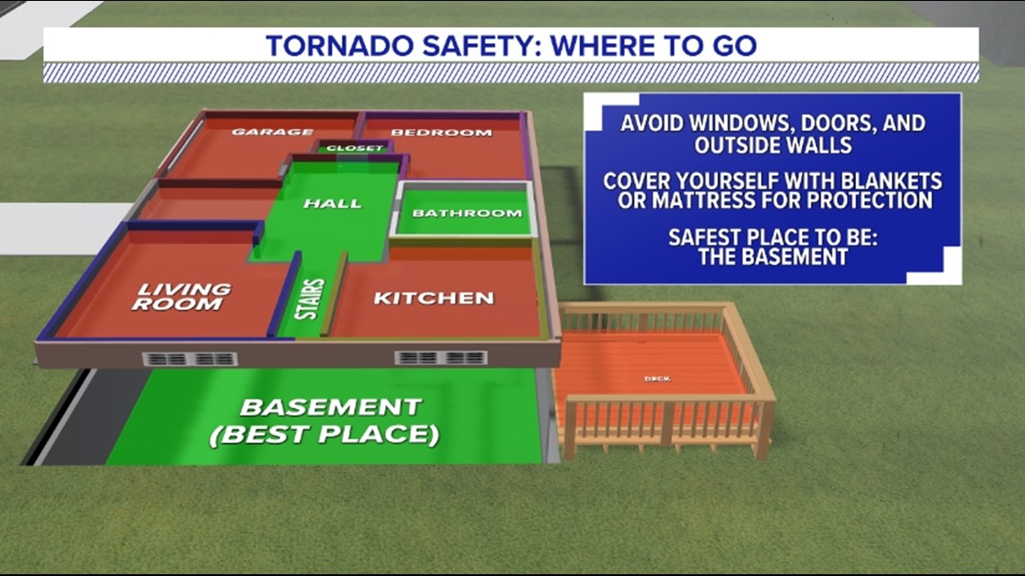
If a tornado warning is issued for where you are, your phone will automatically send you a notification warning you of the danger. When you receive that notification, the best place to go and keep safe is the lowest level of your house, preferably a basement. It's important to avoid windows, doors, and outside walls. Additionally, covering yourself with blankets or a mattress will help protect yourself.


If you live in a mobile home and know that the threat of tornadoes is in the forecast, it's best to find shelter or go to a more permanent structure to stay safe before storms develop.
5. Become involved
One of the best ways to help identify and report severe weather to the NWS is to become a Skywarn Spotter. These are volunteer weather spotters trained to both help identify storms that could become severe and report on different weather phenomena. The NWS periodically offers classes to train spotters.
Organizations can also help keep their members and community safe by becoming joining Weather Ready Nation. These are ambassadors who create outreach content, collaborate on disaster preparedness and incorporation weather and climate information into their decision making.
Don't forget to send in any storm reports, photos or videos to FOX43 using the FOX43 app Near Me feature! That helps us see where storms are and can help us best tell the weather forecast so others can be prepared as well.

