HARRISBURG, Pa. — Will we spend more of our hard-earned money on snow supplies this winter?
Or will Mother Nature help keep our wallets a little fuller, and warmer?
The FOX43 Weather Impact Team has the answer!
But before we look ahead, let’s look back to last season and see how we did with our 2023-2024 Winter Outlook.
Overall, we hit our key ideas.
We forecasted a range of 17-to-27 inches for Harrisburg, and Harrisburg ultimately got 18.7 inches.

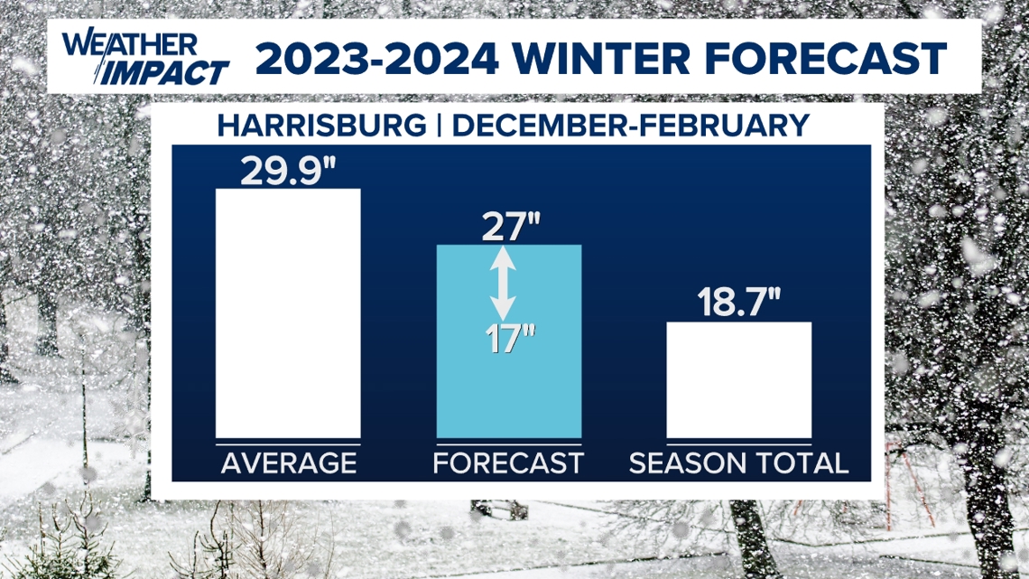
We knew the switch to a strong El Nino would help us a little more with snowfall than the very meager 2022-2023 season, where we only got 5.9 inches.
We also expected a weaker polar vortex to help set us up for more snow by giving us those needed bursts of colder air.
Harrisburg International Airport narrowly missed some higher snow amounts from two February storms, and we believe this is why we fell in the lower end of our range.
Temperatures were also above average as expected, but we could have been more aggressive.

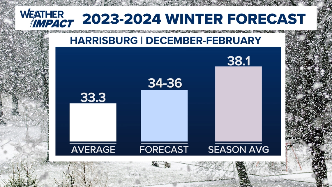
We called for the average seasonal temperature to be 1-to-3 degrees above average, and we fell short just under 2 degrees, meaning it was even milder than we expected.
Looking ahead to the 2024-2025 season, there are some big differences that heavily impacted our temperature and snow predictions this time around.
This winter, we’re shifting back to a La Nina pattern.
To review, this is a cooling of the equatorial waters of the Pacific Ocean.

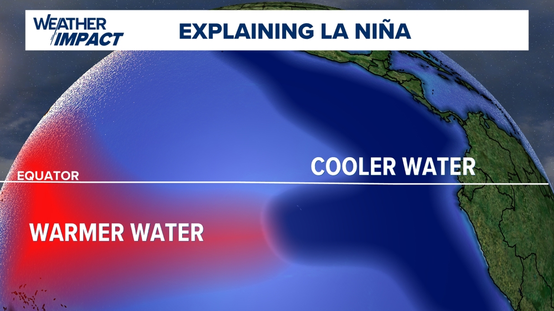
This usually brings milder temperatures to the east coast and forces the storm track through the Great Lakes and Ohio Valley.

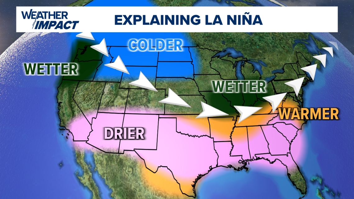
Much more often than not, it leads to below average snow for Central Pa.
Other big-picture patterns we follow indicate less snow too.
You’ve heard us talk about the Pacific Decadal Oscillation the last few years.
It’s still in a strong negative phase, so cooler waters remain off the West Coast.

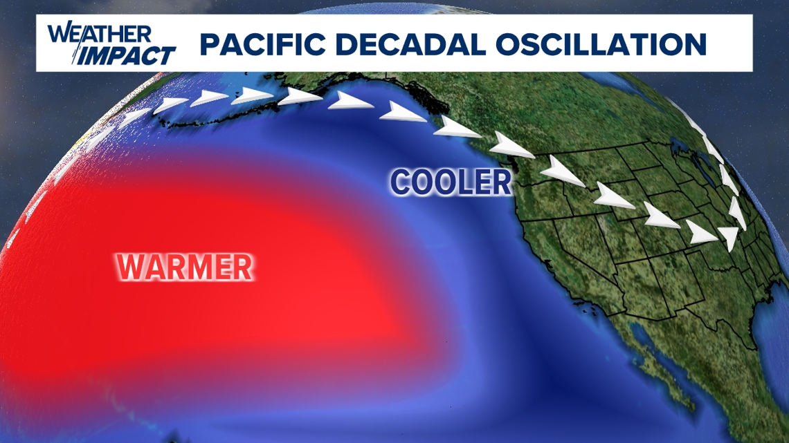
This favors cooler, unsettled conditions across the Western U.S., and milder conditions for us along the East Coast.
That also helps keep the storm track and the coldest winter air to our northwest.

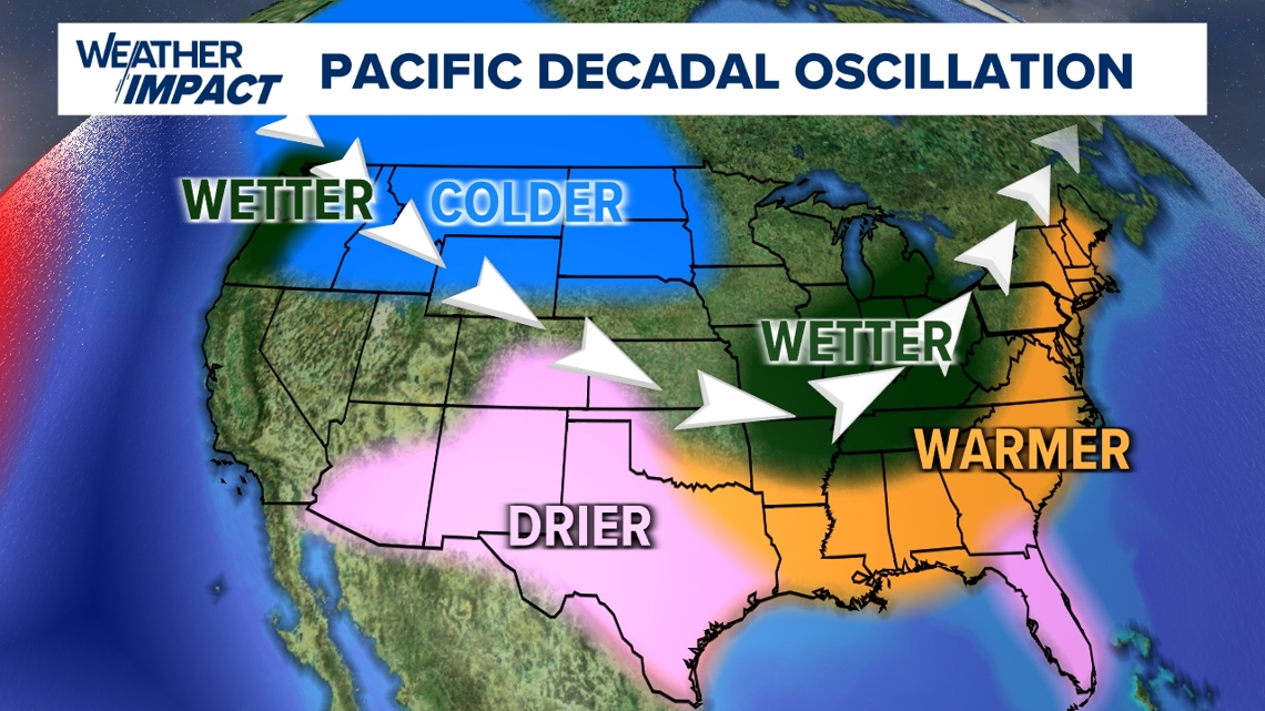
History indicated a potential shift last season, even though scientists can’t predict just yet when these shifts might happen.
The PDO only became stronger in its negative phase this year, so we think that switch is even more unlikely this winter.
We also look at the polar vortex to determine if cold bursts of air are more likely, or if the winter cold stays locked up to the north.
Last year, a weaker polar volar vortex helped us get some longer cold stretches, especially in January.
This year, the odds are even less in our favor.

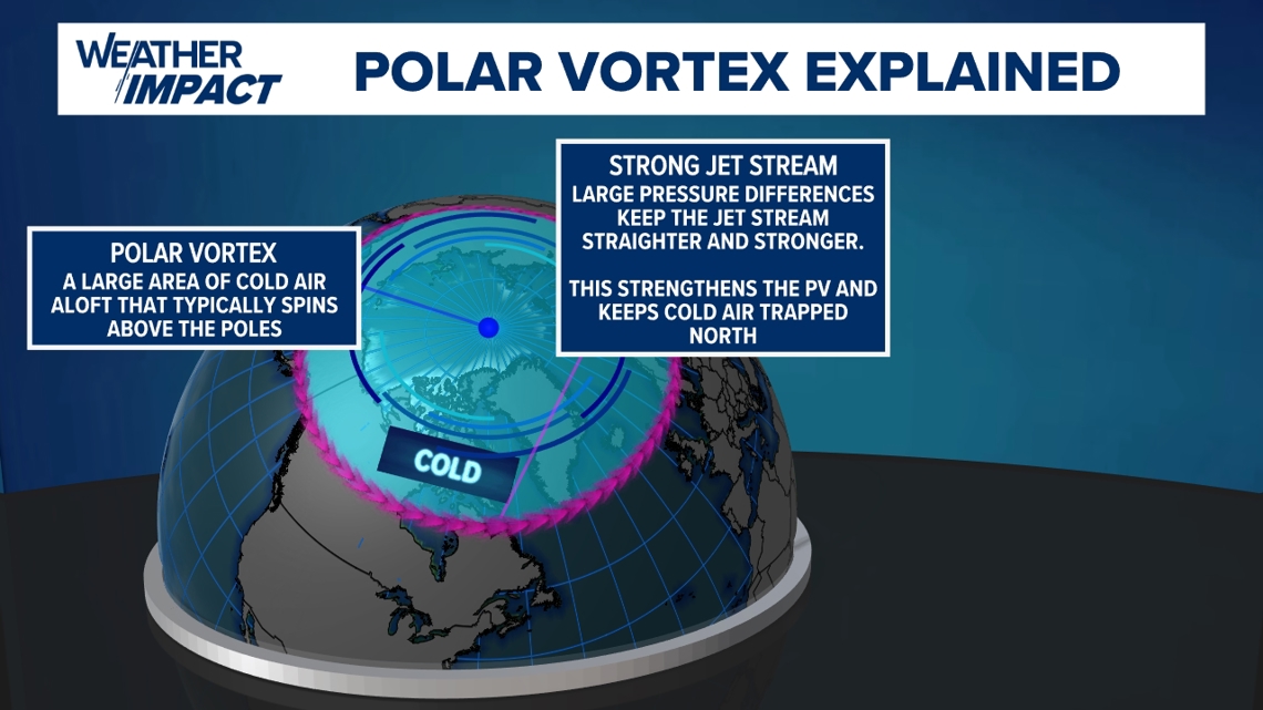
The polar vortex looks stronger this winter, meaning those colder chunks of air we need will be harder to come by, and the ones we manage to get might last only a couple of days at best.
When we put this all together, we expect below-average snowfall yet again this winter, along with above-average temperatures.
Let’s put some numbers on this:
We expect the average seasonal temperature to range about 2-to-4 degrees above average.

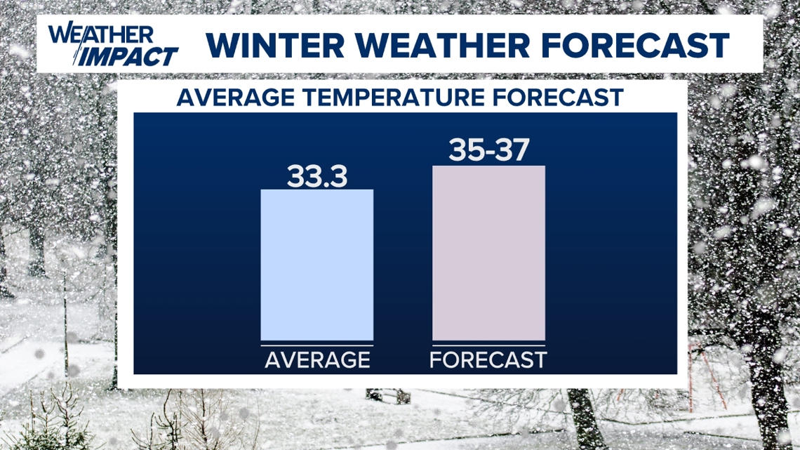
La Ninas are known for mild Februarys, and we think that plays a huge role in the temperature outcome this year.
Since we think it’s another mild winter with the storm track mostly to our west, we expect this to hurt snowfall amounts.
We also think there’s a low chance for a big storm to help us out this winter.
We’re forecasting less snow than last winter, giving us a range of 9-to-19 inches.

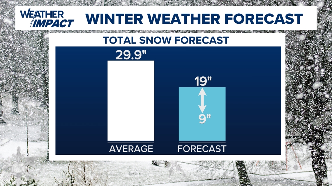
We think this set up brings more of a west-to-east difference in snow totals compared to last year.
So, we’re calling for a bold prediction of 11 inches of snow in Lancaster.
Harrisburg ends up around the midpoint of our range, with a bold prediction of 14 inches.

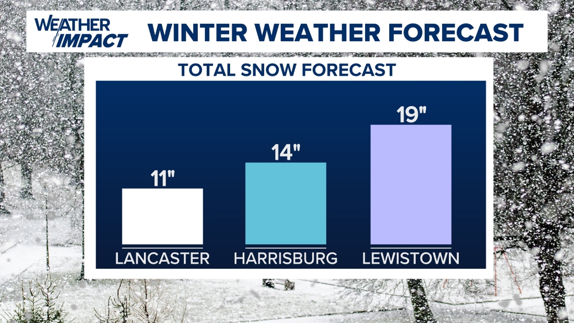
Lewistown has the best chance of getting a favorable storm track and our coldest temperatures, so we’re giving folks there a bold prediction of 19 inches.
But it only takes one big storm to make the difference here!
If a big storm manages to beat the odds, we could end up just outside of our expectations.
As you’ve come to expect from the FOX43 Weather impact Team, we’ll hold ourselves accountable and let you know how we did!
Regardless of the outcome, you can count on our team to keep you safe and prepared for any winter weather impacts this season!
For a more in-depth analysis of the big picture patterns and how they lead to this outlook, check out the FOX43 Weather Impact Team's Winter Weather Podcast here:

