PENNSYLVANIA, USA — Last winter came up short for snow lovers. We know you’re wondering if we’ll see more snow this time around in central Pennsylvania!
Before we look ahead, let’s look back at last season. We forecasted a milder winter with below-average snow, mostly because of a La Niña pattern for the third winter in a row. This was only the third time it’s happened in recorded history. However, it was clear that third-year La Niña seasons feature warm Februarys and below-average snowfall. This weighed heavily on our predictions.
This panned out, but in the name of accountability, Harrisburg fell 10 inches below our 14 to 24-inch range. We knew December was the best chance for a big storm, but it didn’t happen. We allowed for that potential in our snowfall range knowing this could be a tough ask. In the end, we could not get cold air to stay in place enough for much snow.

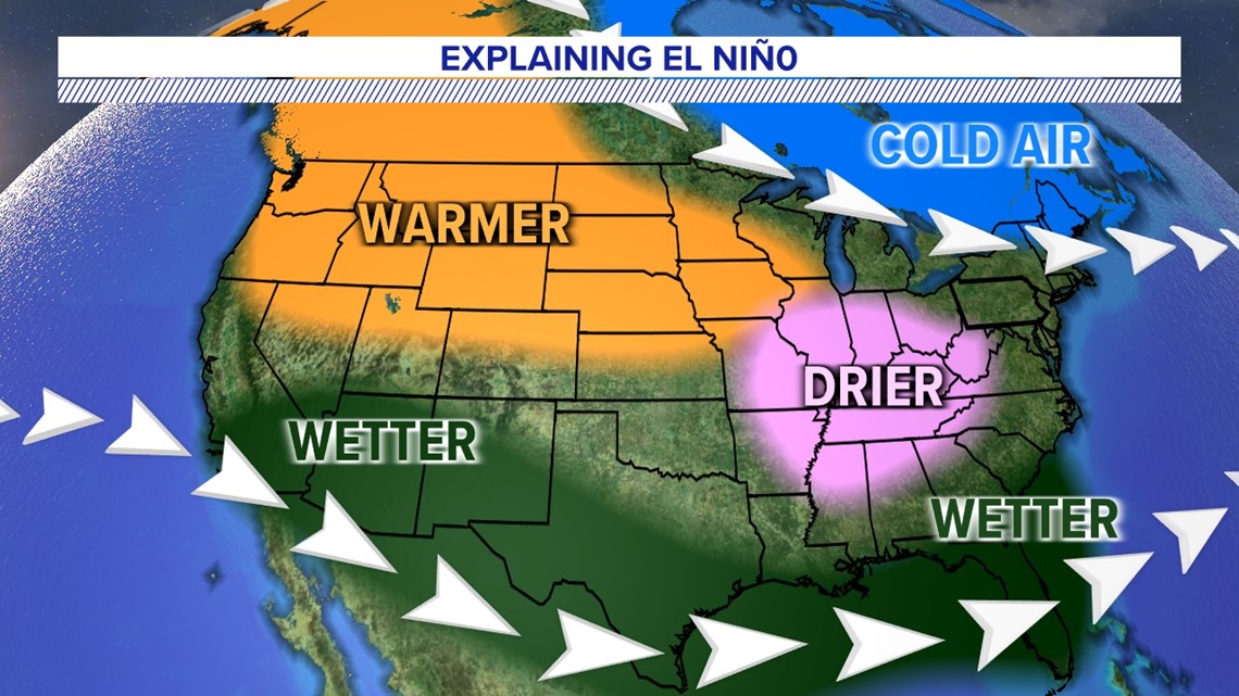
This winter, the setup is very different with the return of El Niño, and the outcome is not as clear as last season. Although that usually means a warmer winter here, it doesn’t always mean less snow. In fact, there have been varying amounts of snow in the last 20 years where a moderate to strong El Niño was present. There’s a lot to unpack when asking, “Why?”

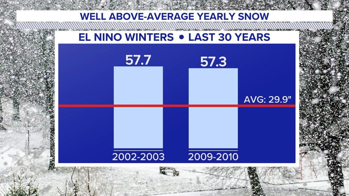
We’ve had two exceptionally snowy El Niño seasons in the last 20 years, with almost 60 inches for Harrisburg! Don’t expect a repeat of that outcome this time around. This outcome can easily be eliminated.
During an El Niño season, the temperatures along the waters of the Central Pacific are warmer than average, unlike the cooler-than-average waters of last year’s La Niña. We’ve learned in our research that where you see the warmest water matters too.

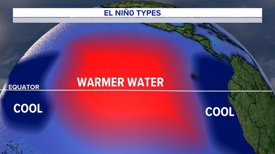

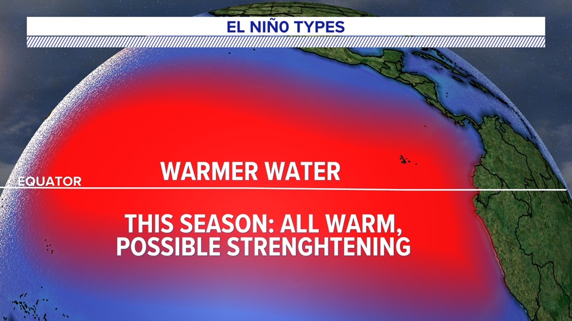
Our snowiest El Niño winters had cooler waters closest to the South American coast and the far Western Pacific. This time, the warmer temperatures are spread all over, which tells us, “Nope!” That was very clear in our analog years. An “analog year” is just a past season we review that has similarities to this season’s setup. It’s common practice to have at least five analog years and use them as a guide to what might be ahead. They are not sure bets, and there are always differences to consider amongst the similarities.

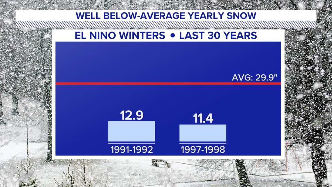
In fact, this El Niño could strengthen further and look more like the 1997-1998 season. It was one of the strongest and disappointed snow lovers! Harrisburg only got 10.5 inches of winter snow. As of this writing, there’s a 30% chance that this El Niño gets that strong. It’s not the most likely outcome, but it still needs consideration.
There are a couple other patterns we looked at last year that could tip the scales away from this outcome, and that’s one of the many reasons not all analog years are exactly the same.

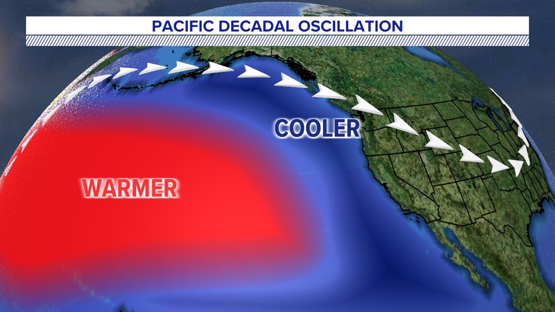
The Pacific Decadal Oscillation (PDO) remains negative. Currently, cooler waters are currently located off the West Coast, and that brings cooler, more unsettled weather to the Western U.S. In the Eastern U.S., this allows for drier and milder conditions. The opposite is expected in the positive phase. Warmer and drier conditions favor the West Coast, while the cooler and unsettled weather is favored more along the Eastern U.S.
History shows a shift could happen around late winter or spring, solely based on timing. El Niño has often helped. If so, colder air from Canada can better connect with storms from late January through February.
However, scientists can’t predict just yet when these shifts might happen. In short, there’s no guarantee. This is one of the strongest negative phases ever recorded. We would need a rather drastic shift, and in similar El Niño seasons, there was some shift in the PDO. However, not one year shifted to the extent that we would need for a more neutral or positive phase. Many are referencing the 1982 to 1983 winter season that featured a similarly strong El Niño. Snowfall from the fall until the spring was a little above average, with 36 inches for Harrisburg. The PDO started in a slightly positive phase in December of 1982 and then shifted a little stronger into the positive phase by February of 1983. We believe it helped make the difference that season.

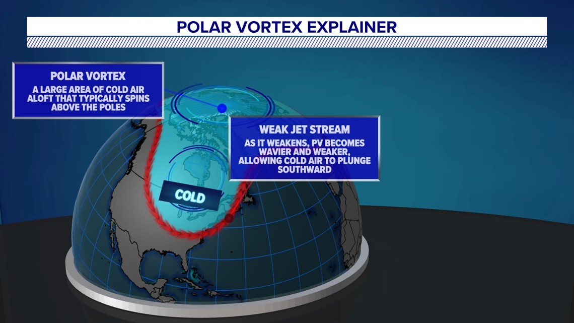
The polar vortex was very strong last winter. This winter looks different. When it’s strong, cold air stays up north at the North Pole. When it’s weak, cold pockets of air break off and can travel to the Northeast. We’re expecting more breaks of cold air by early to mid-January, but they have to reach us. That’s where a shift in the PDO could help us out. A shift to the positive phase would put the East Coast in a position that’s more favorable for cooler and unsettled conditions, helping to better steer those cold chunks this way.
Putting it all together, we think this winter is milder again with more snow than last year. However, snowfall totals fall slightly below average. Here’s what that looks like when we put some numbers on it.

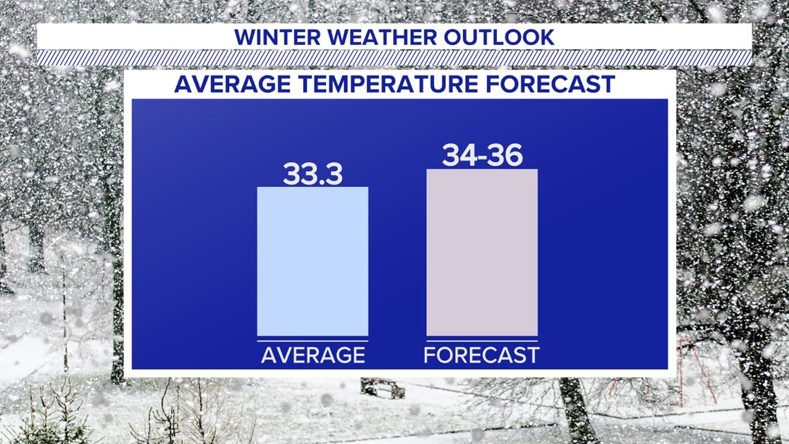
We’re forecasting a seasonal average temperature 1 degree Fahrenheit to 3 degrees Fahrenheit above average, mostly because of December and early January. We’ll likely see cold shots of air reach the state through the first half of winter. However, we believe they’ll have difficulty lasting for more than a couple days and staying place should they line up with storms. This was a problem we ran into all of last winter.

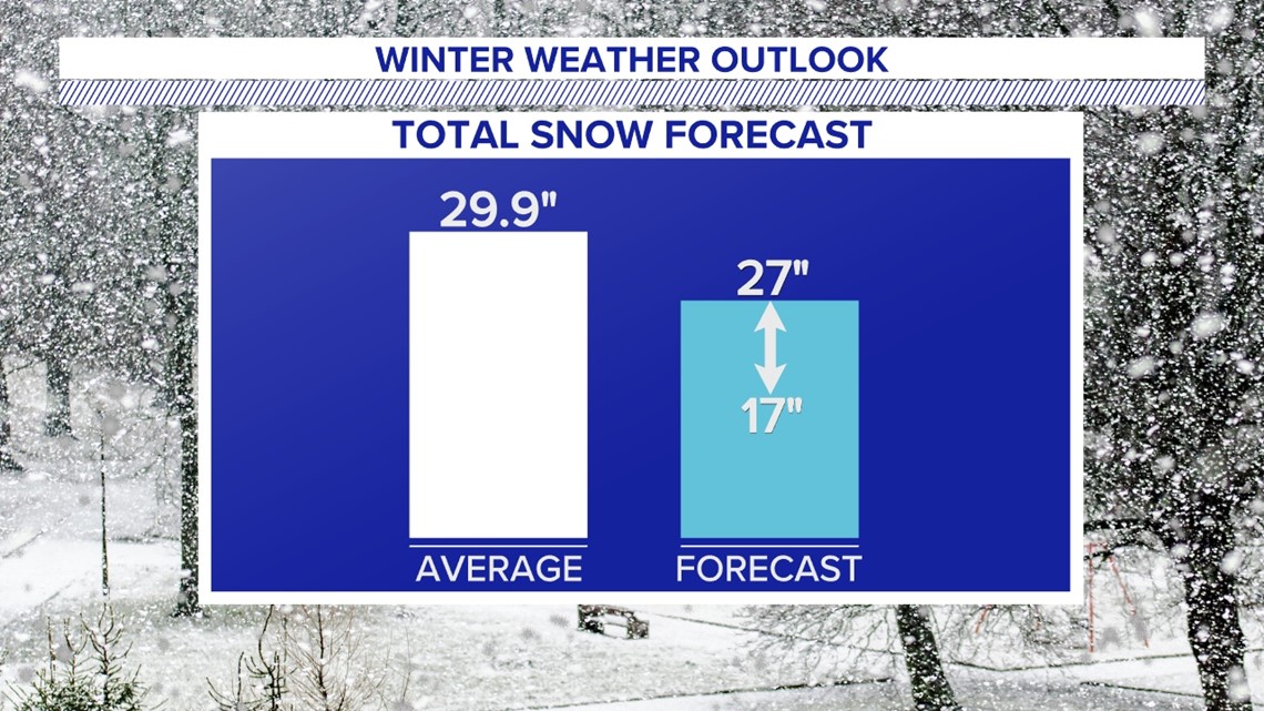
February is our “wildcard” month and brings hope for a major snowstorm or two. We are forecasting 17 to 27 inches of snow to allow for this possibility. We’re banking on cold bursts of air connecting with more storms, so we can play “catch up.” There’s the potential to overperform by about a foot of snow, but we think that scenario is less likely. Our hesitation on a substantial PDO shift ultimately landed us at our 17 to 27 inches. If it doesn’t happen and the Polar Vortex doesn’t play ball, we could fall below this prediction, especially if this El Niño becomes a historically strong one. In short, if February underperforms, we’ll fall below snow projections.


We don’t think there’s a big difference in totals across our area like last year. We’re making a “bold prediction” of 25 inches for Harrisburg. Since Lewistown is to the northwest and usually colder, we’re saying 27 inches. They tend to favor less mixing and more snow with storms, just like you might have noticed last season. We think Lancaster looks similar to Harrisburg, with a bold prediction of 24 inches. This is because we’ve noticed El Niño seasons tend to bring a little less precipitation along the northern and western portions of the state, while the storm track favors south and eastern parts and brings above-average precipitation there. Lewistown isn’t far from the cutoff. As long as the cold is in place, that means more snow south and east. However, the potential for mixed-precipitation events cuts into that, bringing these amounts closer than they might otherwise land.
We expect above-average precipitation regardless of type. The active southern jet of an El Niño pattern has historically favored a storm track in the Southeast regardless of whether the cold air is in place or not. This brings hope for the drought and a potential end by springtime.
We’ll hold ourselves accountable and check back in to see how we did.
Regardless of the outcome, you can count on the FOX43 Weather Smart Team to keep you safe and prepared this winter season.

