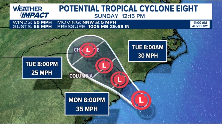
PENNSYLVANIA, USA — A small storm off the southeast coast of the United States is being monitored for tropical development before moving inland later today.
The storm, currently called Potential Tropical Cyclone Eight, is fairly disorganized. If it's able to organize some before making landfall, it will be named Helene.
The center of this storm will move into the Carolina's Monday night into Tuesday and weaken as it does so. The Carolina's are preparing for heavy rain and gusty winds as the storm does so.
The moisture from this storm could impact our forecast starting late Tuesday, though there are still some uncertainties regarding exactly how much rain we could see.
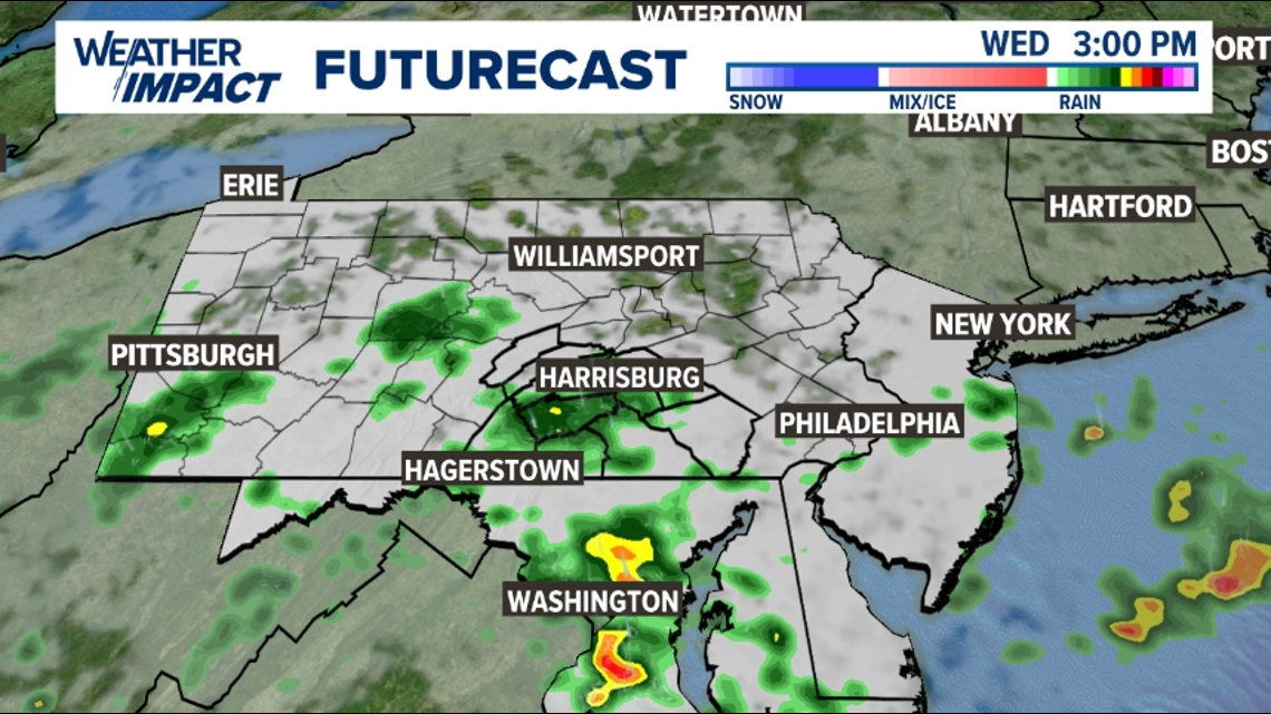
The current forecast calls for just an isolated shower chance late Tuesday, primarily for those south of Harrisburg.
The best chance for scattered showers or some periods of rain for the entire area will be Wednesday, though there will still be dry time through the day.


Rain will be the primary impact of the remnants of this storm for Pennsylvania. No severe weather is expected.
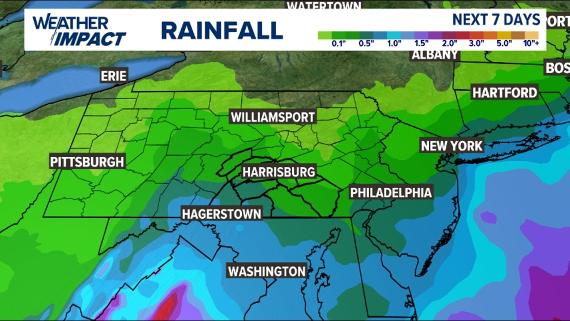
Totals from any rain will likely be highest the farther south you live. Current forecast models have our area picking up anywhere between a tenth of an inch of rain to just under an inch.


We could use some rain. Harrisburg is currently more than 2 inches below where it should be for precipitation in the month of September.
You can find a full look at your local forecast here.


