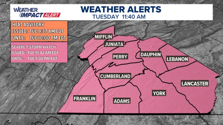
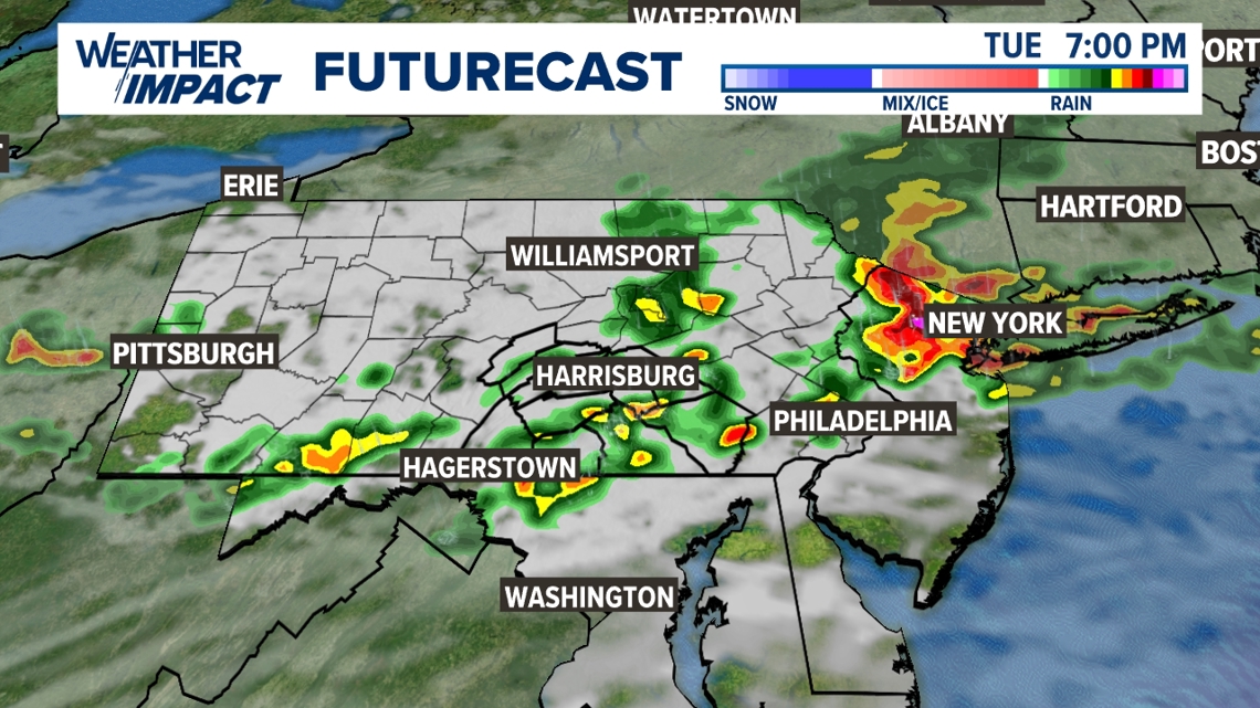
PENNSYLVANIA, USA — The FOX43 Weather Team has issued a Weather Impact Alert from 2 P.M. to 11 P.M. Tuesday. Scattered afternoon and evening thunderstorms could impact evening travels for many. Thunderstorms could produce torrential downpours that lead to areas of flooding. They could also be severe and produce damaging wind gusts.

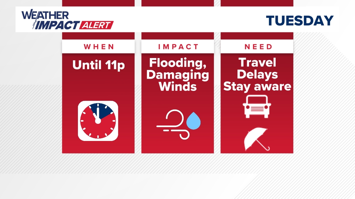

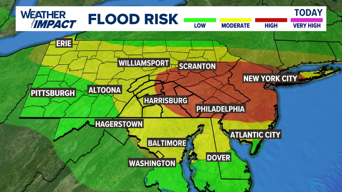
The flooding threat includes most of the area, but the risk is highest east of Harrisburg. This includes much of York County and most of Lebanon and Lancaster counties. Last Saturday’s rain in these locations contributed to the higher risk. Commuters should slow down, pull over if necessary, and avoid any flooded roadways.

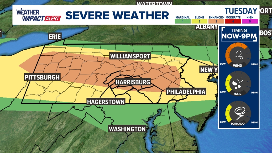
The northern half of our area has been upgraded to a Level 3 out of 5 severe weather threat. The rest of the area is highlighted as a Level 2 out of 5 severe weather threat. Storms could produce damaging winds in addition to the flooding threat. Although it’s a lower risk, storms could also produce pea to quarter-size hail and we can't rule out a few brief tornadoes. Be weather aware. Download the FOX43 Weather App to receive any severe weather alerts that might occur today.

View the full forecast here.