PENNSYLVANIA, USA — The FOX43 Weather Team has issued a Weather Impact Alert on Saturday for some afternoon and early evening storms that could produce isolated damaging wind gusts and torrential downpours that could lead to some areas of flooding.

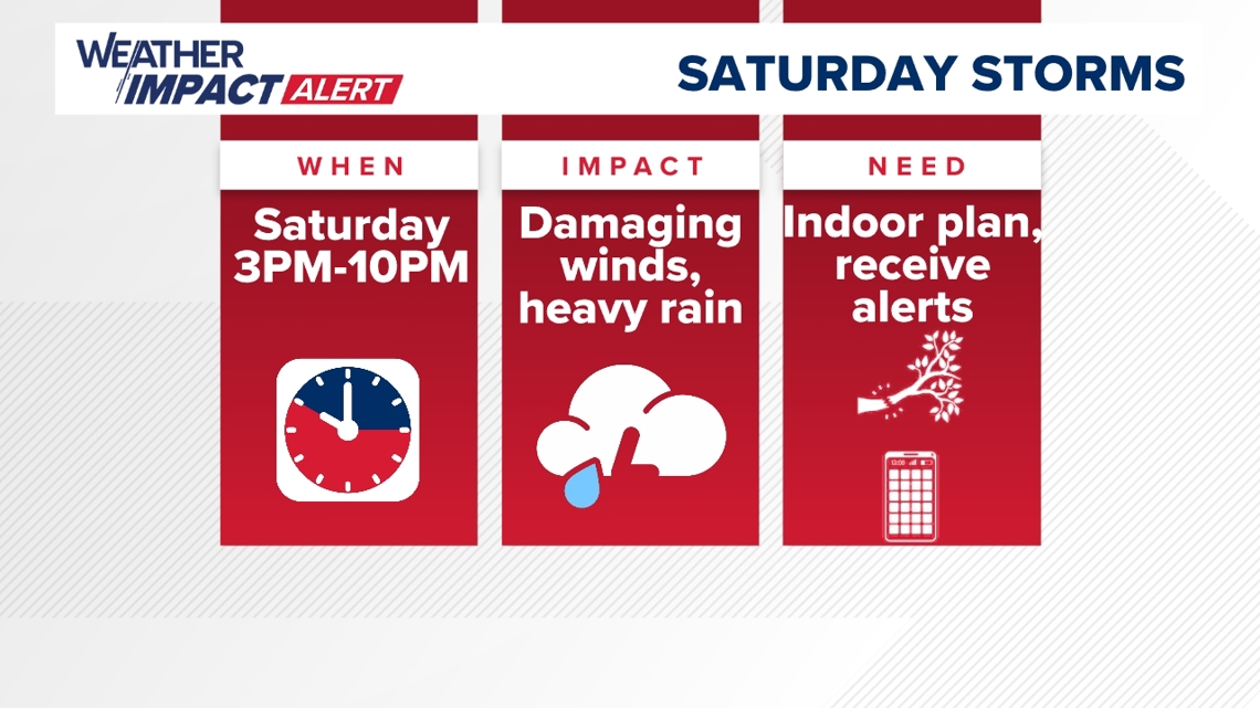

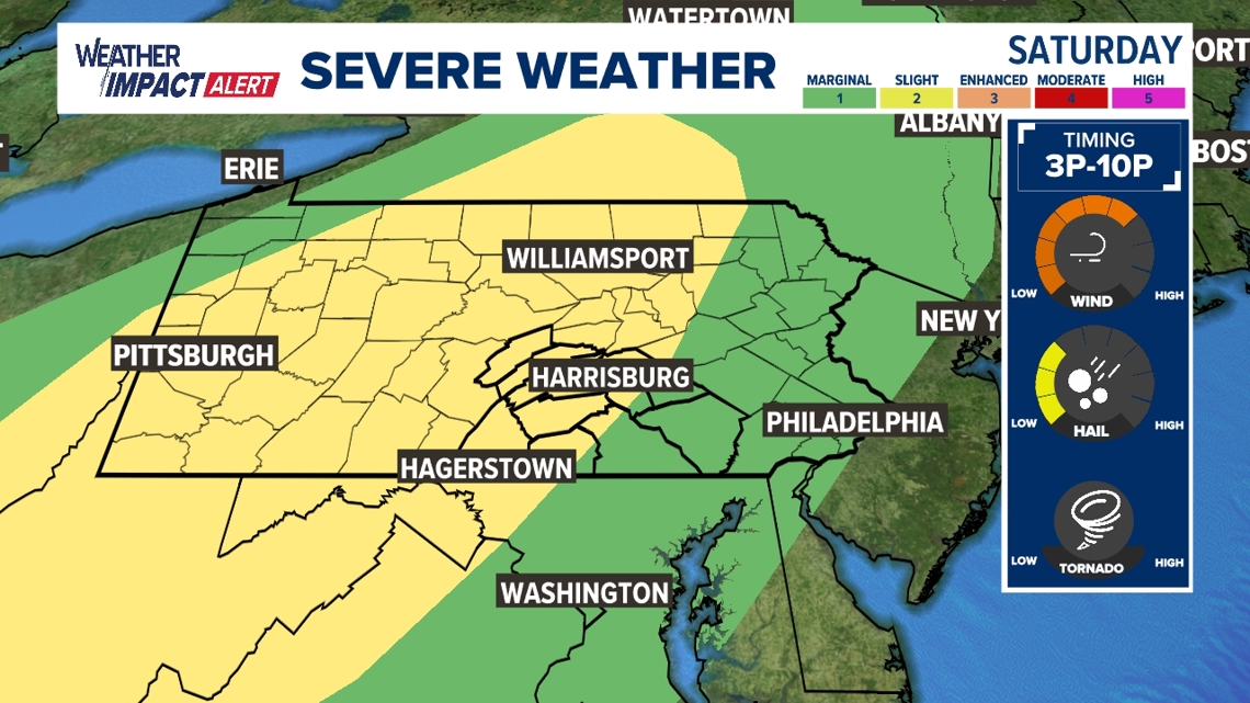
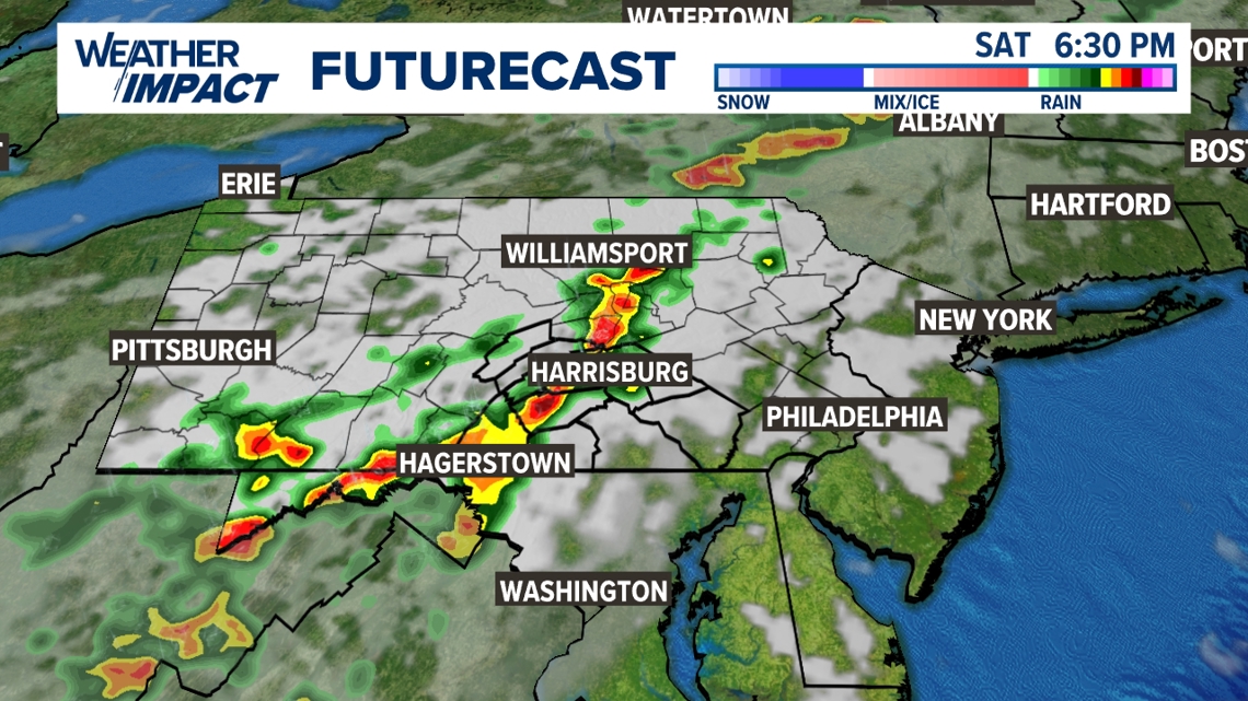
Most of the day is dry and quiet, but a broken line of showers and thunderstorms develops during the afternoon and crosses through Central Pa. until the early evening. The timing of the storms is from about 4 P.M. to 10 P.M. There’s a level 2 out of 5 severe weather threat for areas north and west of Harrisburg. This includes Mifflin, Juniata, Perry, Franklin, and Cumberland counties, but also includes parts of Adams, York and Dauphin counties. Isolated damaging wind gusts are the primary threat. However, storms could also produce pea to quarter size hail and torrential downpours that could lead to areas of flooding. The flooding risk is highest northwest of Harrisburg in spots that were hit hardest with torrential rain from Thursday evening’s storms. This includes much of Juniata County, but also portions of Perry and Mifflin counties. The rest of the area has a very low flooding threat because of mostly dry conditions.

Be weather aware, especially between 3 P.M. to 10 P.M. Make sure you have a plan to get inside if you have outdoor plans. Download the FOX43 Weather App to receive any severe weather alerts that might occur Saturday. Stay with the FOX43 Weather Impact Team for more updates as they come!
View the full forecast here.