

HARRISBURG, Pa. — The winter of 2023-2024 made top ten marks for warmest and wettest on record at Harrisburg International Airport, continuing a warming trend and reversing a months-long drought that was partially to blame to three years worth of a La Nina pattern.
The months of December, January and February were 4.5° warmer in the afternoons and 5.17° warmer for overnight lows for Harrisburg, numbers reflected across the rest of Central Pa. as well.
December and February specifically were more than five degrees warmer for afternoon highs, only brought down by the month of January which was three degrees warmer compared to climatological averages dating back to 1888.

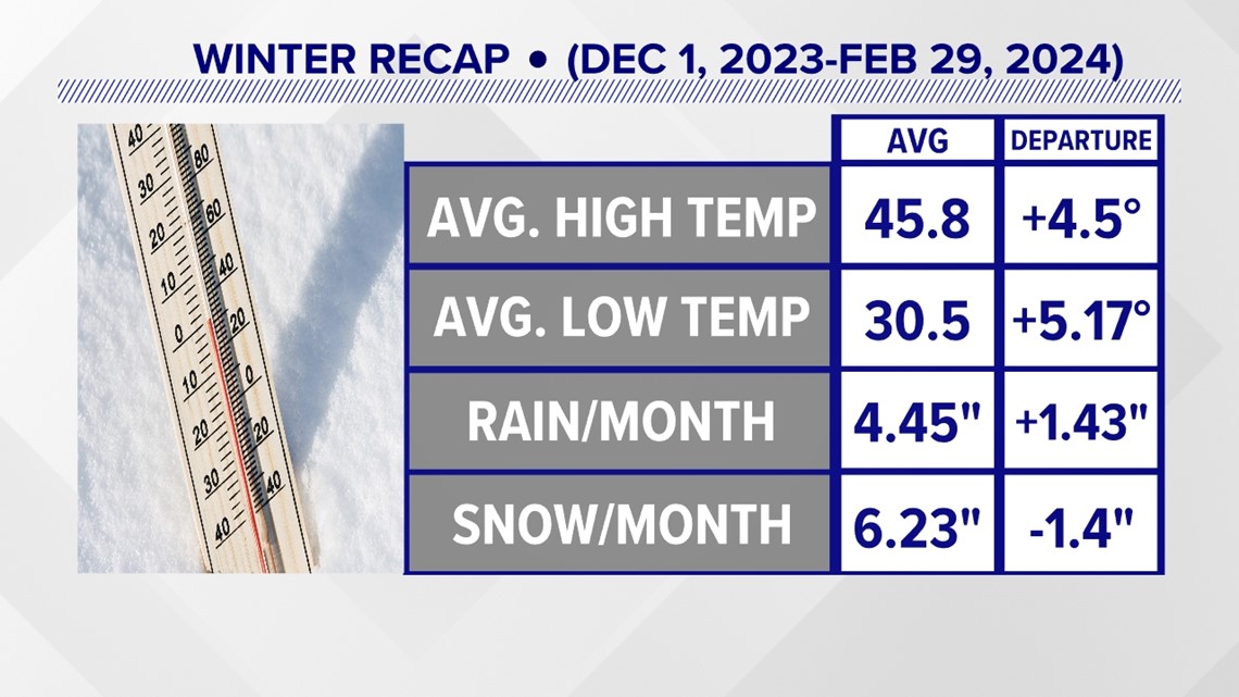
Because of the temperatures, most of the precipitation in the months did fall as rain. In fact, despite recovering from the least snowy winter on record of 2022-2023, we still struggled to maintain average snowfall amounts in the area. If you break down the snowfall totals, each month saw a deficit of 1.4" of snow per month largely due to a nearly snowless December, where only a trace was recorded at the airport. We averaged 6.23" of snow per month, but 9.1" of that fell in January with an additional 9" in February. In total, HIA's gauges brought in 18.7" of snow, about four inches shy of its norm.

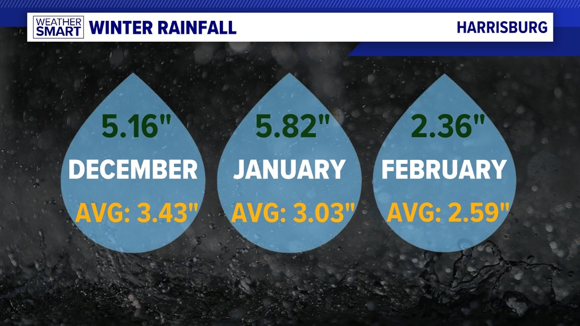
Meanwhile, we excelled in the rainfall department at an surplus of 1.43" per month compared to average, bringing the season total to 13.35" when rounded to the nearest hundredth, compared to an average of 9.05".

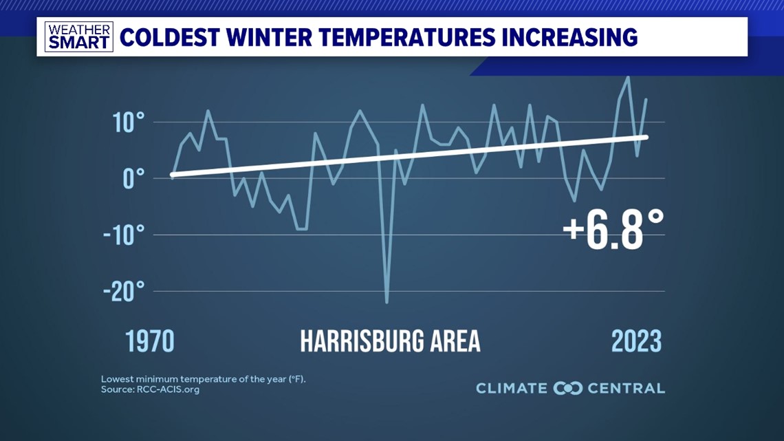
That snowfall deficit and temperature rise continues a trend dating back to 1970 for the Harrisburg Area, whose average "coldest" day of the year has risen by 6.8° during the winter months.
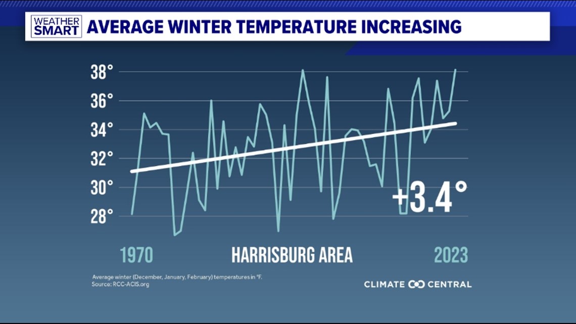
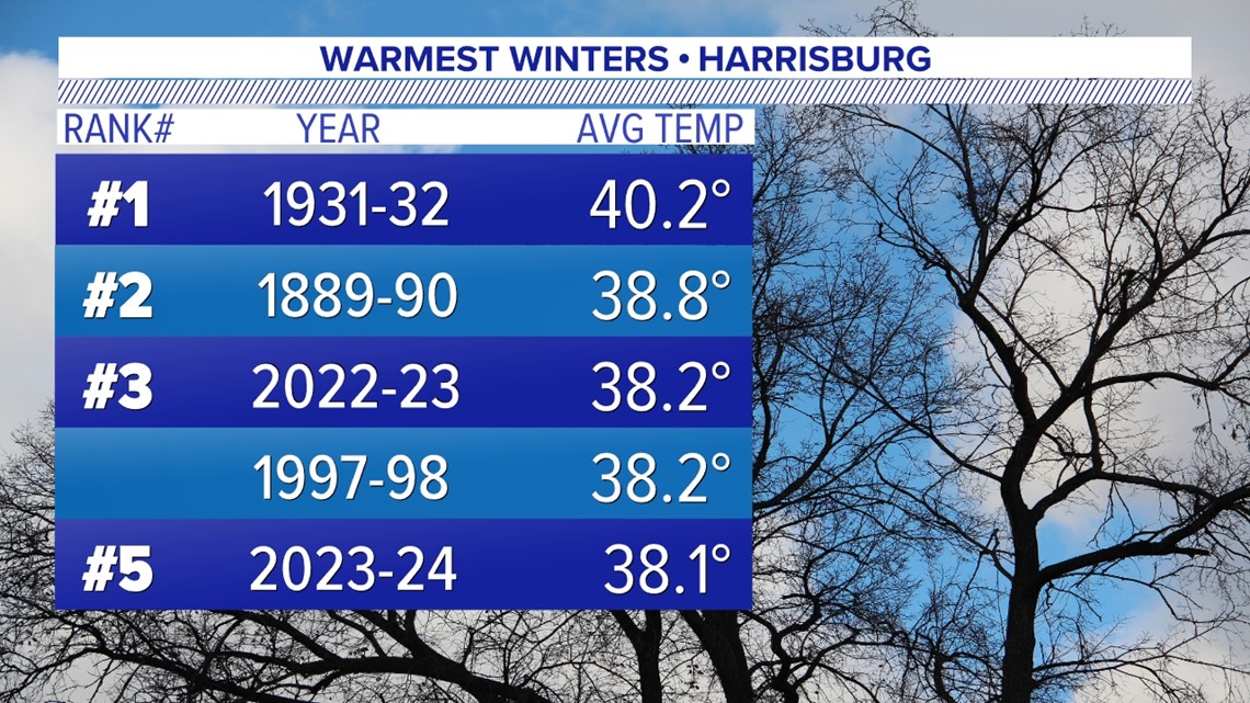
Our average Winter temperature, factoring both highs and lows, has increased by 3.8° in the same timeframe. This year's average temperature, which as previously mentioned came in the top 5 of warmest winters, was 4.84° warmer than the climatological norm.


These warmer winter temperatures have year-round effects, contributing to a longer growing and allergy season, disrupting crops whose soil doesn't freeze properly, disrupting spring snowmelt and water supplies and can economically impact local ski resorts.
The warmer temperatures have continued into March and are forecasted to do so for the rest of the year.