
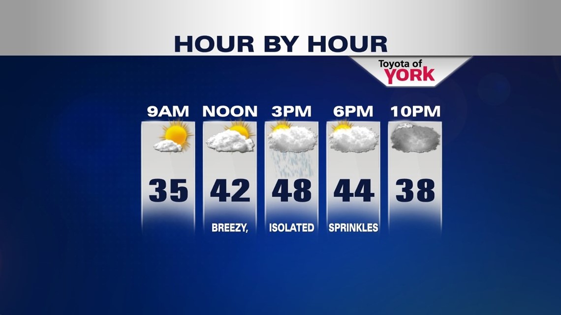
FEW SPRINKLES/FLURRIES THIS EVENING
Once again you may dodge a few sprinkles or flurries heading out this evening. Temperatures will fall back into the low 40s. Overnight, expect partly cloudy skies with lows in the low 30s.
STAMP A DITTO FOR THURSDAY & FRIDAY
Once again we’ll start out with some sunshine but going into the afternoon the clouds will increase and there could be a few hit or miss sprinkles or light showers. Highs will remain below average in the upper 40s.
Friday we’ll see the upper level trough start to flatten a bit which means a little more sunshine. The clouds will still mix in and out and temperatures will run below average but should crack the 50 degree mark. Once again the winds will be a bit breezy.

GETTING RID OF THE CLOUDS
High pressure builds in at the surface helping to finally rid of the persistent northwest flow. Winds will shift to the south and bring in milder air. More sunshine for Saturday will make a great day for outdoor fun and temperatures warming into the mid 50s.

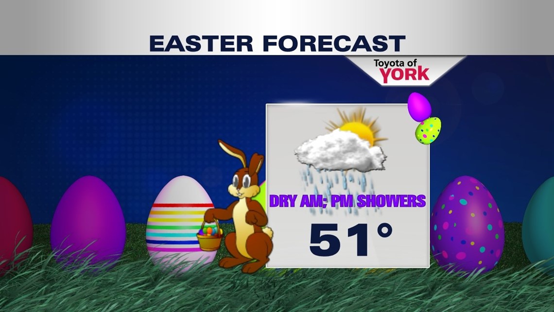
LOOKING WETTER FOR EASTER
Models are coming in quicker with the next system which means showers may arrive in the early afternoon. Morning services for the holiday looking dry, along with any Easter egg hunts. But you’ll want to keep the umbrella handy for the afternoon and evening as showers are expected to be in the area. Highs will still reach the low 50s.
APRIL ALREADY!
Most of Monday, April 1st, looks dry with a mix of clouds and sunshine but can’t rule out a brief shower. Morning temps will be quite mild in the mid 40s so afternoon highs will have no problem getting to the mid 50s before cooler air returns overnight.
It looks as if a frontal boundary may trigger a few showers Tuesday and temperatures will drop back into the 40s once again both Tuesday and Wednesday. Most of the week will run below average for temperatures.
MaryEllen Pann, Chief Meteorologist
Like me on Facebook: maryellenpannfox43
Follow me on Twitter: @MaryEllenFox43