
The National Weather Service has allowed the Severe Thunderstorm Watch to be cancelled. Expect a few scattered showers otherwise, mostly cloudy skies.
Overnight lows will be mild once again in the upper 50s to low 60s.
WIDE RANGE OF TEMPS POSSIBLE
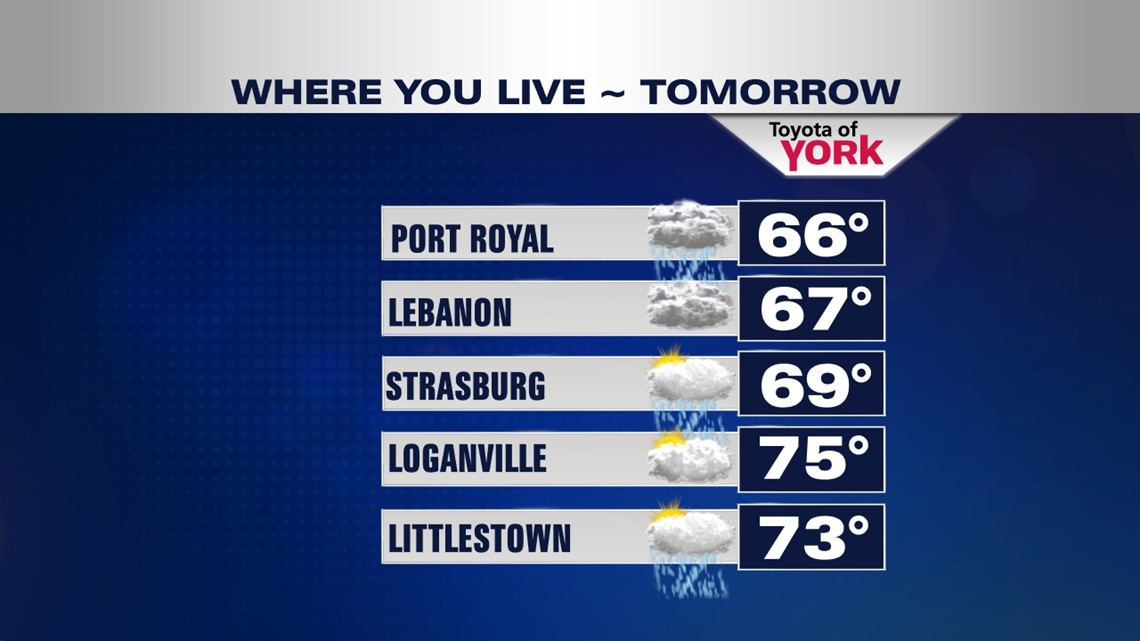
Thursday will be an interesting day for temperatures. There could be a huge swing from cooler upper 50s and low 60s to the north to mid 70s further south around York to the Maryland Line. With the front nearby, there will still be chance for showers.

BEST SHOT FOR RAIN
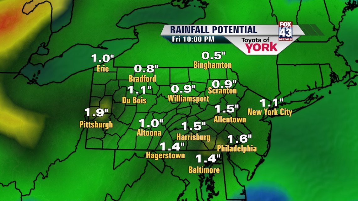
By Friday a potent cold front comes in with an area of low pressure will brings the chance for rain. Looks like the wet weather moves out by afternoon leaving breezy, cooler conditions as we head into the weekend.
We need the rain. We are over 2 inches below average for the year and so far this month we have only managed a trace of rain.

MORE SEASONAL AND COOLER BY THE WEEKEND
Temperatures return to more seasonal averages around 60 degrees as we head into the upcoming weekend. Plenty of sunshine and dry hours to get out and catch up on spring planting or outdoor fun.
Keep an eye to the sky tonight if you have plans to be out. If threatening weather should approach take the necessary cover to protect yourself.
Be sure to like me on facebook for up to date information on the development of storms or follow me on twitter.
Have a nice night!
MaryEllen Pann, Chief Meteorologist
Like me on Facebook: maryellenpannfox43
Follow me on Twitter: @MaryEllenFox43