
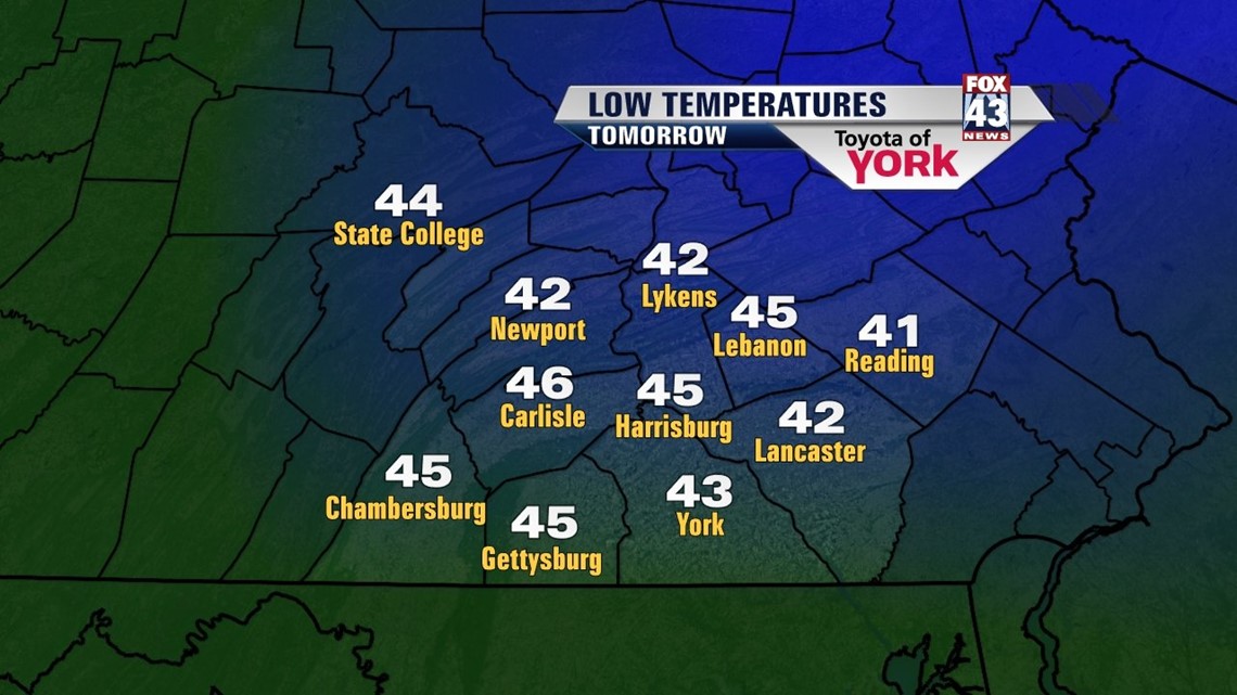
Drier air is beginning to move in from the east helping to break up the clouds. They will continue to decrease overnight. Lows will be much cooler dipping into the mid 40s but near seasonal averages.

BRIGHT MAY START
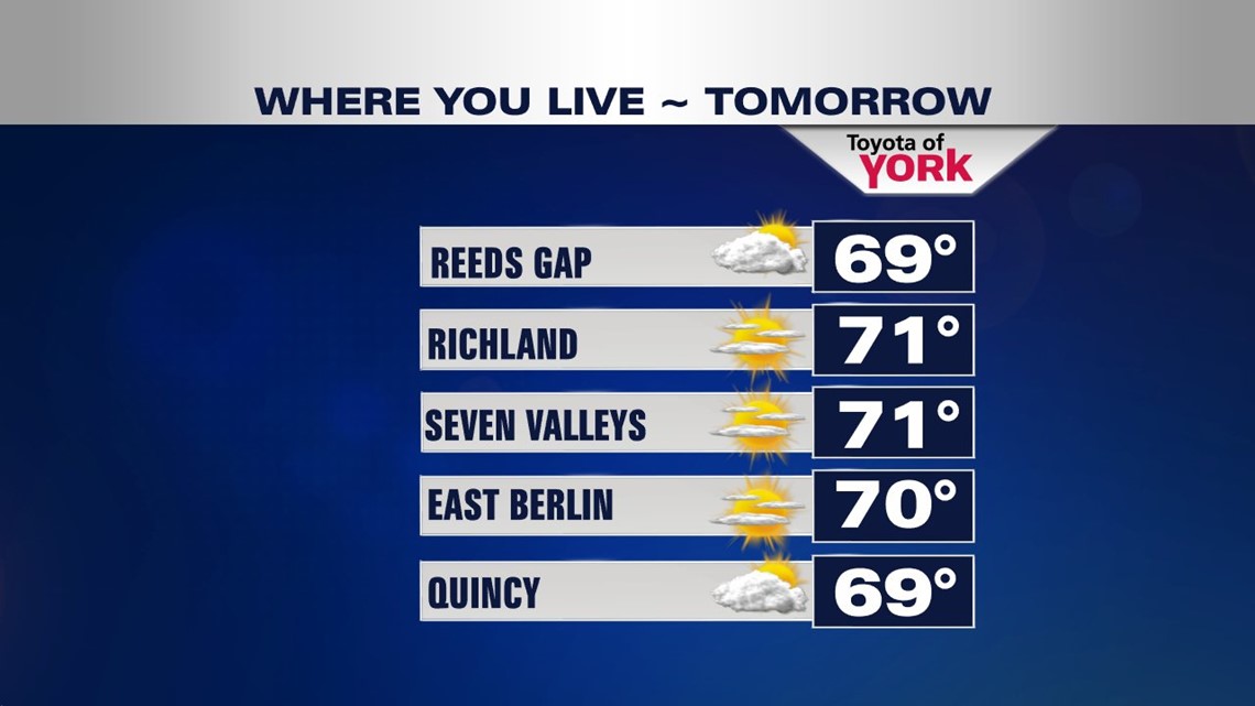
Clouds will continue to decrease in the morning allowing for abundant sunshine for the rest of the day. High pressure nosing into the area is helping to bring in drier air. With the sunshine, temperatures look to hit 70° in many locations, except for our western counties, where clouds may linger a bit longer, highs will top out in the upper 60s.

STAYING SEASONAL
A back door cold front slides our way late Thursday into Friday. We continue to remain dry with sunshine as we round out the week. There may be a few more clouds around with temperatures a few degrees cooler Friday but still quite pleasant in the low 70s for Thursday and upper 60s Friday.
FABULOUS WEEKEND
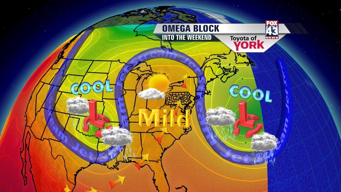
A blocking pattern sets up over the Northeast and Mid-Atlantic. What this means is we remain dry with sunshine and temperatures close to average around 70°. It doesn’t break down until early the following week. Heading into the week, we’ll keep an eye on Monday. Right now it remains dry, although one model shows rain but I am holding it off until Tuesday and even then, it’s not looking impressive. Temperatures remain in the upper 60s to low 70s going into the first full week of May.

Make it a fabulous week!
MaryEllen Pann, Chief Meteorologist
Like me on Facebook: maryellenpannfox43
Follow me on Twitter: @MaryEllenFox43