
High pressure is now in control of our weather. Dew points are back in the 40s and 50s, an indication of dry air in place. This is pretty nice for this time of the year. Enjoy because it won’t last. Summer officially arrives Friday and it will start to feel more like summer going into the weekend as the heat and humidity returns.
TONIGHT
Clouds around today will be gone with the sunset leaving skies full of bright stars. Temperatures will drop below average into the low to mid 50s. Open the windows and give the A/C a break before you have to have it back on over the upcoming weekend.
NO RAIN FOR SEVERAL DAYS
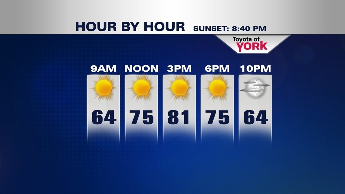
Ridge of high pressure in the upper levels as well as at the surface will bring a stretch of dry weather. Our lawns and gardens will be able to dry out a bit since rain will not be expected to return for a while. High temperatures will be close to seasonal averages in the low 80sThursday.

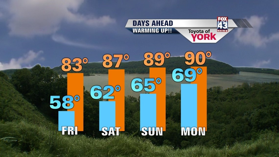
TURNING THE HEAT UP
Over the upcoming weekend, the heat and humidity will climb. There is an isolated threat for a storm Sunday but a better chance for scattered storms going into the next week.

MaryEllen Pann, Chief Meteorologist
Like me on Facebook: maryellenpannfox43
Follow me on Twitter: @MaryEllenFox43