
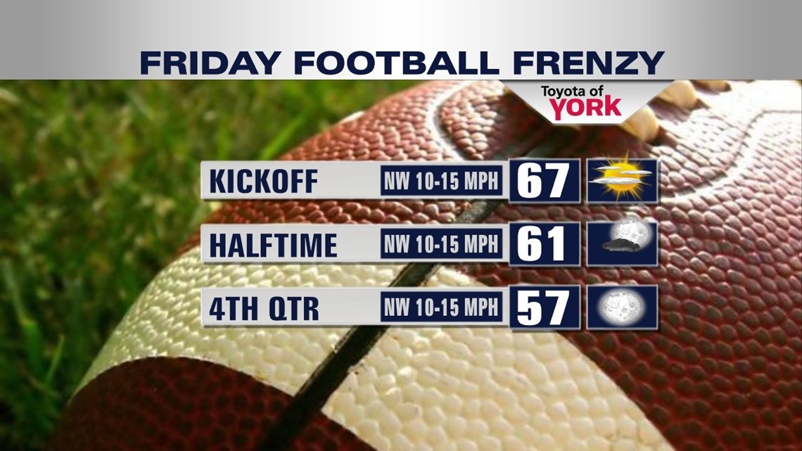
It’s time for Friday night football! Be sure to bundle up. It will be chilly!

FALL AIR RETURNS
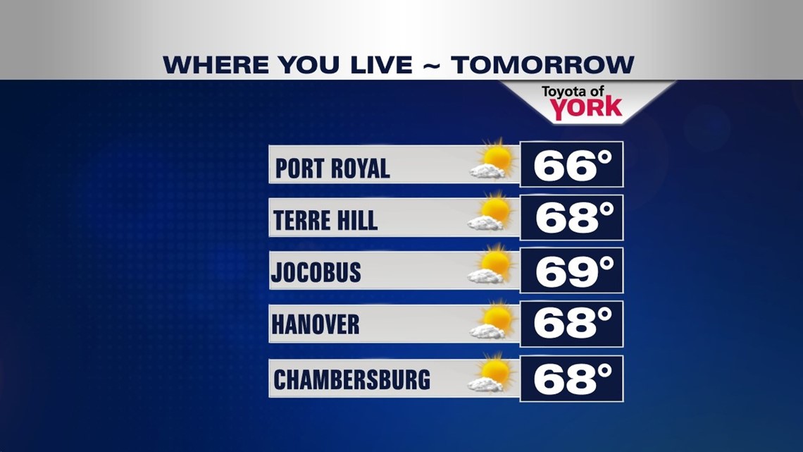
Cooler air continues to pour in behind Thursday’s cold front, bringing a fall-like weekend to the Lower Susquehanna River Valley. Clouds continue to speckle the sky through the rest of the day, with more cloud cover concentrated to the north and northwestern parts of our region. Into the evening, clouds quickly crumble, and temperatures quickly cool. Bundle up for high school football or any other Friday evening plans! Temperatures continue to tumble through the overnight. It’s a very chilly one, with lows falling into the middle to upper 40s. Saturday brings lots of sunshine as high pressure settles over the area. It’s a cool, fall-like day despite the sun. Highs only reach the middle to upper 60s. It’s our coolest day yet! Sunday, the sunshine continues. Temperatures begin to warm a little bit too. Readings touch the lower to middle 70s across the region.

SLOWLY MODERATING
A weak cold front slips through early Monday, and it cools us down a touch. A sprinkle is possible during the morning, otherwise sunshine increases throughout the day after a fairly cloudy start. Highs reach the lower 70s. Expect ample sunshine on Tuesday. Temperatures rise a touch as well. Wednesday, the mercury continues to creep upward. However, clouds begin to increase ahead of our next weather system. The clouds should not prevent temperatures from reaching the middle 70s, but that is still running below average for this time of year.
NEXT SHOWER CHANCE
At week’s end, our next cold front slowly works toward the region. Thursday brings a mixture of clouds and sunshine, with a small shower and thunderstorm chance. Temperatures are back to seasonable averages in the upper 70s. Friday, the front looks to cross the region, bringing more widespread showers and storms to the area. Highs remain in the 70s.
MaryEllen Pann, Chief Meteorologist
Like me on Facebook: maryellenpannfox43
Follow me on Twitter: @MaryElle