
CLOUDS RETURNING
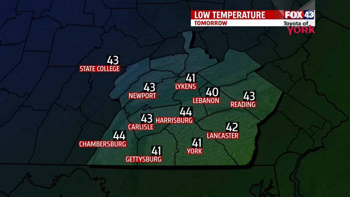
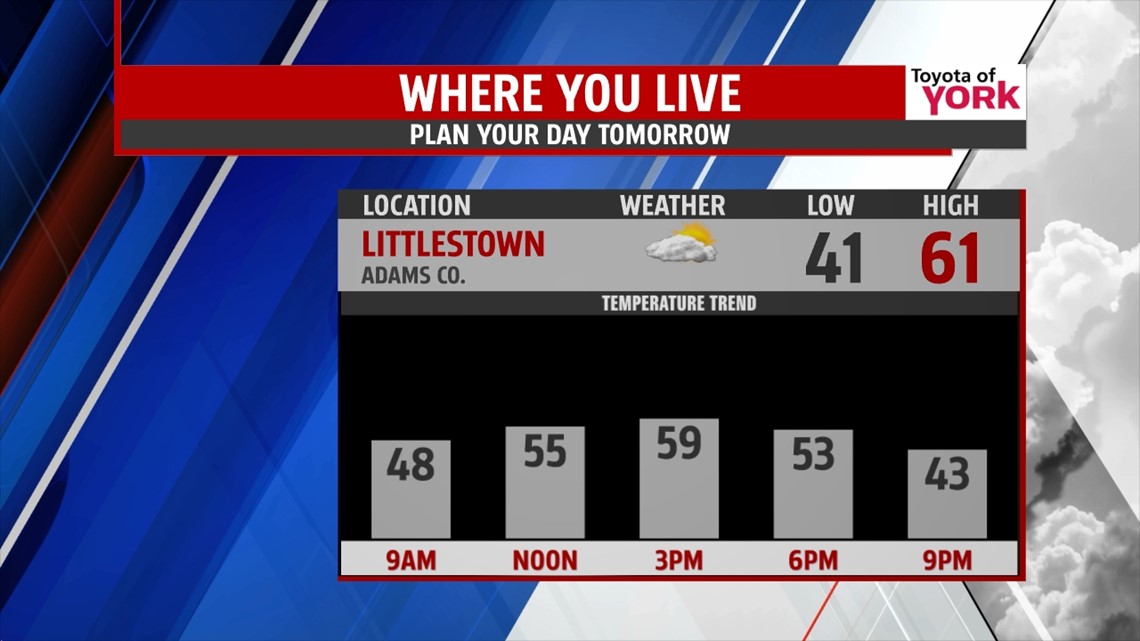
High pressure in control of our weather brought beautiful fall weather today and southerly breezes warmed temps above normal in the mid 60s this afternoon. Clouds return tonight, keeping our temps a bit milder in the low to mid 40s and there could be a stray shower north of Harrisburg early tomorrow as a cold front slips through. Most remain dry.

TRANSITIONAL TUESDAY
Cold front comes in early and may trigger a shower north otherwise it will be partly sunny and cooler. Temperatures will reach the upper 50s to low 60s in the afternoon. Winds will be breezy 10 to 15mph out of the west.

SHOWER CHANCES LOOK WEAK
Wednesday an upper level disturbance will swing through keeping skies overcast and scattered showers around. More importantly, it will be noticeably cooler with highs only in the low to mid 50s!! The coldest air of the season will rush in behind the disturbance for the end of the week.
COLD, COLD, COLD
Thursday and Friday the flow aloft will continue to pump in colder air. Sunshine will mix with clouds and right now it looks as if we miss out on any shower activity. Highs will remain in the low 50s while morning lows will run in the 30s. We could be dealing with frost and freeze concerns as well.

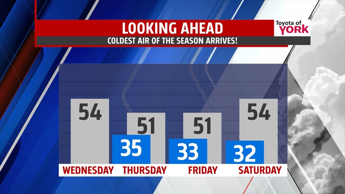
High pressure looks to build in for the weekend bringing more sunshine and somewhat milder temperatures.
Hello fall!
MaryEllen Pann, Chief Meteorologist
Like me on Facebook: maryellenpannfox43
Follow me on Twitter: @MaryEllenFox43