

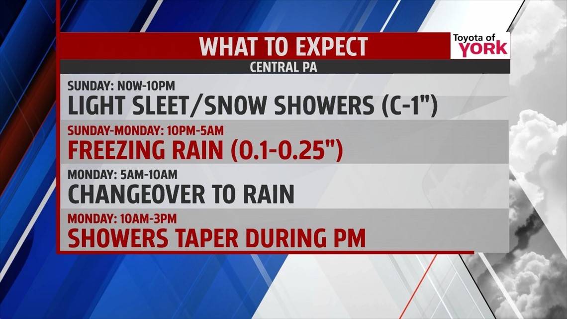
WINTRY MESS WRAPS UP

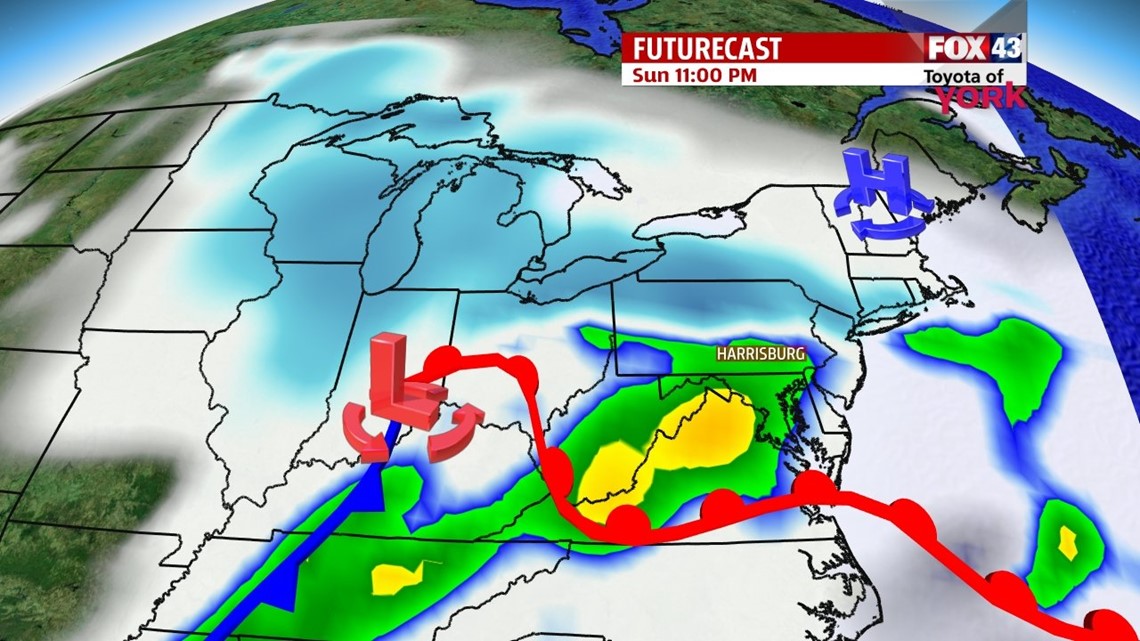
A break from the snow is working in across the region, and this lasts into part of the evening. As temperatures above the surface warm, returning precipitation will be in the form of sleet and freezing rain. The freezing rain with be patchy, but combined with the snowy mess, roads will be slick and slippery, with hazardous travel conditions. Rain begins to mix in late, with most of the area all rain by daybreak. Some of our normally colder spots could keep freezing rain through mid morning, especially to the northwest. Total ice accumulations are up to a tenth of an inch for most, but some localized areas could see a quarter of an inch. After that, it’s all rain showers for Monday, with highs near 40.
FRIGID BLAST
Tuesday skies should clear out after a few morning flurries, and a cold air mass begins to settle in. Highs are near 30 degrees on Tuesday. A powerful arctic front pushes through into Wednesday, bringing a blast of cold air. Lake effect flurries are likely. Highs will be in the 20s, and Wednesday morning lows are in the teens! Skies are partly sunny for Thursday, with the frigid air still in place.
VERY SLIGHT WARMING
Temperatures remain well below average into the weekend. Expect a mixture of sunshine and clouds on Friday with highs creeping just above the 30 degree mark. Saturday clouds thicken, with temperatures reaching the middle 30s. The clouds look to stick around into Sunday.
Have a great week!
-Andrea Michaels