

CALM NIGHT

The rest of the afternoon and evening are looking calm across the Lower Susquehanna River Valley, but that changes quickly. A developing storm system heads this way overnight, thickening clouds across the area. It’s a calm night, with lows falling into the 20s. By daybreak some snow showers begin to enter the picture.
WATCHING NEXT STORM
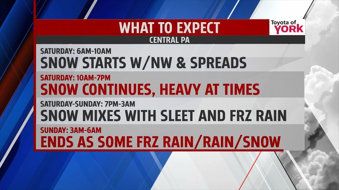
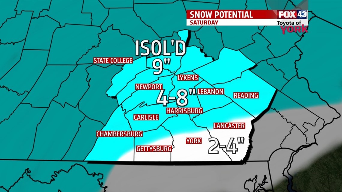
Saturday snow showers begin during the morning hours to the west and northwest, overspreading the region through the morning and into early afternoon. Heavier snow will work in at times during the afternoon and evening hours. Saturday evening, a changeover to an icy mix (mainly freezing rain) takes place as warmer air moves in aloft and cold air remains at the surface. Before the changeover, about 2 to 8 inches of snow is expected across the area, with isolated higher amounts to the north and northwest (see map). Ice accumulations are expected to be light, on the order of a tenth of an inch. This is still enough to create icy spots on the roads. Everything looks to clear out by Sunday morning, but it’s a mostly cloudy day with some flurries in store. Highs are in the lower 30s.
STAYING BELOW AVERAGE
Temperatures remain below average through the beginning of next week. It’s dry, with intervals of clouds and sunshine. There is the chance for some light snow showers Tuesday, otherwise the week looks mainly dry. After starting in the upper 20s on Monday, high temperatures slowly climb into the upper 30s by Thursday. Friday is our next shower chance, with highs in the 40s.
Have a great weekend!
-Andrea Michaels