

SUNNY STRETCH BEGINS

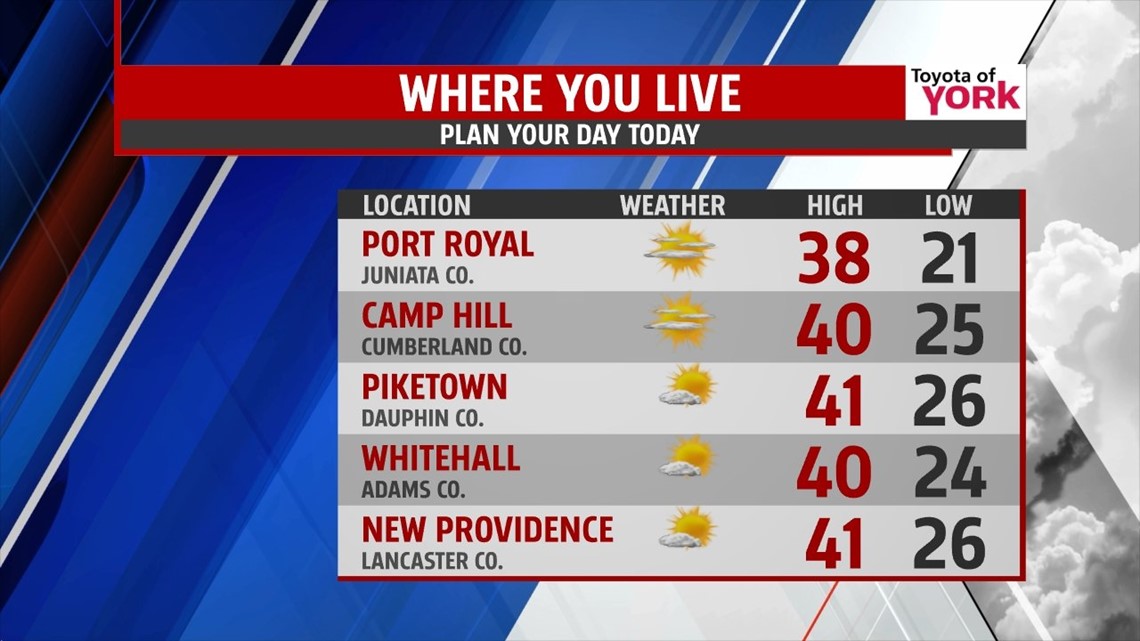
A weakening disturbance dropping this way from the northwest brings a few passing clouds across the Lower Susquehanna Valley Friday morning. Temperatures begin pretty chilly, in the 20s across the entire region. High pressure moving into the region increases sunshine for the afternoon hours. With abundant sunshine, high temperatures are in the upper 30s to lower 40s. Skies stay mostly clear through tonight, with lows once again in the 20s.
50/50 WEEKEND
As a more southerly flow develops this weekend, temperatures warm into the middle 40s Saturday under plenty of sunshine. The nice stretch of weather comes to an end Sunday as another storm system develops and moves this way from the south. Clouds quickly thicken up Sunday morning. It moves up the coast, bringing rain showers to the area Sunday afternoon and evening.
ARCTIC BLAST BEGINS THE NEW YEAR
The system exits by Monday, bringing a return to the sunshine, but a cold shot of air moves in as we say goodbye to 2013 and welcome 2014. Be ready to bundle up for New Year’s Eve and Day plans! A few flurries are possible on New Year’s Day. Otherwise, the cold sticks around through Thursday. Expect highs below the freezing mark through this timeframe, with frigid nights too.
Have a great weekend!
-Andrea Michaels