
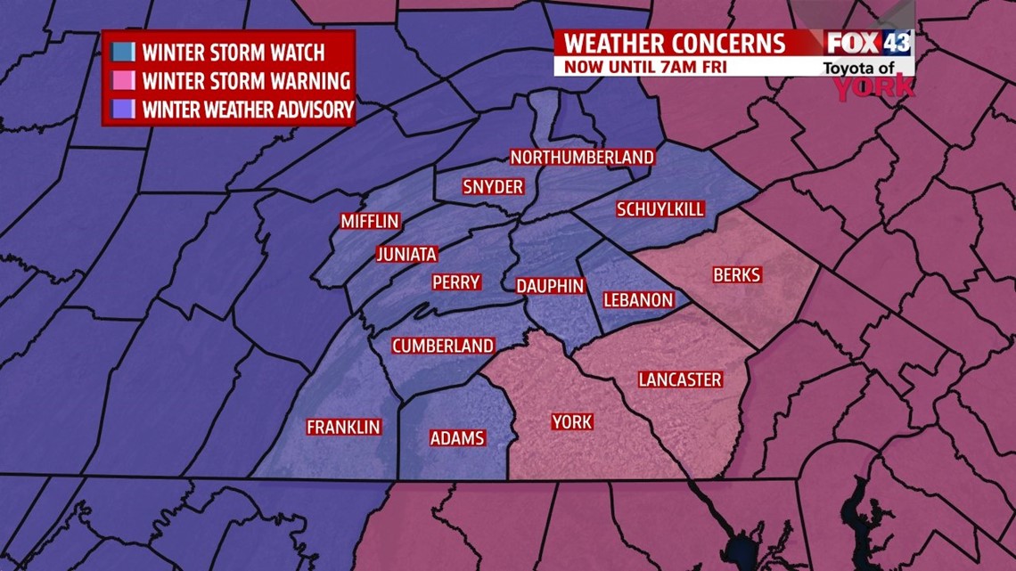
YORK AND LANCASTER COUNTIES IN WINTER STORM WARNING
The National Weather Service has issued a Winter Storm Warning for York and Lancaster where heavy snow and accumulations of 4 to 8 inches is likely. The warning is in effect until 1am. Elsewhere a Winter Weather Advisory remains in effect until 7am Friday. Snow accumulations of 2 to 6 inches is likely. As we head into the evening and overnight, traveling will become increasingly difficult with lowered visibilities and blowing snow. On top of the snow possibilities and concerns, we will also be dealing with strong gusty winds which will result in wind chill readings below zero. The winds are expected to pick up after midnight as the coastal low strengthens. Temperatures will be falling from around 20 at midnight to the teens by morning and won’t rebound much in the afternoon.

OVERNIGHT
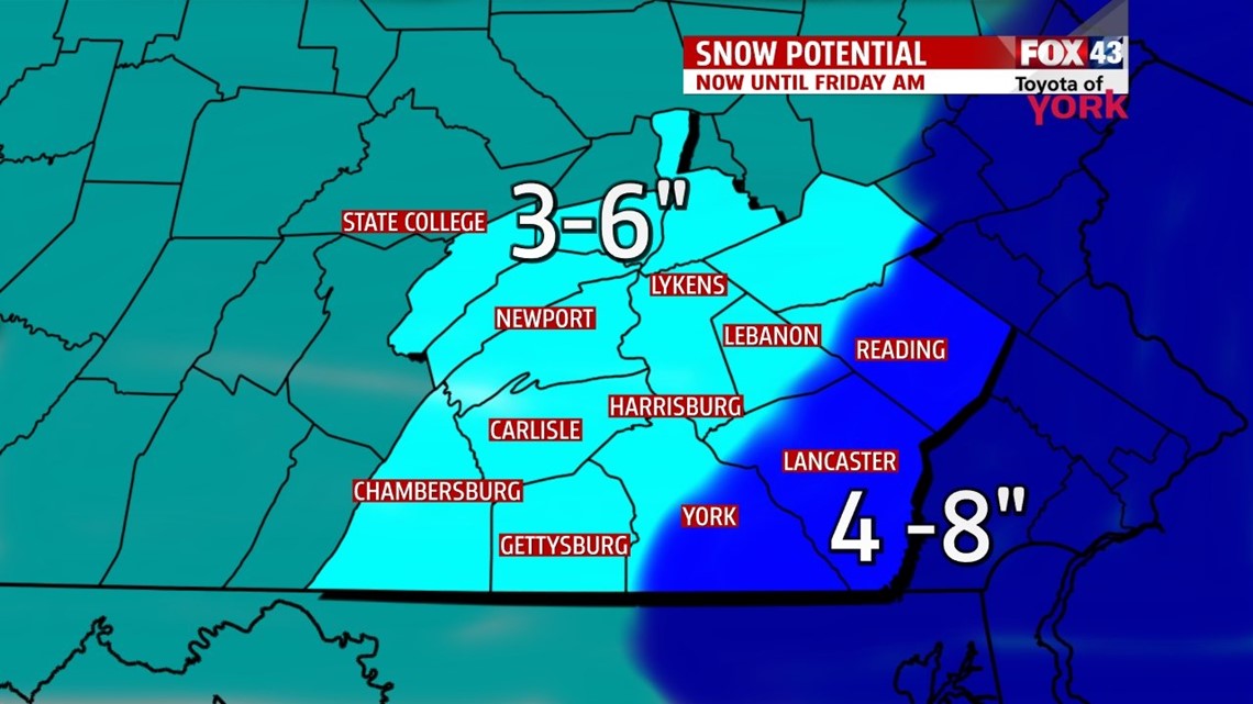
Snow intensity picks up as coastal low deepens. Winds will be increasing too. Temperatures will fall through the 20s in the evening and drop to the teens by tomorrow morning. But with the winds will feel more like single digits to below zero. Total snow amounts should reach anywhere from 2 to 6 inches by morning.

FRIDAY FREEZE
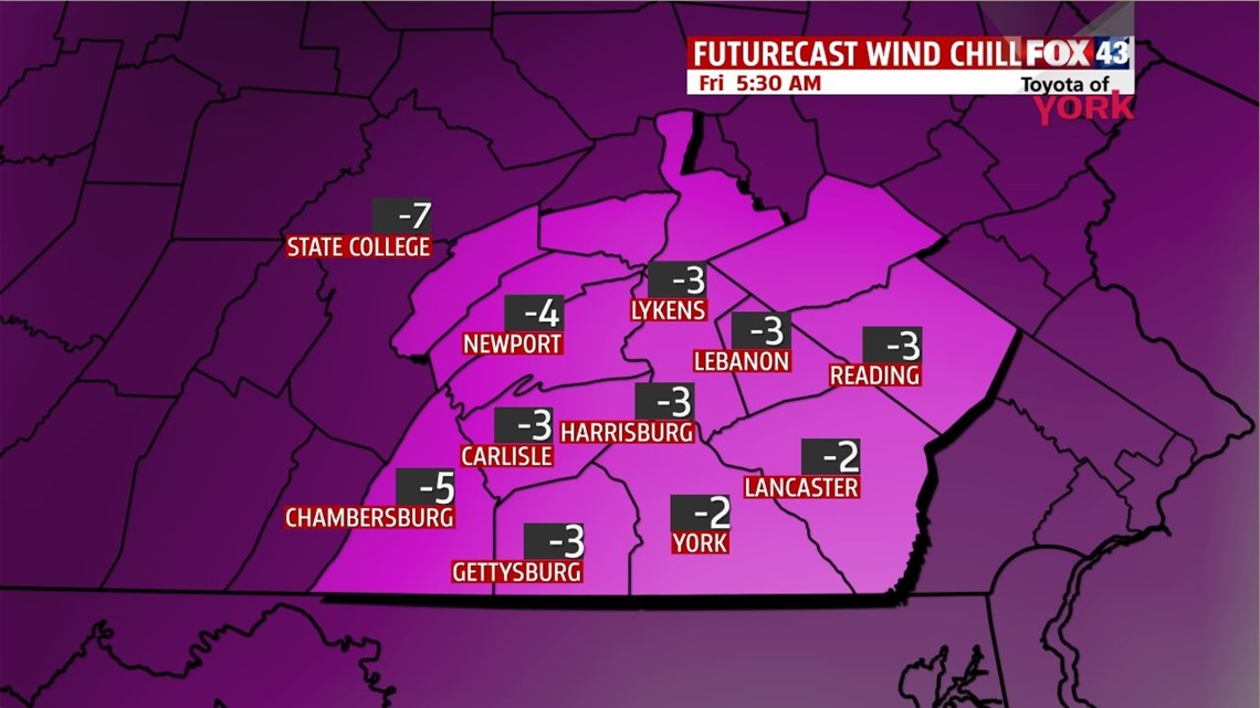
Snow shuts off quickly from west to east after 2am but blowing snow will be possible. Clouds will decrease and you will feel a big difference in temperatures, as an arctic chill settles in across the area by morning. Temperatures will fall to the low to mid teens but with winds out of the northwest 15-25 mph and gusting higher, it will feel like below zero. Plenty of sunshine as skies clear and high pressure builds in, but it will offer little relief to the Friday freeze as high will only budge a degree or two topping out in the mid teens. Winds should ease up by evening Friday and with clear skies will lead to overnight lows in the single digits Saturday morning.


WEEKEND OUTLOOK
Saturday will be cold with morning lows starting in the single digits. We’ll rebound to the mid and upper 20s under mostly sunny skies. The next storm system comes in Sunday. Most of the morning and early afternoon will be dry. We will be on the milder side of the system so we should start out with rain transition to a mix overnight. Highs Sunday will reach the mid 30s.
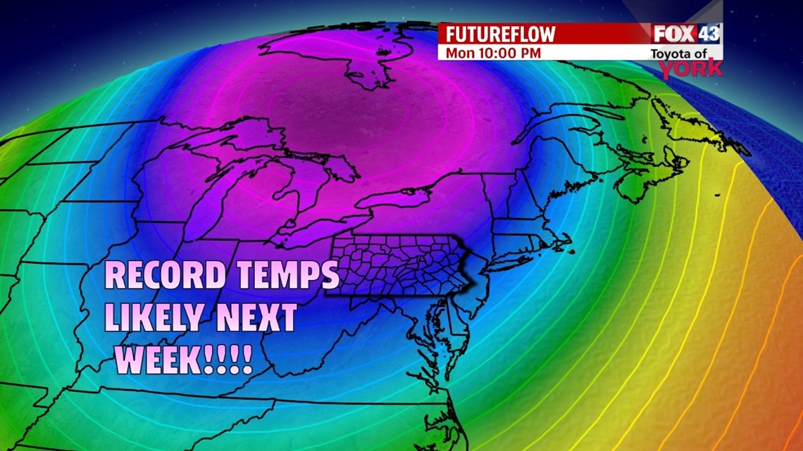
FRIGID TEMPS RETURN NEXT WEEK
Monday morning mix to snow will be possible as storm pulls away. Temperatures will plummet as another Arctic blast settles in across the area by Tuesday and Wednesday. With morning lows below zero to near zero and highs only in the teens is possible, we could be breaking records in the temperature department. We’ll keep you posted!

MaryEllen Pann, Chief Meteorologist
Like me on Facebook: maryellenpannfox43
Follow me on Twitter: @MaryEllenFox43