
…A WINTER STORM WARNING is in effect until 10PM for Adams, Cumberland, Dauphin, Franklin, Juniata, Lancaster, Lebanon, Mifflin, Perry, and York Counties…
KEEPS ON COMIN’: The heaviest snow wraps up by 11AM, but snow will continue to fall during the rest of the day. We’re seeing some sleet mixing in across our southern counties. A potent Nor’easter continues to strengthen as it rips up the eastern coast. It all comes to an end tonight, but not before we pile up a few more inches in spots as some bands of moderate snow develop later in the evening.
AMOUNTS: See our updated snow map below based on current conditions and totals. There will be sharp cut-off of snow amounts the farther northwest you travel.

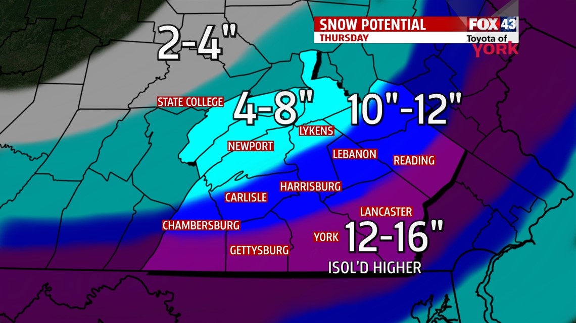
Here’s a list of the major towns in each range.
12-16″: Gettysburg, York, Lancaster, Reading
10-12″: Chambersburg, Carlisle, Harrisburg, Lebanon, Pottsville
4-8”: Newport, Lykens, Mifflintown, Lewistown, State College
HAZARDS: The snow continues to cause plenty of travel problems. It’s greatly reducing visibilities as well as making very slick roadways and at times impassible roadways. Some weakened trees from the ice storm last week may fall with the added weight of the new snow, so beware of downed limbs and power lines. Winds will blow snow over plowed roads and reduce visibilities.
VALENTINE’S DAY: We’re partly to mostly cloudy. Highs hit the middle to upper 30s. A clipper brings some snow showers, but your evening plans should still be OK. Snow overnight may add 1-2″ of snow to the ground.

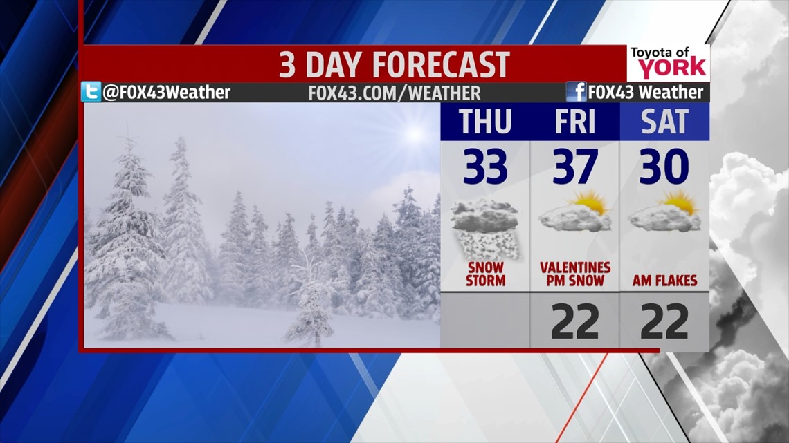
WEEKEND: Some snow showers may greet us Saturday morning, but the day looks dry and partly cloudy with a cold high of 30°. Sunday, we may begin with a handful of snow showers, giving way to partly cloudy skies and highs in the upper 20s.
NEXT WEEK: A warming trend begins. Highs are in the low 30s Monday and near 40° by Tuesday! A system will bring some rain or rain/snow mix Tuesday. Expect warming for late week!
Be safe today and send us your reports, photos, and whatever you got for us via Facebook or Twitter!
“Energy and persistence conquer all things.” – Benjamin Franklin
– Jeff Jumper, WPMT FOX43 Morning Meteorologist
Follow me on Twitter: @JeffJumperWX
Like me on Facebook: Jeff Jumper FOX43