
OVERVIEW: Cold front sweeps across the area this evening. Another area of low pressure rides up from the Tennessee Valley to the Delmarva coast by Saturday evening. This second system has the potential to bring significant rain. An upper level low will pass by just to our south Saturday night into Sunday keep the rain chance into the start of Sunday. Milder but more unsettled conditions head our way for next week.
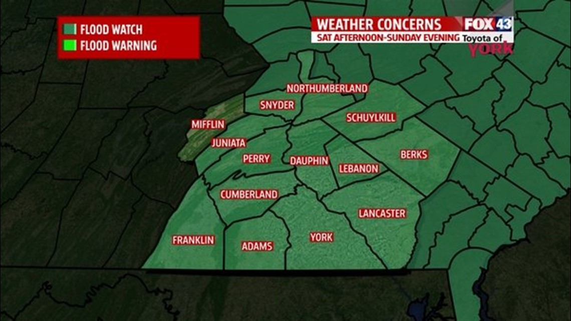
FLOOD WATCH: With the anticipating wet weather, a FLOOD WATCH goes into effect Saturday afternoon until Sunday evening. Storm total rainfall amounts could reach 1 to 2 inches. This may cause significant rises and possible flooding of small streams, creeks and main stem rivers.

THIS EVENING: Isolated threat for showers otherwise, mostly cloudy, breezy with temps falling from the upper 50s to around 50.
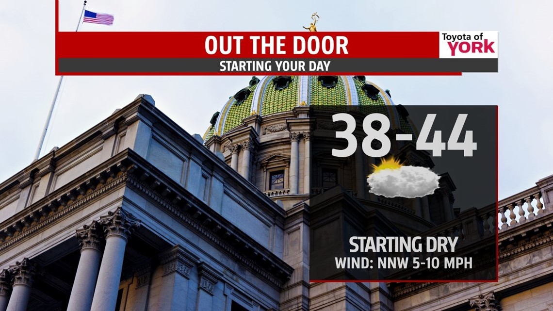
OVERNIGHT: Mostly cloudy, may be a few areas with fog, lows in the upper 30s to low 40s. We should remain dry until the morning hours.

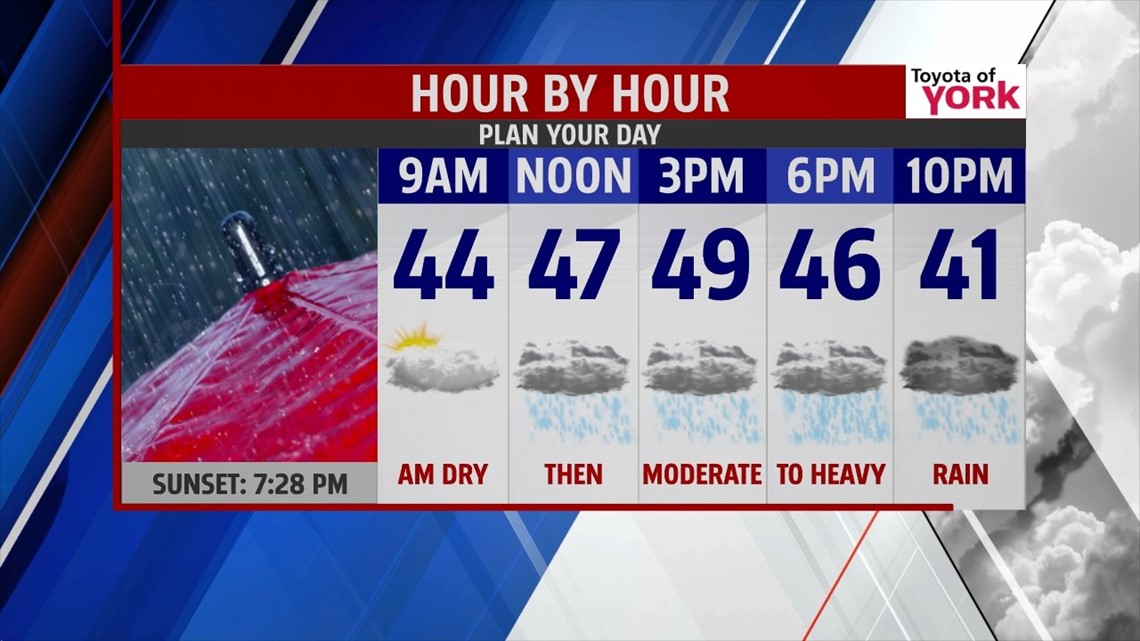
TOMORROW: Rain spreads in quickly from late morning on and stays with us through Sunday early afternoon. Temperatures will move little only warming to near 50. Highs will actually take place just after midnight in the middle 50s. Rain continues Saturday into Sunday. We could pick up 1 to 2 inches of rain with isolated higher amounts in our eastern counties.

Upper level low and trough moving in will keep showers and clouds around for Sunday and keep temperatures around 50 degrees.
STARTING MILD NEXT WEEK: The upper level pattern changes and becomes more zonal allowing systems to move quick but also keeping temperatures milder. Heading back to work, we’ll see mostly sunny skies with much milder temperatures in the upper 50s to low 60’s Monday. The next system quickly arrives Tuesday with a few isolated showers mainly north and some mild air ahead boosting our temps to the mid 60’s. The front will knock temps back just a few degrees to the low 60’s for Wednesday with mostly sunny skies. A warm front moves in for Thursday bringing a chance for showers late in the day towards evening. It will be mild with highs in the low 60’s. It will be followed by a cold front that pushes in Friday keeping shower threat around to end the week.
Have a nice night.
MaryEllen Pann, Chief Meteorologist
Like me on Facebook: maryellenpannfox43
Follow me on Twitter: @MaryEllenFox43