

GRADUALLY DRYING OUT

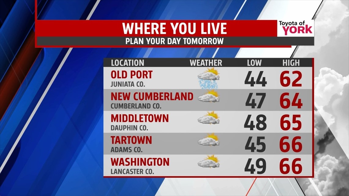
Drier days are ahead as an upper level storm system continues to slowly lift north of the region. A few spotty showers are still possible through the rest of the day, but any that form quickly fade during the early evening hours. Then, skies are partly cloudy through the rest of the night. Low temperatures are a bit cooler, falling into the 40s. Friday looks mainly dry as well. There’s only a chance for an isolated shower, mainly to the western parts of the area. Otherwise, some sunshine pokes through once again, especially during the morning hours. Highs fall back into the 60s.
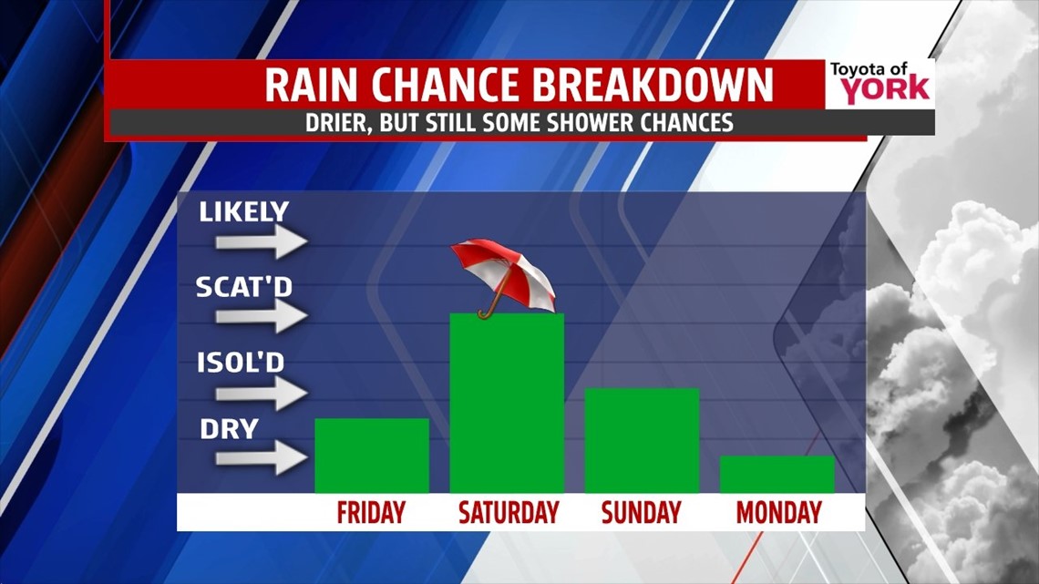
STILL SOME SHOWER CHANCES
The weekend continues to reflect an overall drying trend, but it will not come without any shower chances. Saturday is our best chance for widespread showers as a weak cold front swings through. By Sunday, we’re mainly dry, but an isolated shower or two is still possible. Highs are in the middle 60s through the weekend.
SLOWLY WARMING
Monday through Wednesday feature more sunshine. A warm front will slowly slip north, helping to gradually warm the region. Temperatures steadily climb from the middle 60s Monday to near 70 degrees by Wednesday. By Thursday, the front completely clears the area, ushering in some much warmer air. Highs rise well into the 70s. A few showers are possible too as the warm front crosses, but it will be a mainly dry period.
Have a great night!
-Andrea Michaels