

MAINLY DRY EARLY WEEK

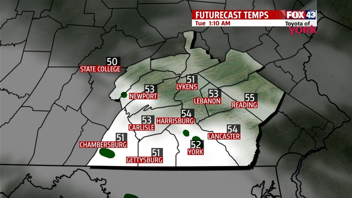
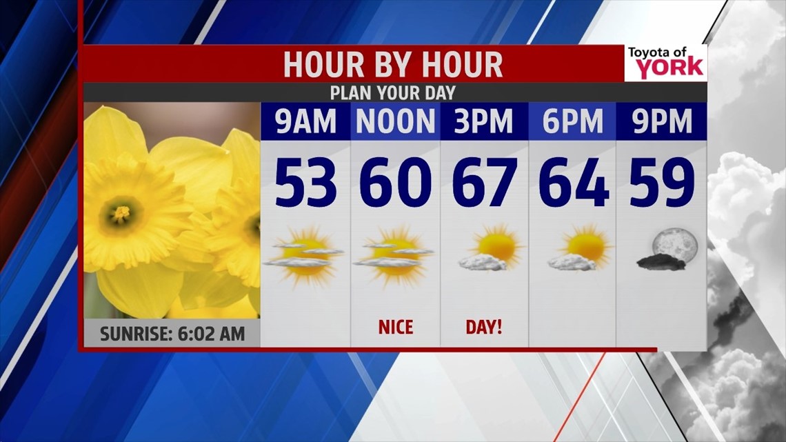
Yesterday’s front continues to sit just to our south, keeping us on the cooler side. Afternoon temperatures peak a bit below seasonable averages. Some clouds to our northwest begin to drift in late in the day and continue to thicken into the evening. Some isolated showers are possible, mainly along our west and southwestern parts. That chance continues through the night. Low temperatures fall into the lower to middle 40s. The clouds exit Tuesday morning, giving way to plentiful sunshine. Temperatures are a bit closer to seasonable averages in the middle to upper 60s. Wednesday is similar to Tuesday, but a warm front lifts north. This brings the chance for some late day showers.
WARMING UP!
The warm front continues to lift north through Thursday morning, keeping showers in the forecast. Then sunshine returns for the afternoon, and a mild flow sets up. Highs jump into the middle to upper 70s, and continue to climb into Friday. The front is completely north of us by then, ushering in some unseasonably warm air. Highs are in the lower 80s.
TURNING UNSETTLED
Saturday a cold front approaches the region, bringing the chance for showers and thunderstorms. High temperatures will still reach the 70s. Sunday remains unsettled with a continued shower chance. By Monday, skies dry out. Highs remain in the 70s through Monday.
Have a great night!
-Andrea Michaels