
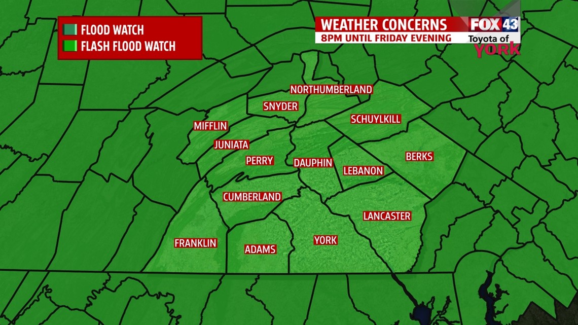
OVERVIEW: We say good bye to the warm and humid air which will be replaced as a cold front swings through tomorrow afternoon. Heavy rain ahead of the system moves in tonight but exits the area by early afternoon. Widespread showers and thunderstorms with periods of heavy rain may lead to some flooding. FLASH FLOOD WATCH goes into effect this evening and continues until tomorrow evening. Cooler, drier air moves in for the weekend with only a stray shower chance for Saturday. We see the warmth and humidity return by the middle of next week.

EVENING FORECAST: Showers and storms mainly west will continue while much of the area remains rain free. Temperatures will drop from around 80 degrees to the lower 70s.
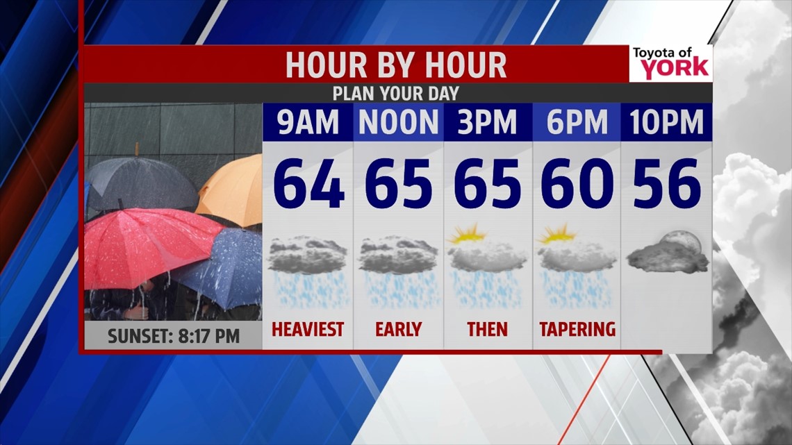
OVERNIGHT: Rain picks up and remains steady through the morning commute. Pockets of heavy rain will be likely. The front will be very slow to move so some areas where rain hovers over longer could see the rain pond on roadways or flood basements. Rapid rises along the creeks and streams will be a concern as well. Temperatures will remain in the 60s.
WET START: Friday starts out with heavy rain which will taper around noon time. We could see clearing in our west counties by afternoon while a few showers may still linger in the east. Highs will take place just after midnight. Temps hold steady in the low to mid 60s but fall to the 50s heading into the late afternoon and evening.

WEEKEND OUTLOOK: Upper level trough and energy keeps the clouds around mixing with sunshine. Temperatures will be noticeably cooler in the upper 60s both days. Some upper level energy swinging in may trigger an isolated shower Saturday but most of the area remains rain free. Sunday will see more sunshine
NEXT WEEK: The heat and humidity makes a return heading into the middle of next week.
Have a good day!!!
MaryEllen Pann, Chief Meteorologist
Like me on Facebook: maryellenpannfox43
Follow me on Twitter: @MaryEllenFox43