
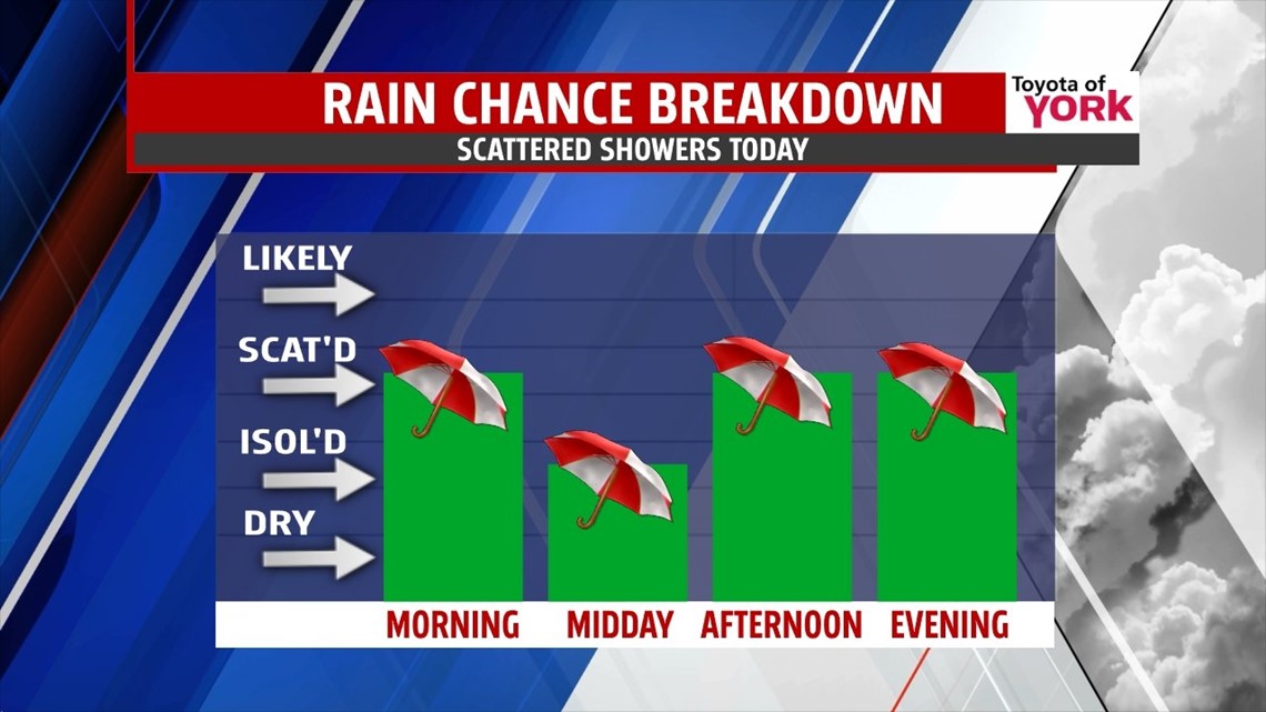
RAIN & COOLING: The cold front continues to sag southward today, and showers and storms linger for another day. Expect highs today to top out near 80° before cooler air pushes in from the east. We’re mostly cloudy to overcast, with scattered showers and storms during the day. Cooler air creeps in on easterly flow during the afternoon and evening. Lows dip to the low and middle 50s with clouds, mist, drizzle, and a few showers overnight.

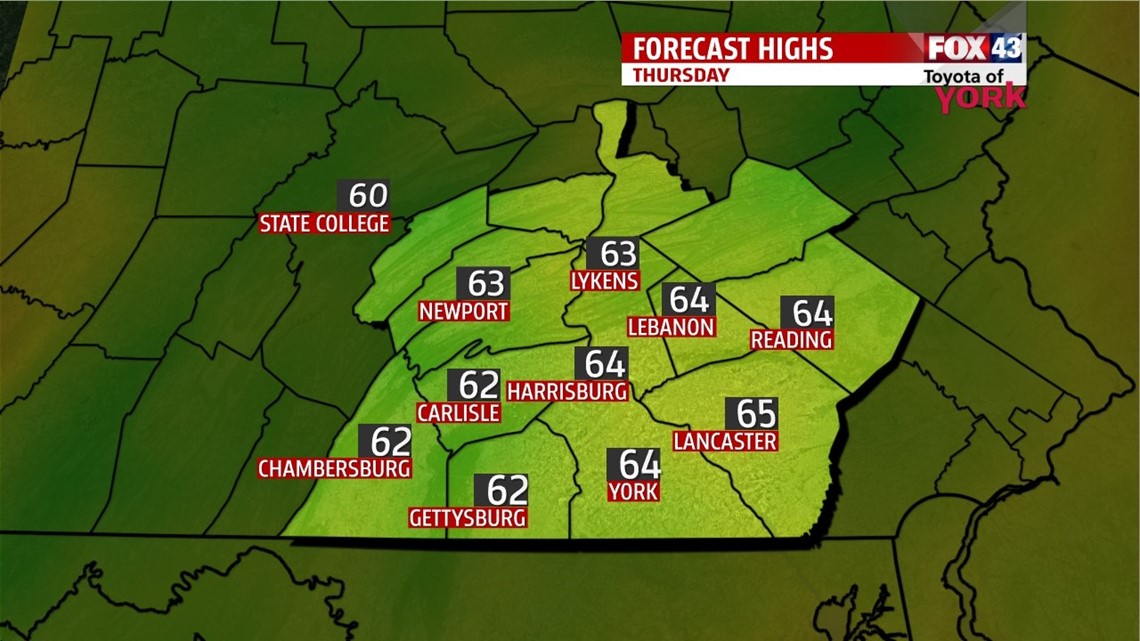
COOL THURSDAY: A low level easterly flow is with us for a day. This is a telltale sign that clouds will hang tight and cool air will funnel in underneath the clouds. Highs will only top out in the middle 60s, with a few showers and some drizzle weather through the day. We may clear a bit to the northeast by evening.

FRIDAY: Another cold front sags south from the Great Lakes region. This will help to scour out the low clouds later on Friday. We may see a few showers or storms fire with it as well. Highs should make it to the middle 70s.
WEEKEND: Saturday and Sunday are mostly sunny with warm air building back into place. Expect highs in the upper 70s Saturday and near 80° on Sunday. Enjoy!
NEXT WEEK: It looks warm with highs in the 80s again. Some showers and storms may fire late Monday with storms lingering into Tuesday with the next system.
Make it a wonderful Wednesday!
“It does not matter how slowly you go as long as you do not stop.” – Confucius
– Jeff Jumper, WPMT FOX43 Morning Meteorologist
Follow me on Twitter: @JeffJumperWX
Like me on Facebook: Jeff Jumper FOX43