
HOT AIR: We’re peaking midweek with the heat and humidity way up! Highs today will be in the low 90s. Humidity will make it feel closer to 100°. Expect a hazy, foggy start with passing clouds through the day. An isolated storm may fire late, which could be strong. We’re dropping to the low 70s tonight.

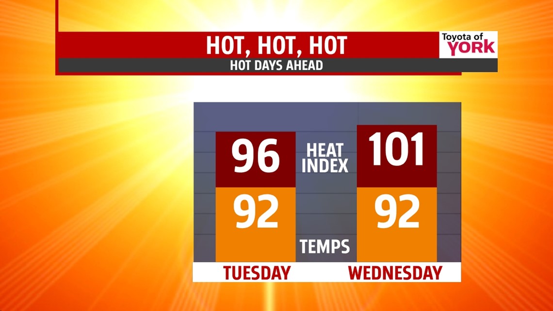
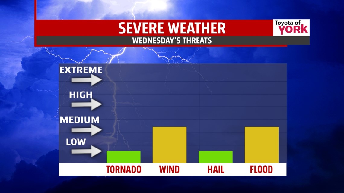
STORMS: Let’s do it again on Wednesday, shall we? Highs hit the low 90s with heat indices at 100°. We’re partly cloudy with showers and storms firing especially in the late afternoon and evening. These storms have the potential to organize along a stalled frontal boundary. They will produce heavy downpours which may cause localized flooding. Also, the storms may be strong to severe with damaging wind gusts as the primary threat, along with frequent lightning. Stay alert.

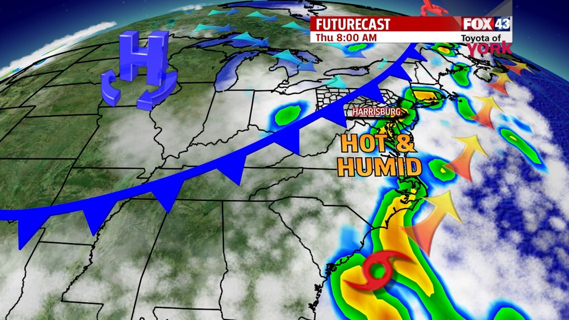
A cold front rolls through on Thursday, helping to fire more organized thunderstorms. Expect another hot and humid day, with highs in the upper 80s. A few storms could be strong to severe, but you should expect heavy downpours and frequent lightning with all the moisture in place. The storms should taper overnight as high pressure begins to push east.

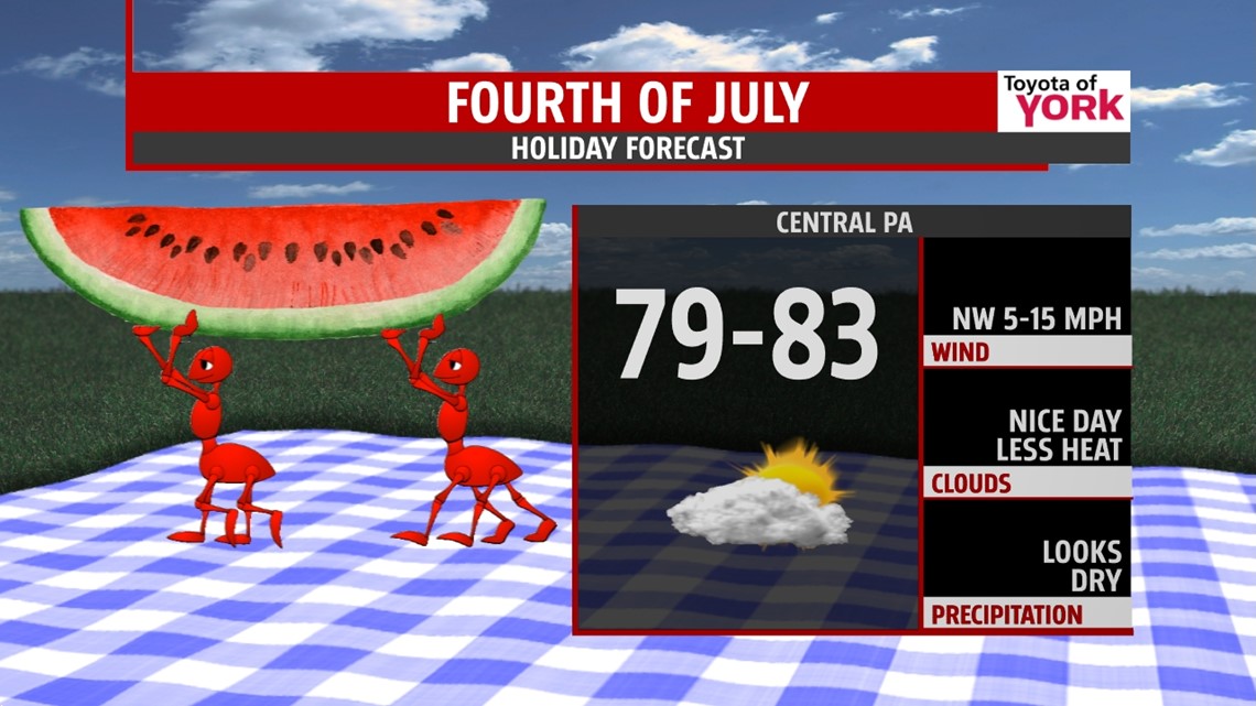
4th OF JULY: As of now, we’re watching the tropical system and how fast the front clears. We expect skies to clear from NW to SE. Temperatures drop and the humidity dissipates. Highs hit the low 80s under partly cloudy skies. A nice breeze will help usher in drier air, but we may see an early shower, especially east. Barbecues, pool parties, and evening fireworks will all go off without much weather concern.

WEEKEND: The bliss is here in time for the weekend. It’s mostly sunny and seasonably warm with highs in the middle 80s. Humidity stays in check too, just a tad muggy. Rain chances look to hold off as well. What a weekend!
TROPICS: We have our first tropical system of the 2014 Atlantic season. It meanders off the eastern Florida shore through mid-week. Then, the system if forecast to race along the east coast. A cold front passing through PA on Thursday will help steer the system out to sea into the weekend. Locally, impacts look exceptionally low, but those heading to the beaches this weekend may have to deal with some rain and winds to start the holiday weekend, as well as some rough waters. We’ll keep watching and tweaking the forecast.
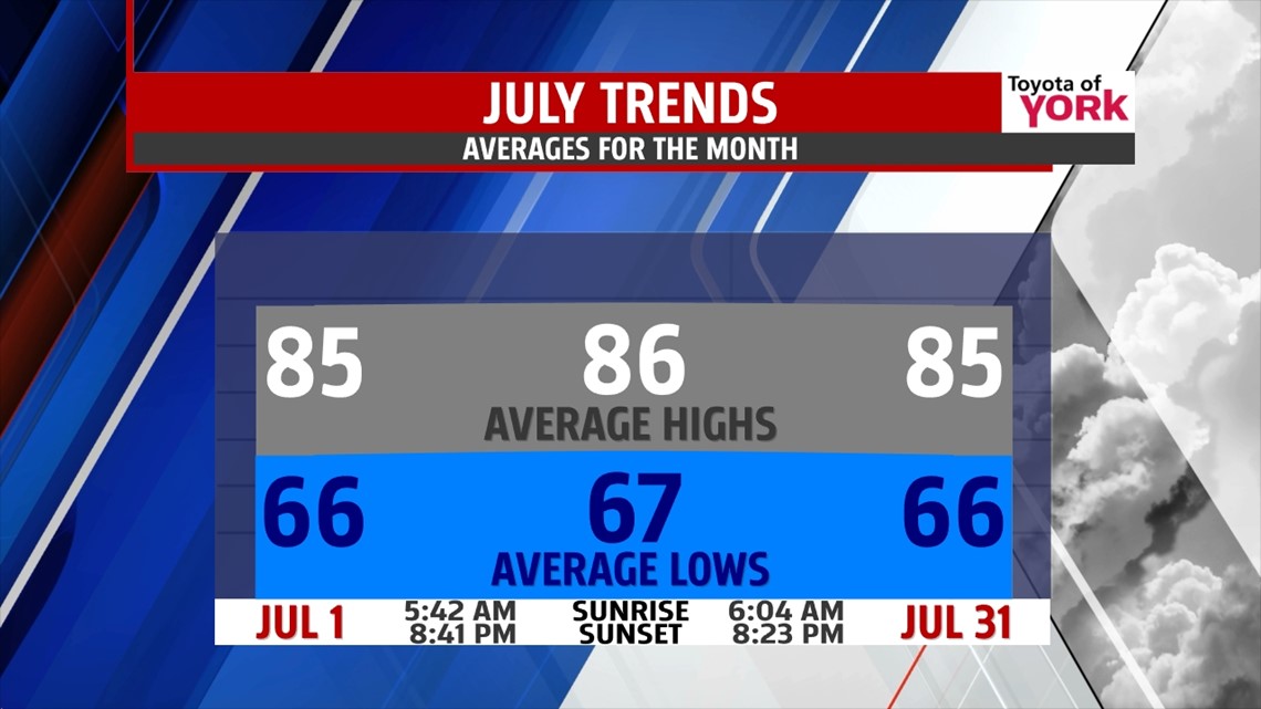
Make it a terrific Tuesday! Here’s a look at the July averages!

“The fool doth think he is wise, but the wise man knows himself to be a fool.” – William Shakespeare
– Jeff Jumper, WPMT FOX43 Morning Meteorologist
Follow me on Twitter: @JeffJumperWX
Like me on Facebook: Jeff Jumper FOX43