
SEVERE THUNDERSTORM WATCH in effect until 9pm for the entire area. Scattered thunderstorms will produce the threat for damaging wind gusts and hail this afternoon and evening.


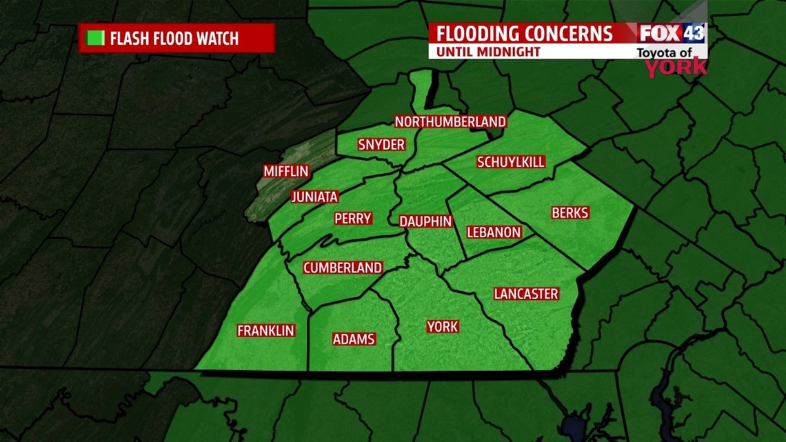
FLASH FLOOD WATCH in effect until midnight for the entire area. Training thunderstorms or storms that move over the same areas will produce very heavy rainfall. Doppler radar estimates that up to 2 inches of rainfall may occur in an hour. Be on the lookout for rapidly rising waters along small creeks and streams as well as poor drainage areas. Rain may pond quickly on roadways too.

THIS EVENING: Strong to severe storms will be possible this afternoon and evening. Make sure to keep an eye to the sky and take cover immediately if threatening weather approaches. Storms may produce damaging wind and hail and there is an isolated threat for a tornado. Temperatures are very warm in the upper 80s and will fall to the upper 70s as we head towards 10pm.
OVERNIGHT: Thunderstorm threat will end but showers will still be possible as Hurricane Arthur rides up the coast colliding with the cold front. Showers will be mainly likely in our eastern counties for the morning hours. Humidity will be on the decline as drier air slowly works in.


TOMORROW: High pressure will be nudging eastward and help shift our winds more northwesterly which will provide drier air. Temperatures will be cooler and air will be more comfortable. A strong breeze will set up with winds around 10-20 mph and gusting higher. Skies should be mostly sunny by the afternoon.


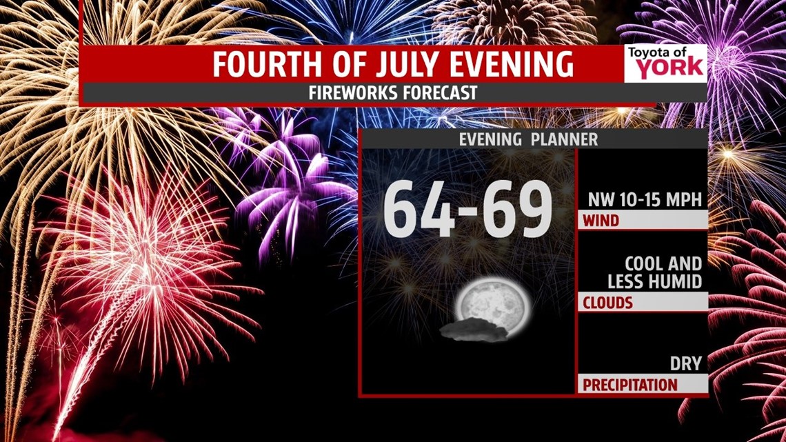
Fourth of July fireworks should be good to go as winds should start to relax in the evening hours.

OUTLOOK: Big bubble of high pressure overhead will bring another fabulous weekend to us with plenty of sunshine, cooler and more refreshing morning lows in the upper 50s to near 60 and highs near seasonal averages in the low to mid 80s. It will turn warmer and more humid next week with storm chances returning.
MaryEllen Pann, Chief Meteorologist
Like me on Facebook: maryellenpannfox43
Follow me on Twitter: @MaryEllenFox43