
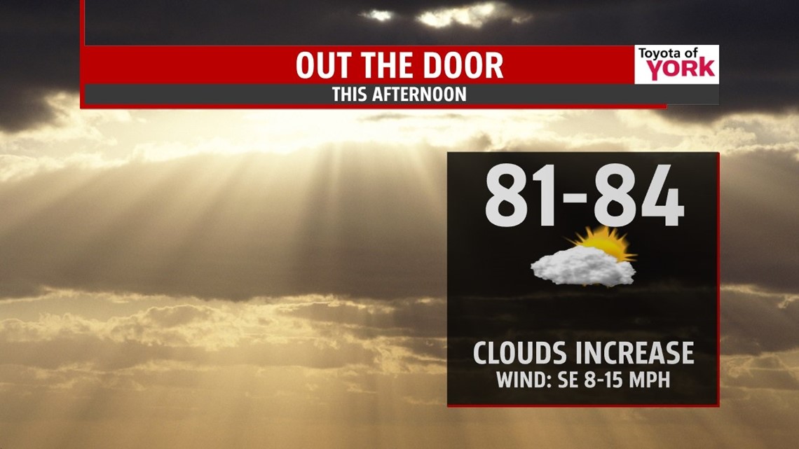
DRY START: It’s cool and mostly sunny to kick start your work week, but that won’t last long. Clouds build quickly with highs today topping out in the low to middle 80s as we await our next storm system. It does look mainly dry for the day today, but some showers may arrive after dark. Tonight, we bottom out in the middle 60s with rain filling in quickly.

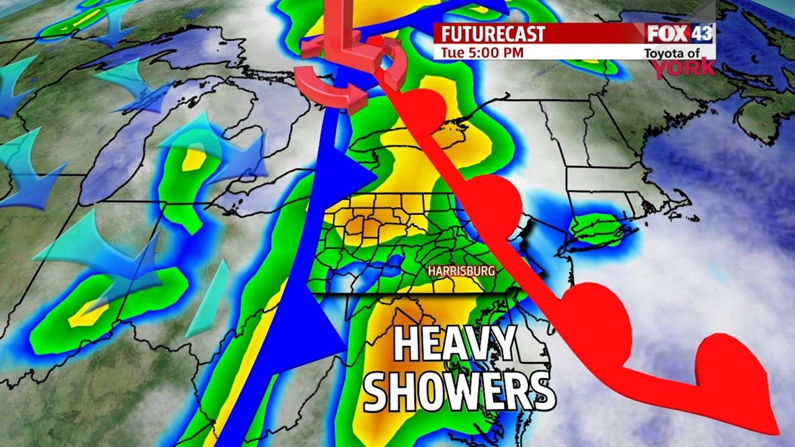
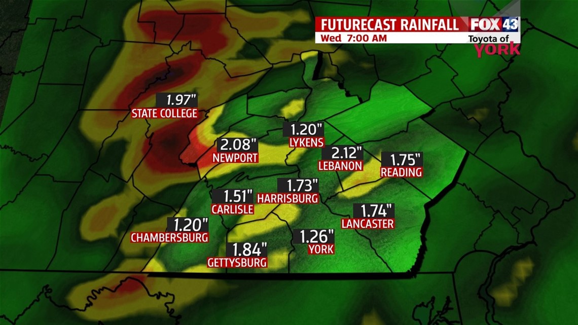
FRONT: A fast paced cold front slices through on Tuesday. This will bring heavy rain and a few embedded thunderstorms. We’re looking at 1-2” of rain for most, with locally heavier amounts. Flooding will be a concern where the rain falls faster than the ground and drainage systems can handle. Stay alert for flash flooding. Rain tapers overnight. Highs are in the upper 70s with plentiful cloud cover.


As cooler air aloft slips in, it keeps clouds and lingering showers in the plan for Wednesday. Highs are held near 80°. By the end of the week, drier air slips in and skies gradually clear for sunshine as highs settle in the middle to upper 70s! It’s another fall preview.

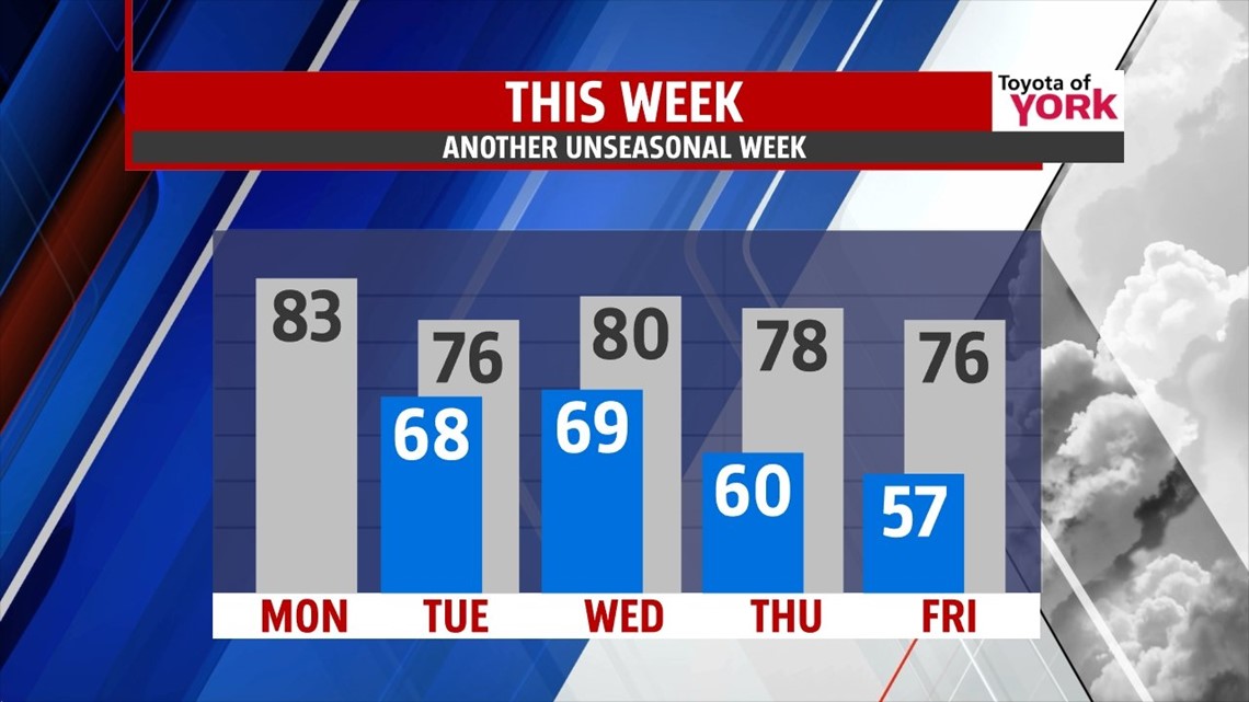
WEEKEND: High pressure and cool air hangs on for the weekend. Expect mostly sunny skies with highs in the low 80s. Humidity stays in check as well.
Have a wonderful Monday! Andrea is in for a few days so I can attend the AMS Summer Community Meeting in State College to help us better our forecasts and delivery to you!
“Happiness is not something ready made. It comes from your own actions.” – Dalai Lama XIV
– Jeff Jumper, WPMT FOX43 Morning Meteorologist
Follow me on Twitter: @JeffJumperWX
Like me on Facebook: Jeff Jumper FOX43