
MILDER AIR LINGERS
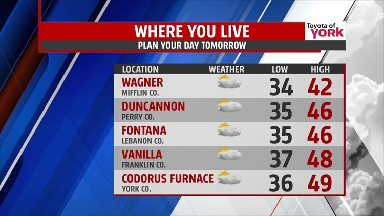
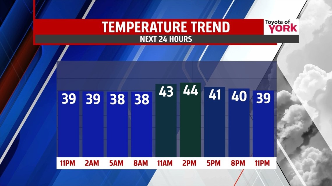
High pressure continues to keep us dry and milder this evening despite plenty of clouds, and we remain dry to begin the new workweek. Tonight, the clouds hang tough throughout the Lower Susquehanna River Valley. It’s a milder night too, with overnight low temperatures falling into the middle to upper 30s. Monday brings another day above seasonable averages. Highs reach the middle to upper 40s. As our next storm system approaches, the clouds are here to stay overall, but some sunshine may sneak in during the afternoon.
NEXT RAIN CHANCE

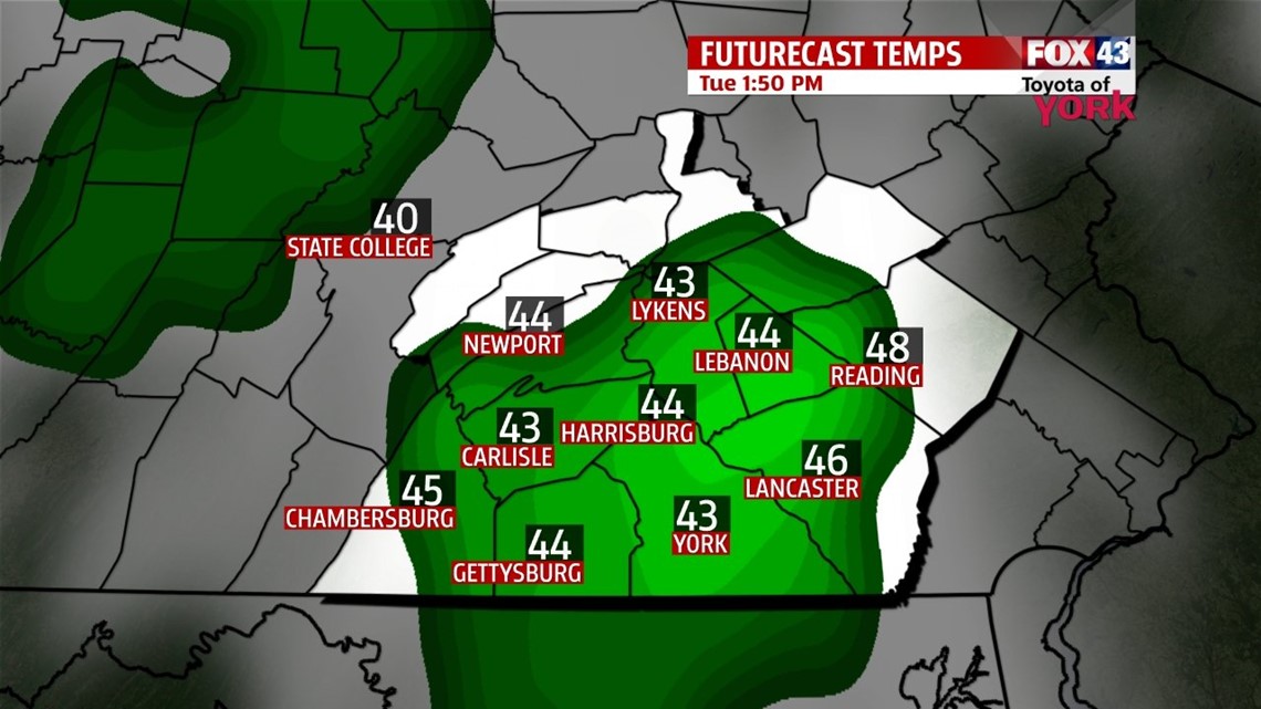
Tuesday a weak system approaches, bringing the chance for showers, with the best chance during the second half of the day. Wednesday is drier, but a few early morning drops are still possible. Highs temperatures hover in the 40s through midweek.
END OF WEEK
Thursday and Friday remain dry with a mixture of clouds and sunshine. Temperatures continue to hover near or slightly above seasonal averages for this time of year, in the lower 40s. Looking ahead to next weekend, computer models continue to hint at a potential storm system. We’ll be watching for rain and/or snow chances.
Have a great week!
-Andrea Michaels