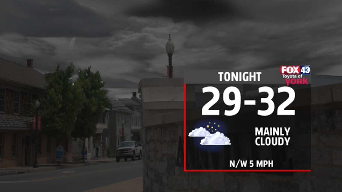
OVERNIGHT
Our late winter season storm is moving way. We are left with flurries and drizzle as low level moisture hangs around. Temperatures will only fall from around 34 to near 32. Low level moisture stubborn to move out so clouds will be hanging around for much of the night. Mist and drizzle will shut off around midnight or so. Lows will only drop to the upper 20’s to low 30's.

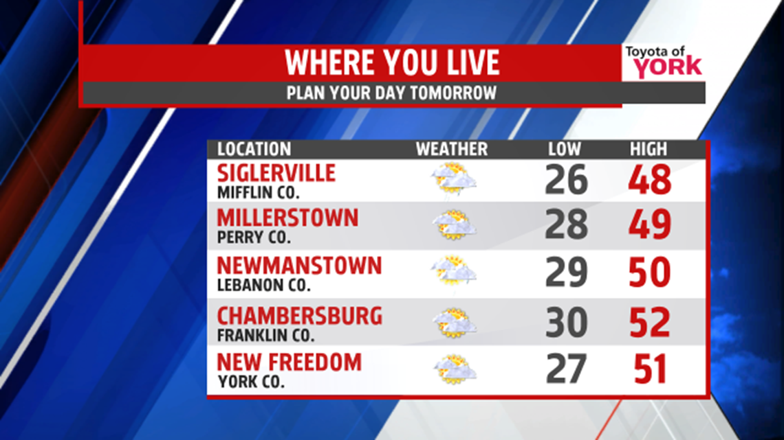
Our first full day of spring we’ll see temperatures will to more seasonal averages in the upper 40’s to low 50’s ahead of a fast approaching cold front. Sunshine will mix in and out of the clouds and the breeze will shift more to the southwest allowing for the milder air to move in. There may be an isolated shower or two with the front in the evening but most of the area will not see rain. Behind the front it turns chillier once again as colder air settles in for a few days.

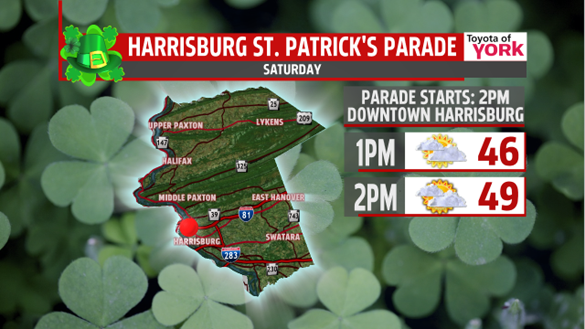
If you are heading to the St. Patrick’s Day parade in downtown Harrisburg, it should be a decent day with temperatures in the upper 40s to near 50 at the start of the fun!