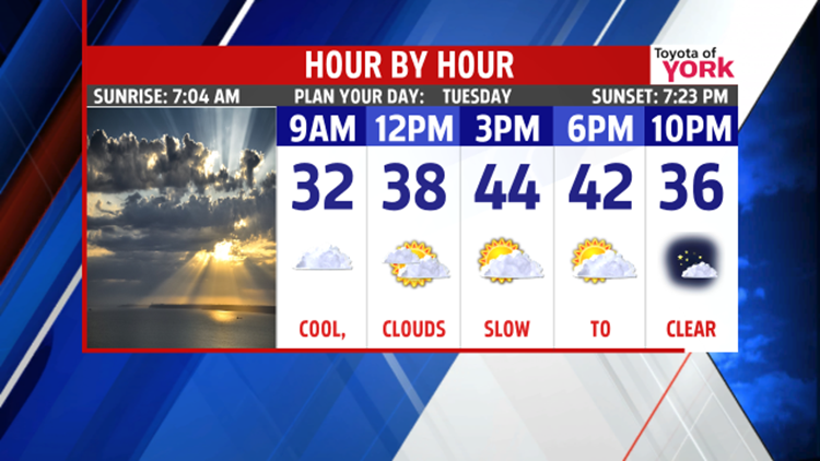
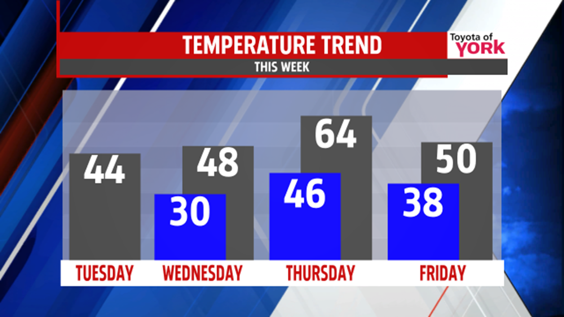
MODERATION: After a chilled Monday, we only warm up a tad today. Morning clouds are slow to give way to afternoon sun with highs in the middle 40s. Overnight, clouds roll back in with lows near 30°.

A weak low pressure system rolls by Wednesday with the chance for some showers during the day. It’s mostly cloudy with highs held in the upper 40s.
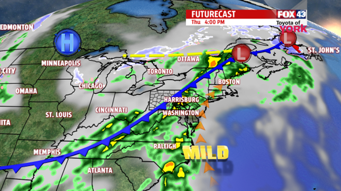
WARM & STORM: A second system arrives for Thursday evening. Ahead of it, we get some nice warm air to slip in. We’re talking highs in the middle 60s! It’s mostly cloudy with scattered showers early, then a line of showers and maybe some thunderstorms later in the evening.

FRIDAY: We’ll see some cooler air slide in behind Thursday’s system. It’s partly sunny and drying out with highs closer to 50°.

WEEKEND: Cold, Canadian high pressure builds in for the weekend. Expect partly cloudy to mostly sunny skies. Cooler air settles back in with low to middle 40s for highs.
Make it a terrific Tuesday!
“Winning is only half of it. Having fun is the other half.” – Bum Phillips
- Jeff Jumper, WPMT FOX43 Morning Meteorologist
Follow me on Twitter: @JeffJumperWX
Like me on Facebook: Jeff Jumper FOX43