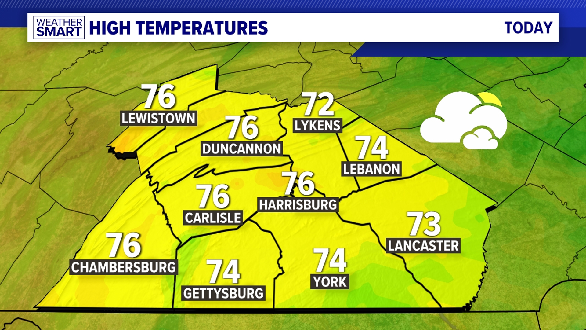

ONE MORE DRY DAY
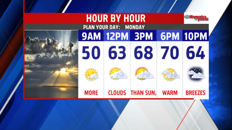
Some passing clouds to the north fade into the evening hours, leading way to another mostly clear night throughout our area. The winds taper, and overnight lows fall into the upper 30s to lower 40s. Monday brings sunshine to start, but clouds arrive and thicken quickly during the afternoon as a stationary boundary sets up to our north. Warm southwesterly breezes boost temperatures to near 70 degrees.
TURNING UNSETTLED

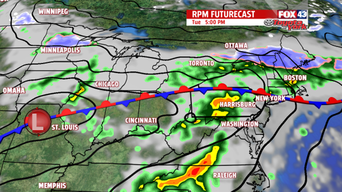
Weak disturbances push through and ride along the stationary boundary, and this brings us showers chances through midweek. Highs fall from the middle to upper 60s Tuesday into the 50s on Wednesday. Thursday, high pressure to the north tries to nose in some drier, but chillier air. Depending on how successful it is, some sunshine should return to the area. It comes at a price, with temperatures falling into the upper 40s to lower 50s. Temperatures could end up a bit chillier depending on how much cold air funnels into the area.
MORE APRIL SHOWERS
Whatever reprieve from the wet weather Thursday brings is over quickly. Our next system slowly pushes east, bringing a return to showers both Friday and Saturday. Temperatures do recover Friday, rising through the 50s. We could be near 70 degrees on Saturday! Sunday dries out with plenty of sunshine.
Have a great week!
-Andrea Michaels – FOX43 Weekend Meteorologist
Follow me on Twitter: @amichaelswx
Like me on Facebook: Andrea Michaels FOX43