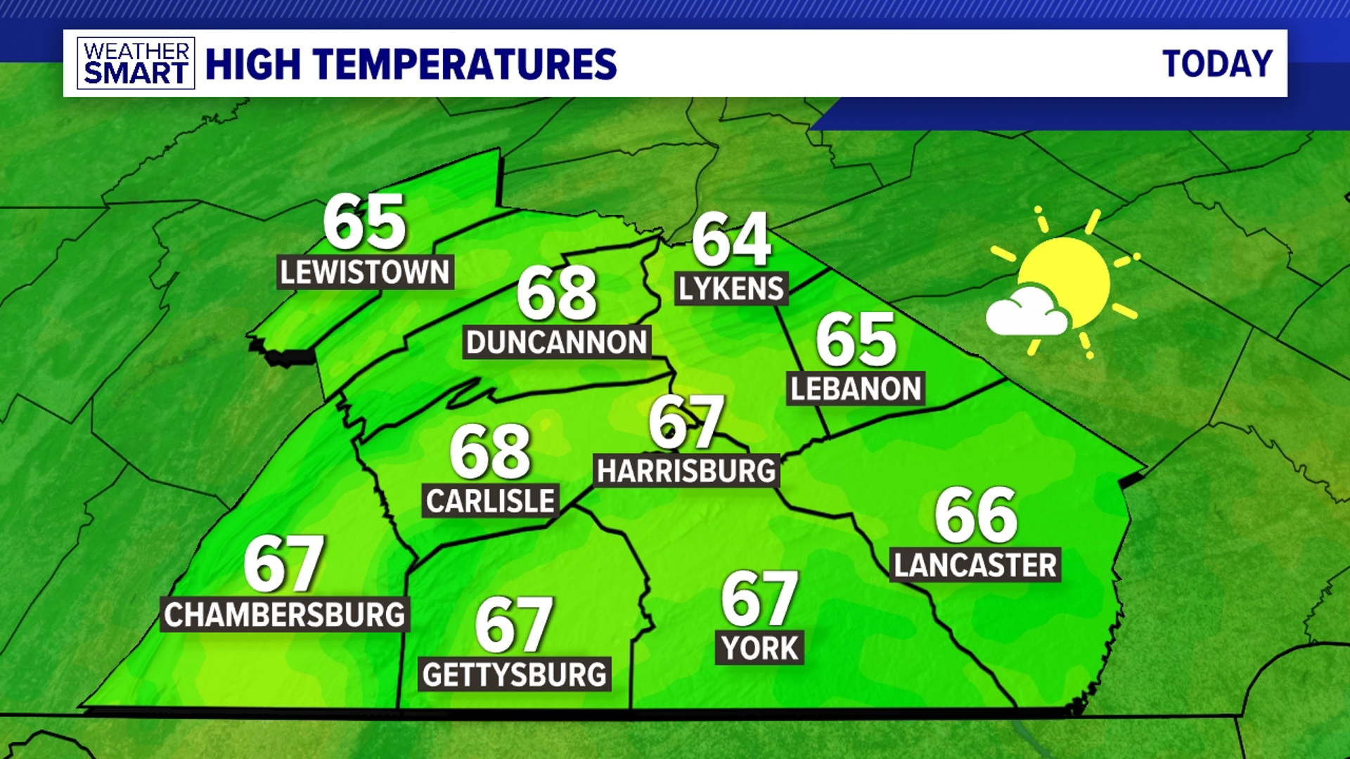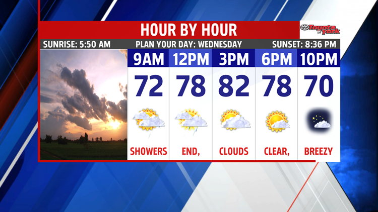
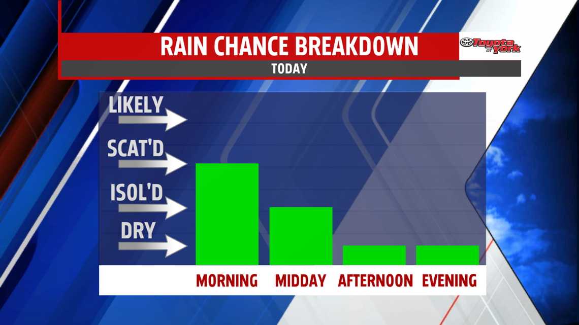
CLEARING
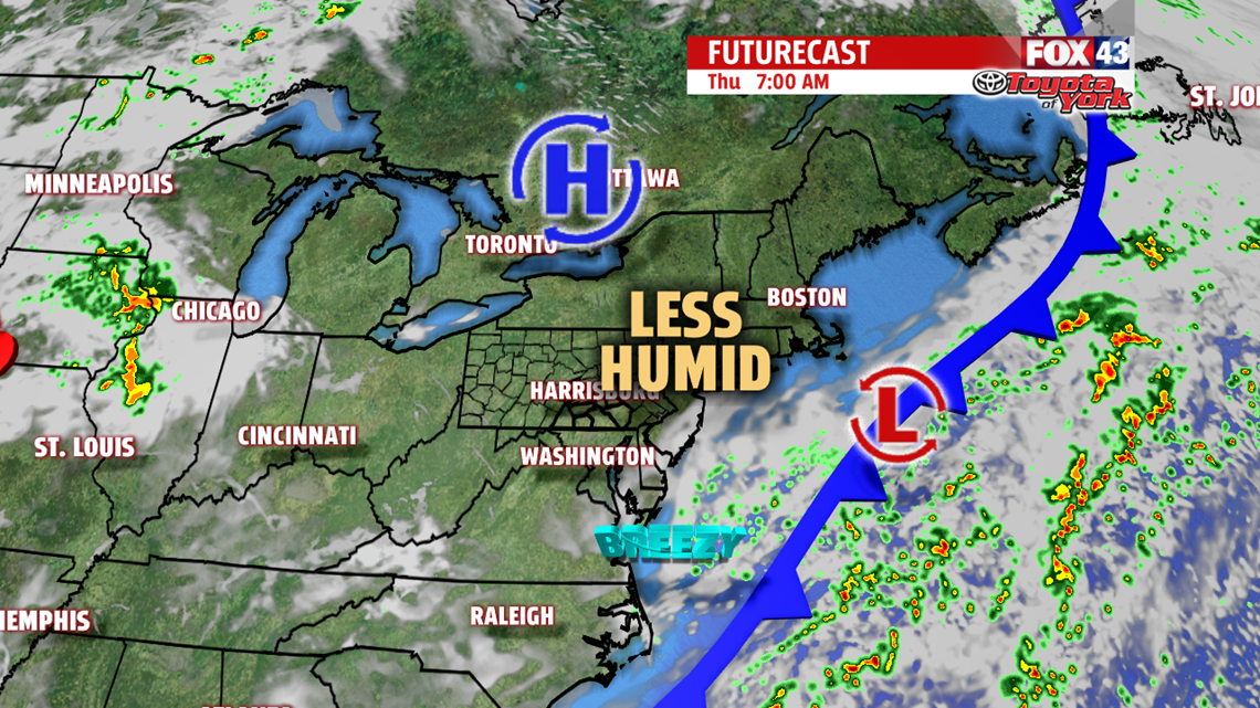
A cold front passes today allowing much less humid air to work in through the day. Some early shower chances continue across the area after heavy rain in spots overnight. Showers will slowly shift away by 12-2PM, confined mainly to the far southeastern counties.

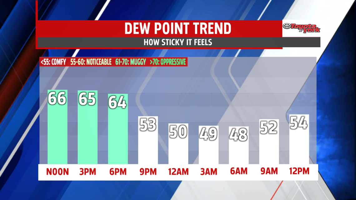
As showers end, a breeze kicks in with northwest winds at 10-20mph, shuttling in much less humid air across the region. The cloud cover breaks up too by evening! Highs today hit the lower 80s. Overnight, as humidity tanks, temperatures drop to the upper 50s!

LATE WEEK
Enjoy the sunshine and comfortable air for Thursday and Friday. Highs Thursday top out in the lower 80s while Friday’s highs touch the middle 80s. A few passing clouds will be all that inhibits the sun through both days.

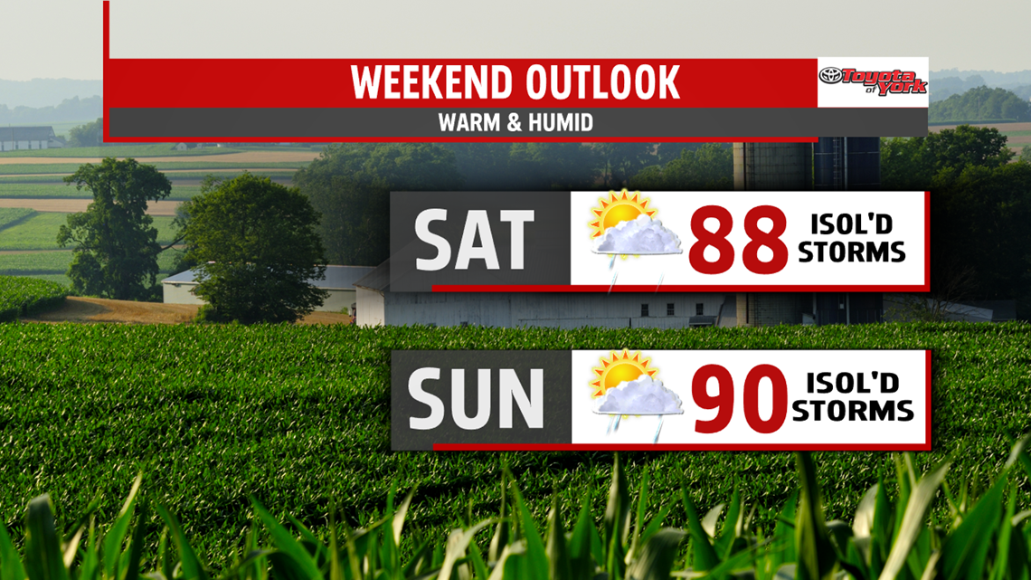
WEEKEND
We’re watching a warming pattern, but we’re still on the edge of a stormy pattern. So expect partly cloudy skies with highs in the upper 80s to near 90° over the weekend with more humidity in play. Storm chances are in the cards for later in the day too on both days.

NEXT WEEK
We’ll keep unsettled weather in the forecast for the start of the work week. We make a run at the upper 80s to near 90° through mid-week. Shower and storm chances continue.
Have a wonderful Wednesday!
“Every employee rises to the level of his own incompetence.” – The Peter Principle