SHOWERS, FEW STORMS END MILD SPELL
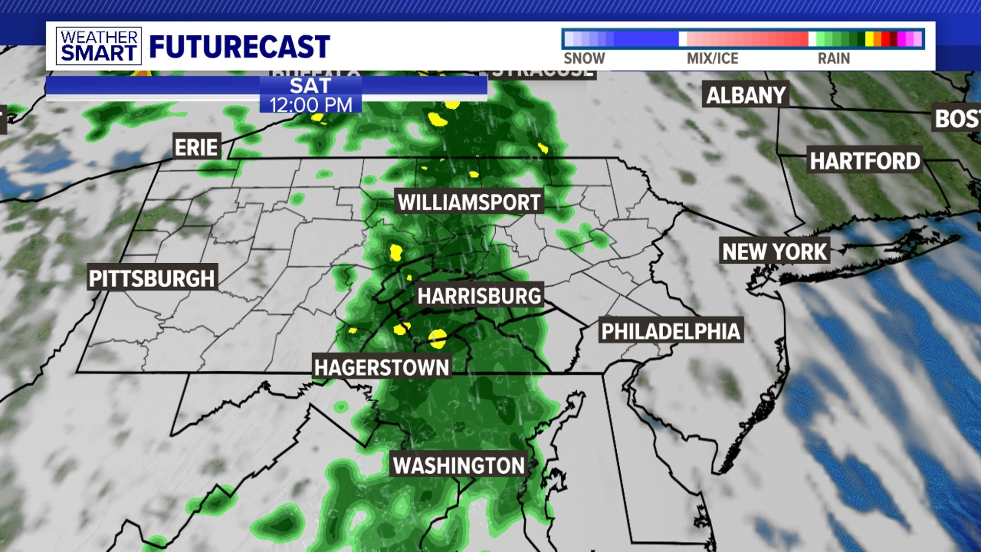
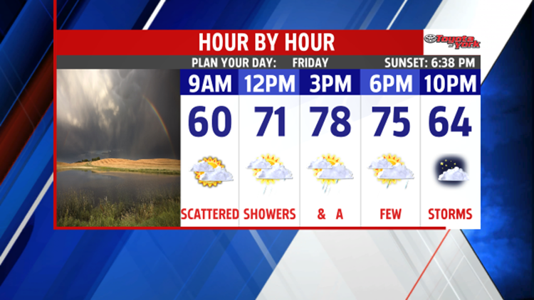
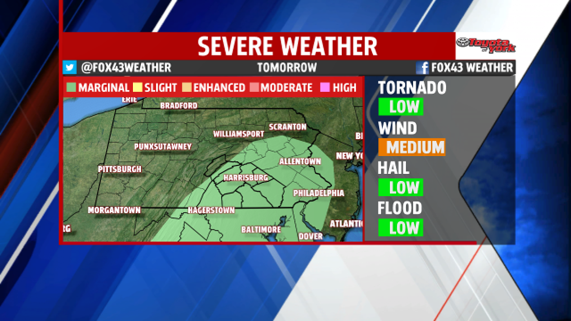
We’ll enjoy one more mild day in the 70’s despite clouds and threat for showers, as a cold front swings in late in the day. There also is a chance for thunderstorms to develop, some of which could contain strong gusty winds. Storm Prediction Center has placed the area under a marginal risk, the lowest threat, for severe weather.

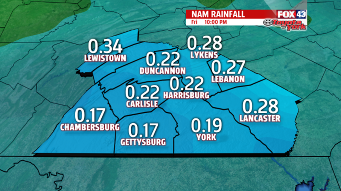
We don’t expect much in accumulation because of the speed of the front but areas could pick up anywhere from .10″ to about a .25″ of rain.

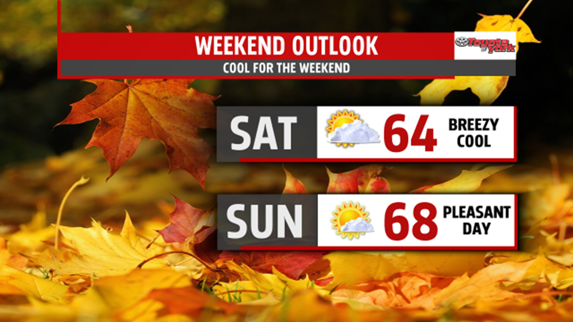
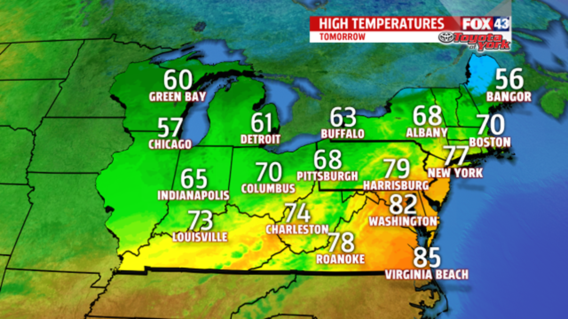
Behind the front, much cooler air filters south across the area for the start of the weekend. Highs will only warm to the low 60s and the breeze will add to the chill. Morning clouds will give way to plentiful sunshine, which may mix with a few passing clouds during the afternoon.

Skies clear overnight and with high pressure moving in overhead, will combine to make for a very chilly start Sunday morning. Temperatures will range from around 40 to 44 degrees. There is an outside chance a few areas dip into the 30’s. Sunny skies and a lighter breeze will warm us into the mid and upper 60s.