

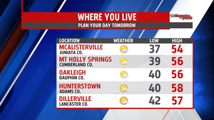

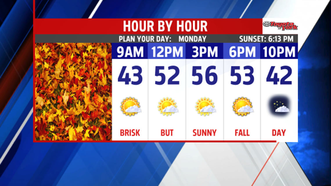
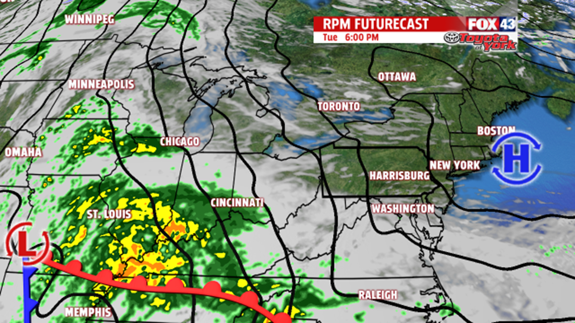
COOL FALL AIR: Clouds continue to break up this evening in the wake of a cold front that moved through Saturday night. Skies turn mostly clear through the night, and northerly winds help bring on the chill. Readings fall into the upper 30s to lower 40s. Monday full sunshine is back, with readings in the middle to upper 50s. Tuesday remains dry, but clouds filter in throughout the day ahead of our next storm system. High temperatures reach the upper 50s to lower 60s.

MIDWEEK RAIN: Rain is in store for the middle of the week. The rain arrives Wednesday, and lasts through the night. One to two inches of rainfall is possible. Some showers likely linger into the early part of Thursday. Highs are near 60 on Wednesday, and then highs are in the lower to middle 60s Thursday.
DRYING OUT: By Friday and Saturday, the sunshine is back. Another chilly air mass arrives too. This knocks high temperatures into the lower to middle 50s. The Halloween forecast looks dry and seasonably chilly for now! Sunday is a bit milder, and it’s a bit cloudier too.
Have a great week!
