COLDER AIR ARRIVES!
Showers have come to an end. Fog and drizzle will continue for another hour or so, and then the clouds will decrease later tonight. Temperatures will fall through the 40s this evening. Overnight, they will drop into the mid and upper 30s to near 40.

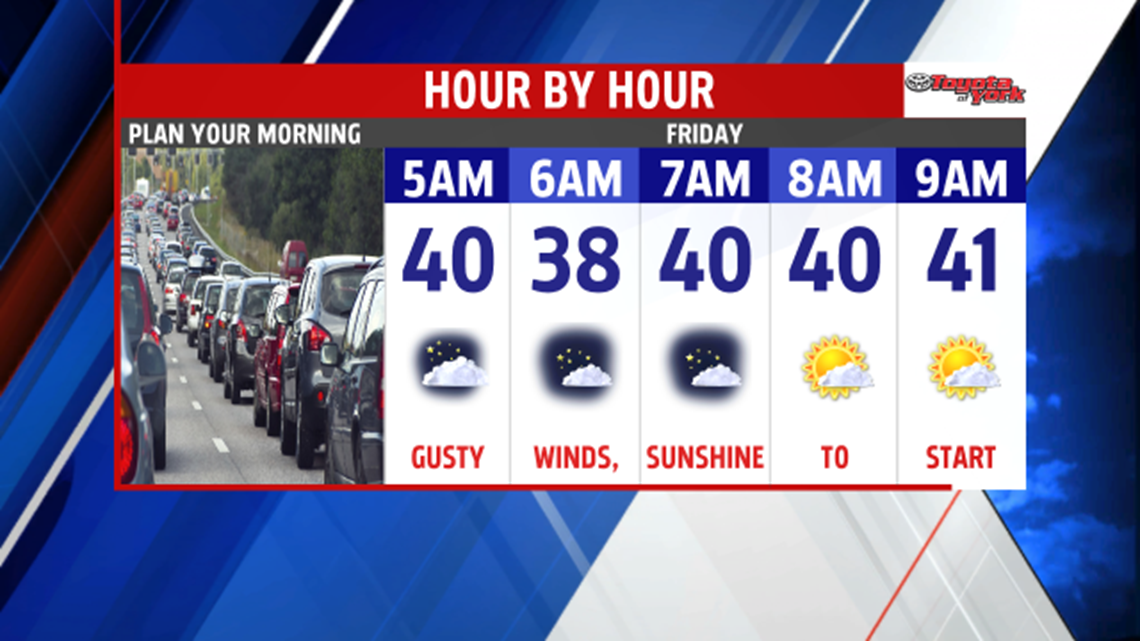
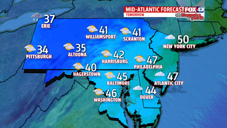
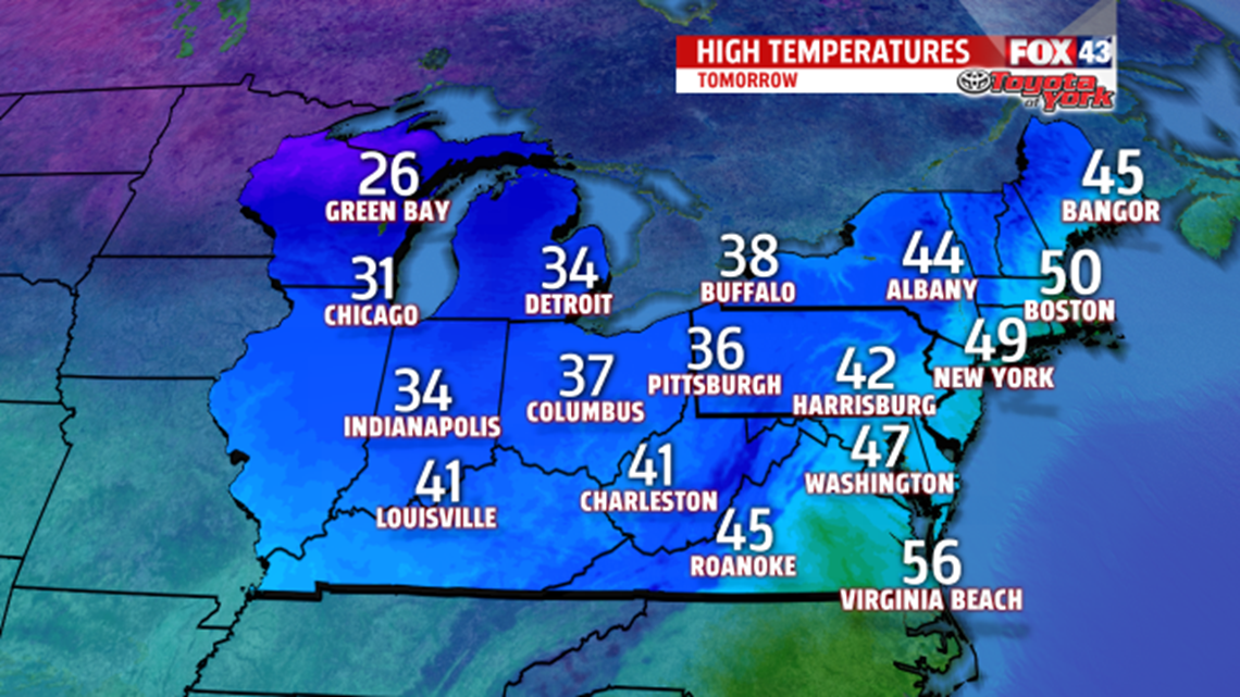
The day starts out with some sunshine, however, with strong cold air advection in the upper levels; the clouds will bubble up during the afternoon hours. The winds will also be picking up, adding to the chill. Northwest winds will reach 10 to 15 mph, gusts will near 25mph. Highs are reached early in the low 40s, and then will fall during the late afternoon and early evening into the 30s. Heading into Saturday, the winds will be even stronger and temperatures will be colder. Morning lows will plummet to the 20s, and will struggle to warm through the 30s under mostly cloudy skies. Upper level trough exits late Saturday, plus, high pressure builds in from the south at the surface, allows winds to calm down Sunday. With more sunshine around for the second half of the weekend, expect lows in the 20s to warm quickly to seasonable averages.

MILD CHRISTMAS WEEK
It looks like our cold spell will be short-lived. Heading into Christmas week, temperatures will quickly warm back into the 50s, maybe even low 60s. However, with several systems expected to move through, we’ll have several opportunities for rain showers.
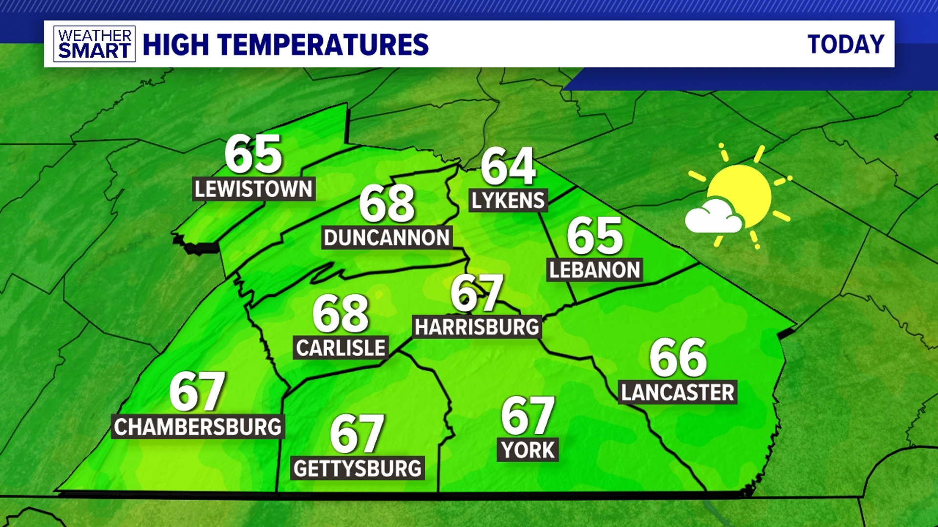
Hope you are enjoying a nice day!
MaryEllen Pann