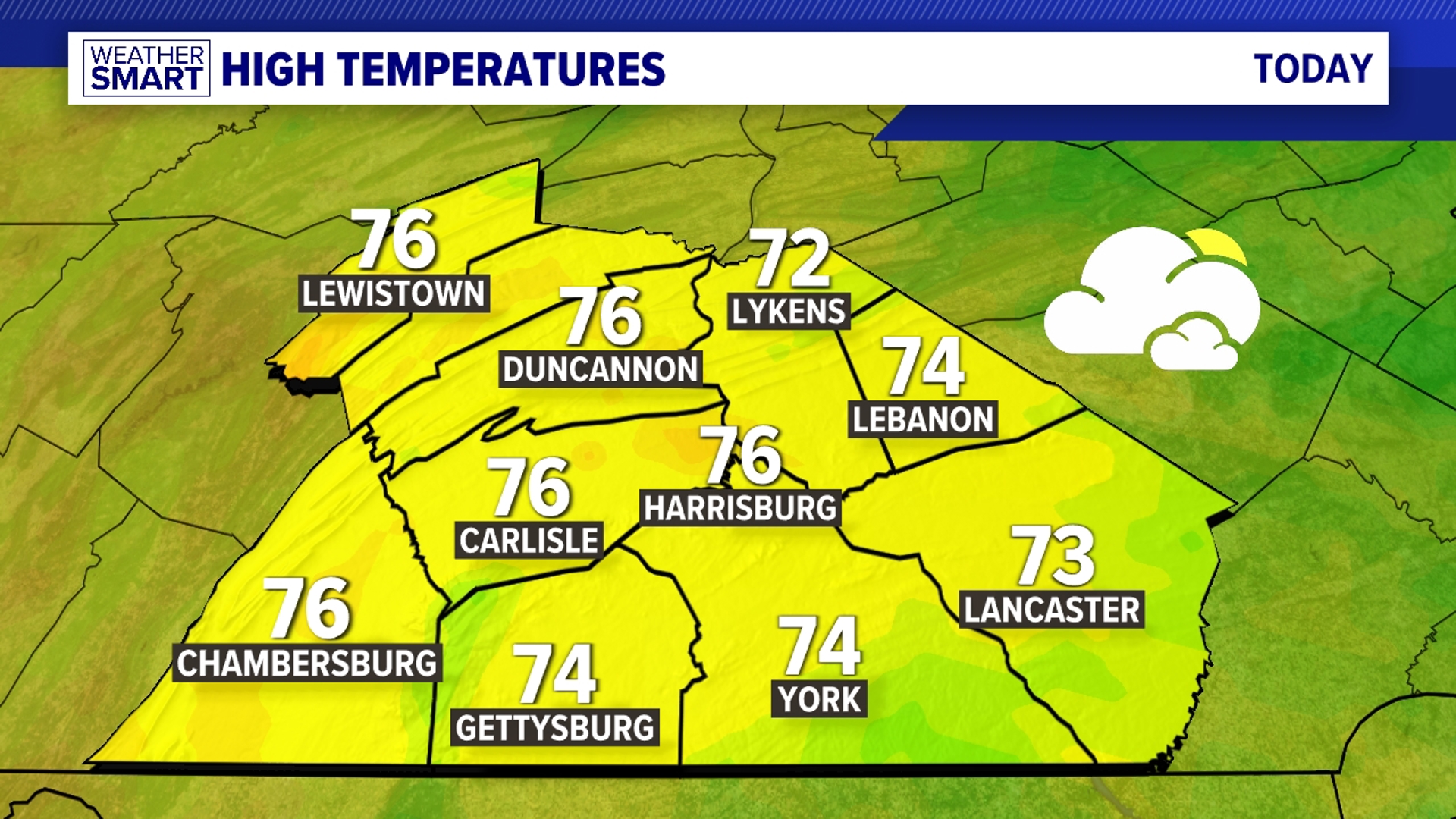

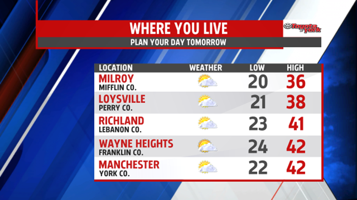
A BIT MILDER: High pressure currently in control of the weather helps keep conditions dry moving through the end of the week. Tonight, lighter winds keep the wind chill factor in check. Temperatures are not nearly as cold, falling into the 20s. A mixture of sunshine and clouds is expected for Thursday. It’s a bit milder too, with many spots exceeding the 40 degree mark.

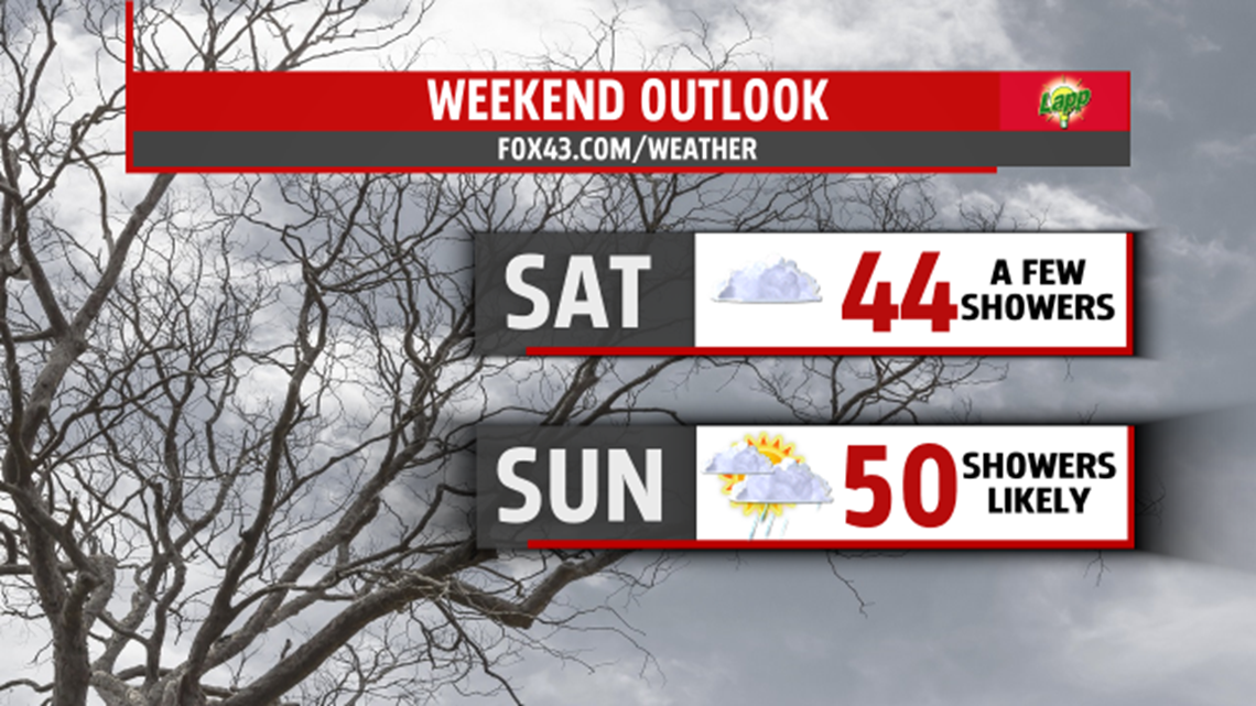
UNSETTLED WEEKEND: Friday, clouds thicken quickly as our next system approaches. It’s still a fairly mild day, with highs in the upper 30s to lower 40s. A few evening showers are possible, but most should stay dry. We’ll be monitoring temperatures very early Saturday morning. Some pockets of drizzle, and therefore freezing drizzle, are not out of the question with a few light showers. Temperatures quickly rise Saturday morning, so this isn’t an issue for too long. Skies remain clouds with a few showers possible. Highs are in the lower to middle 40s. Sunday brings a better chance for more widespread showers. Readings are even milder, with numbers rising to near 50 degrees.
ANOTHER COLD BURST: Another cold push of arctic air moves in early next week. The first comes through Monday, bringing partly sunny skies. Temperatures are near the freezing mark. Tuesday’s skies are still partly sunny, and temperatures are a couple degrees milder. The second burst rolls through Wednesday, and this keeps temperatures near the 30 degree mark. Skies are mostly cloudy, with some flurries possible.
Have a great night!