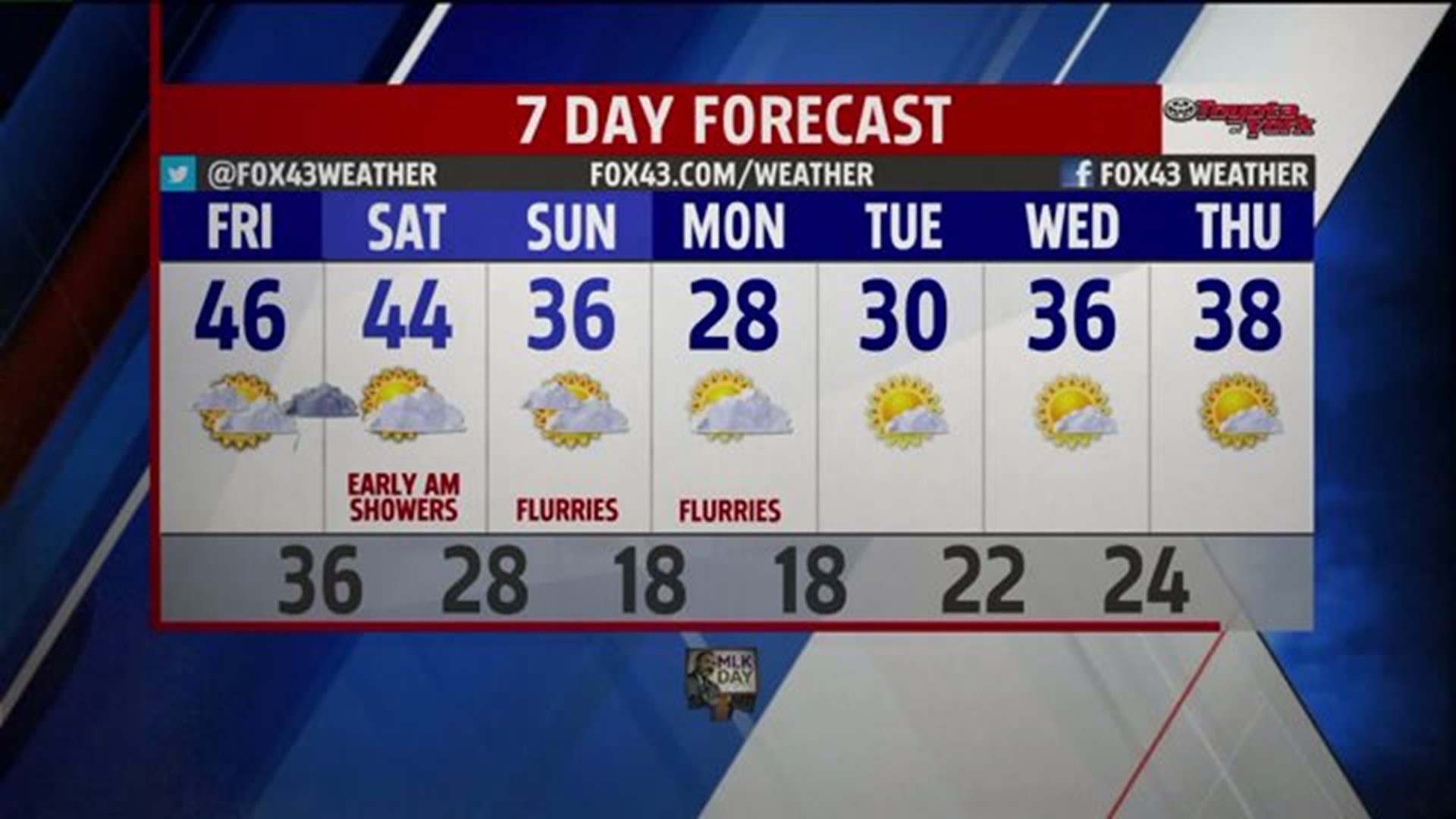
MILD COUPLE OF DAYS
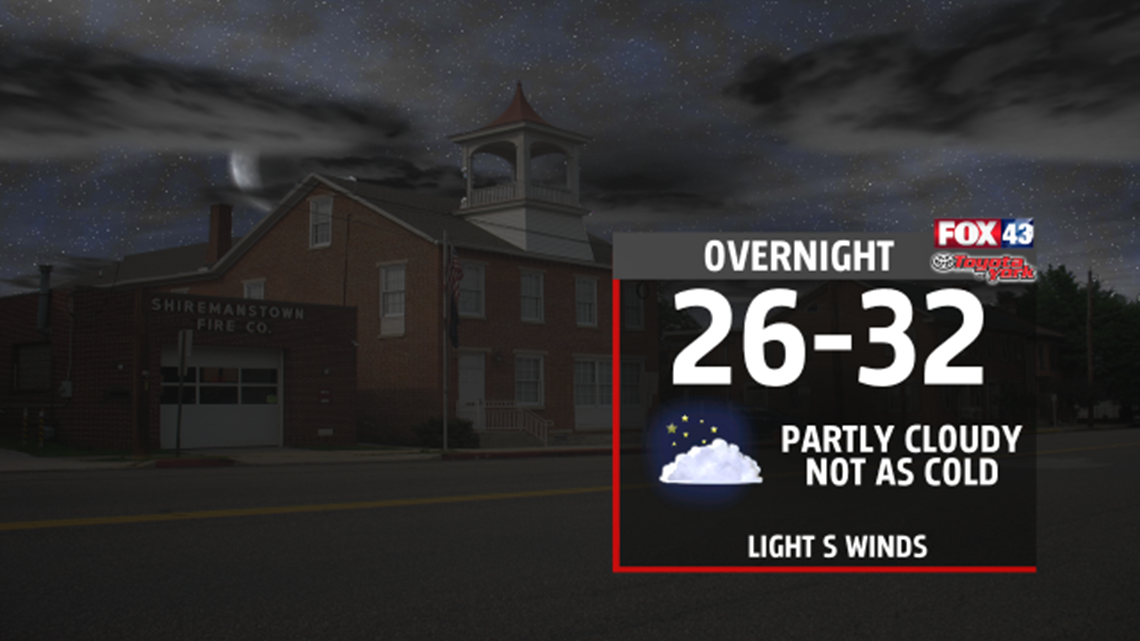
Temperatures stay mild in the 40s before a cold front followed by colder air brings the chill back. Tonight, skies are partly cloudy and not as cold with lows near 30 by morning.

Clouds will increase through the day, despite that, temperatures will warm to the mid 40s thanks to a southerly wind. The flow shifts more to the southeast, as an area of low pressure slides northeast along the coastline through the day late day hours. It will help to spread showers across the area towards late evening.

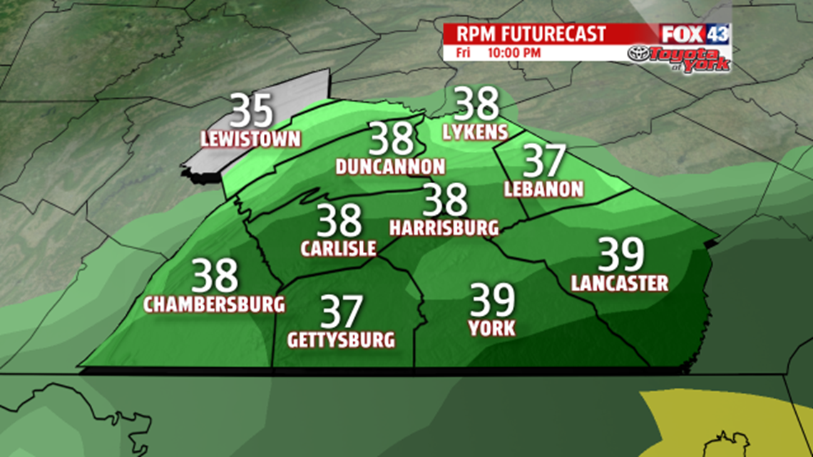
Temperatures should remain warm enough for precipitation to remain rain; however, some higher elevated areas in the mountains may experience a brief period freezing rain. The chance remains on the low side. Rain showers should exit early Saturday morning as the front sweeps east and off the coast. Sunshine will break out mixing with the clouds, winds will pick up pulling in colder air but we should see temps once again in the low to mid 40s before the chilly air sets in for the second half of the weekend. Highs will remain in the 30s. With the cold flow over the Great Lakes, we could see Lake Effect snow flurries or light snow showers. As of now, they are not a concern.
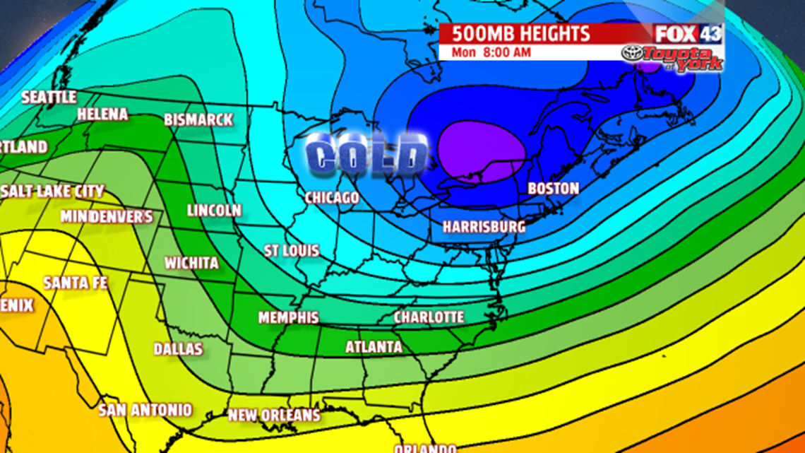
ARCTIC AIR RETURNS
Arctic high pressure slides south from Canada across the center portion of the United States. The flow will remain out of the north-northwest aiding in keeping the cold air in place into early next week. Morning lows return to the teens, while afternoon highs struggle through the 20s. Dry weather is expected with a warming trend later in the week.