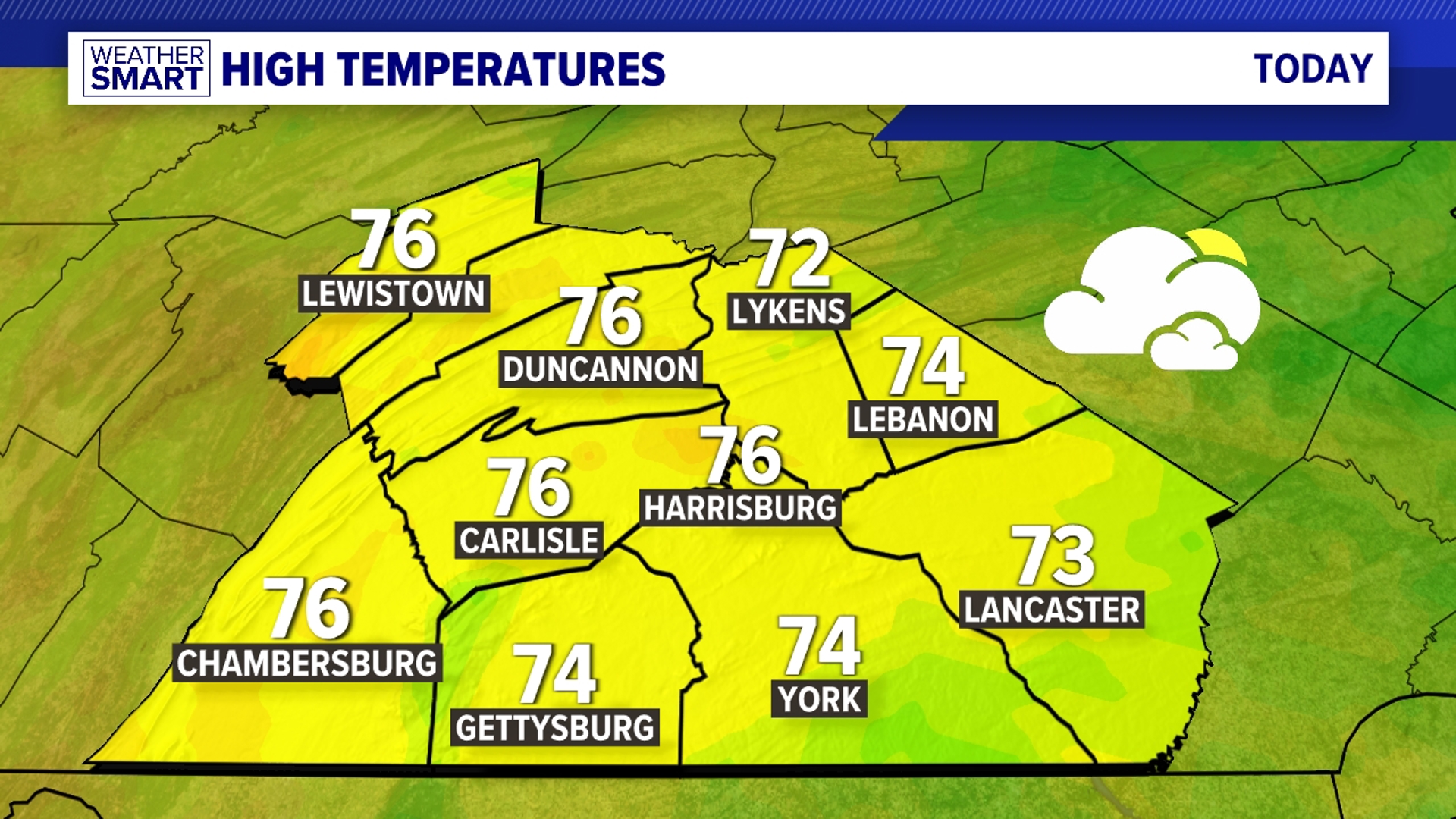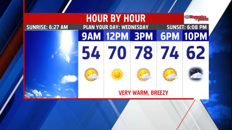


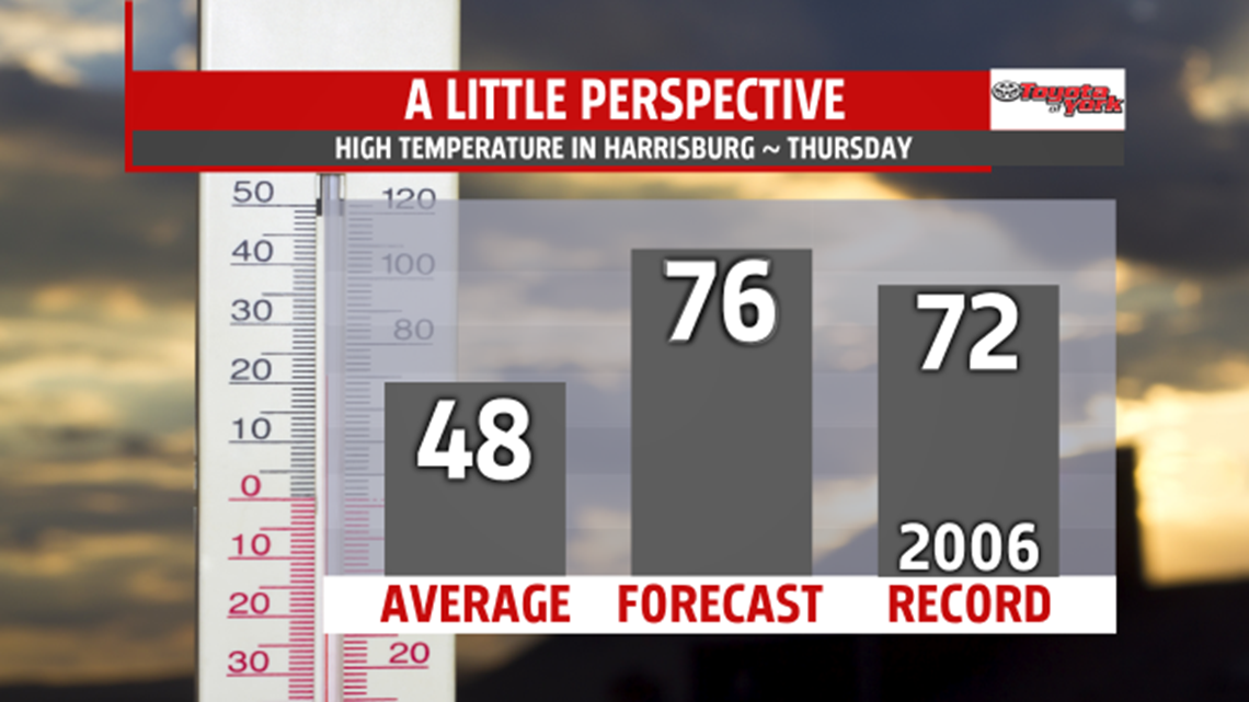
MORE SPRING FEVER: High pressure dominates has taken full control of the weather, bringing more of a late spring feel as opposed to late winter feel. After a mild start, more unseasonable warmth is on the way! Highs jump well into the 70s on Wednesday with plenty of sunshine. We could come close to tying record high temperatures! Through the night, skies become partly cloudy, and it remains very mild. Overnight temperatures are warmer than average high temperatures, with numbers in the upper 40s to middle 50s. Our next cold front edges closer to the region on Thursday, but showers should hold off until the night. Temperatures are in the 70s once more despite thickening clouds.


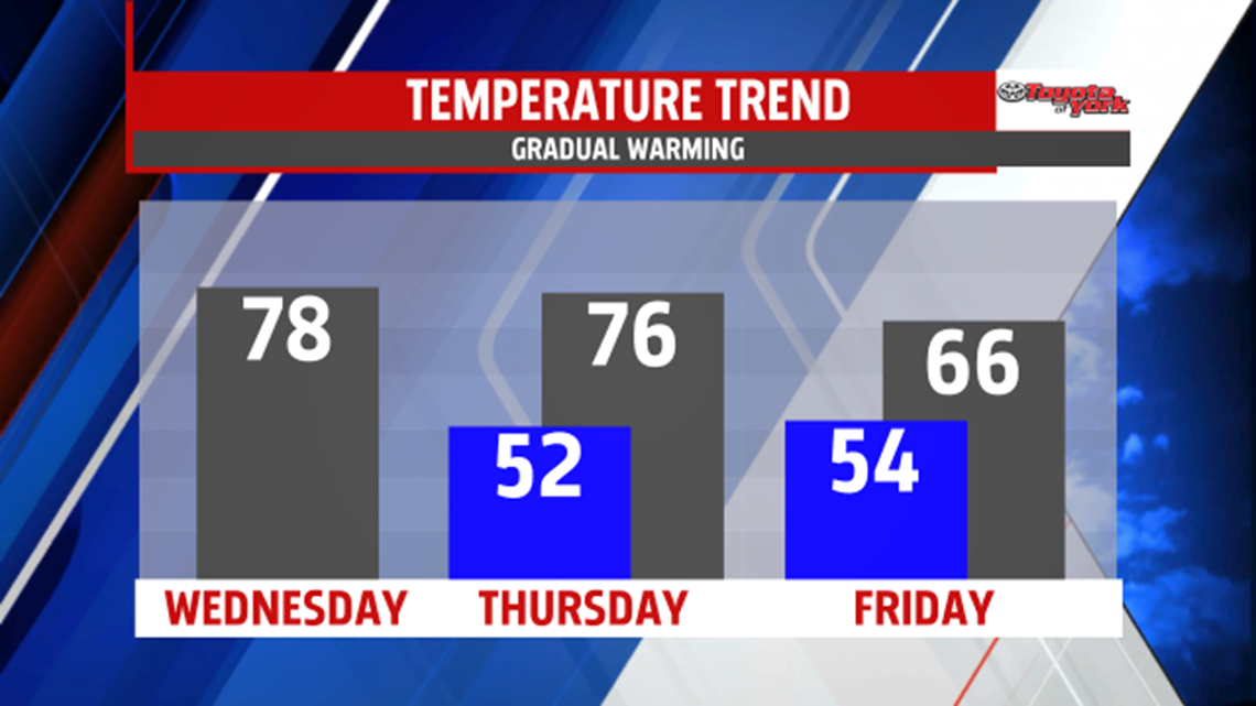
NEXT WEEK: Monday showers could linger, with temperatures remaining above average. Showers could linger into early Tuesday, and skies should dry out by the afternoon. Highs should still be well above average, with readings in the lower 60s.
Have a great Wednesday!