

GET READY FOR WET WEATHER
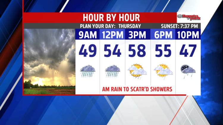
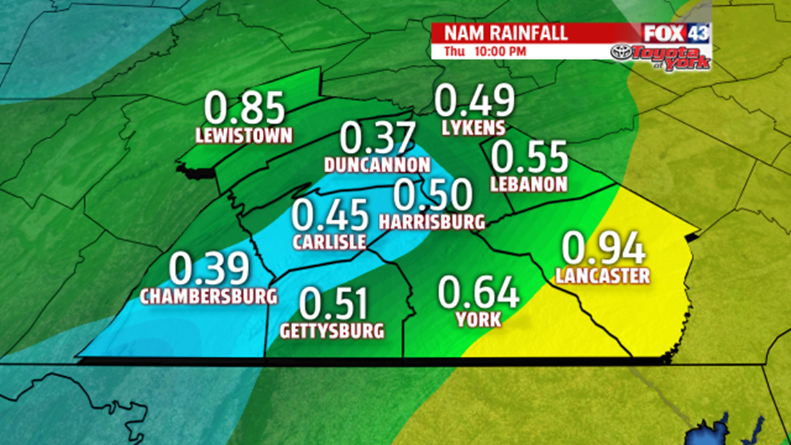
A Cold front slides east spreading showers into the region overnight towards morning. Rain picks up in intensity during the latter part of the morning drive. The clouds and showers moving in will keep morning lows in the 40s. Rain tapers to scattered showers during the afternoon. With the break in showers during the afternoon, it is possible some areas could sneak to 60 degrees. Most areas see highs in the upper 50s. Rainfall will amount on average to .50”, with isolated higher amounts.

Skies are partly to mostly cloudy Friday but it is drier to end the week. You will notice the chill is back with temperatures only climbing to the middle 40s.
WHERE IS SPRING?
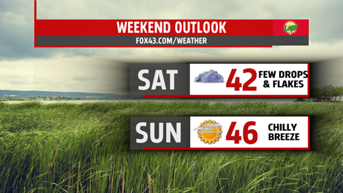
Another cold shot of air blankets the area for the weekend. Temperatures continue well below seasonal averages. A fast moving disturbance brings plenty of clouds and perhaps a few drops or flakes for Saturday. High temperatures are brisk in the upper 30s to near 40 degrees. Sunday is not much warmer but with more sunshine, highs should climb to the middle 40s. A mixture of clouds and sunshine is expected Monday as a warm front sweeps north through the area. We’ll begin the week with milder temperatures in the 50s. There is a chance for a few late day showers, but the greater threat arrives Tuesday with a cold front.

Stay with FOX43 Weather for updated changes to the forecast through the rest of the week!
Have a good day!
MaryEllen Pann,
Chief Meteorologist
