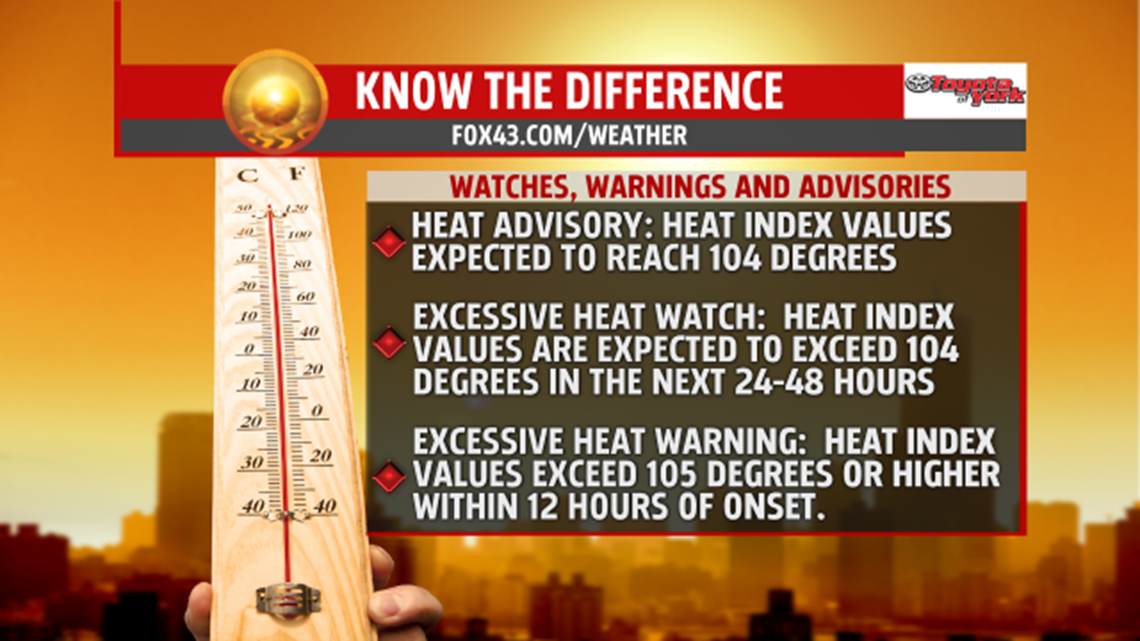
DANGEROUS HEAT CONDITIONS POSSIBLE

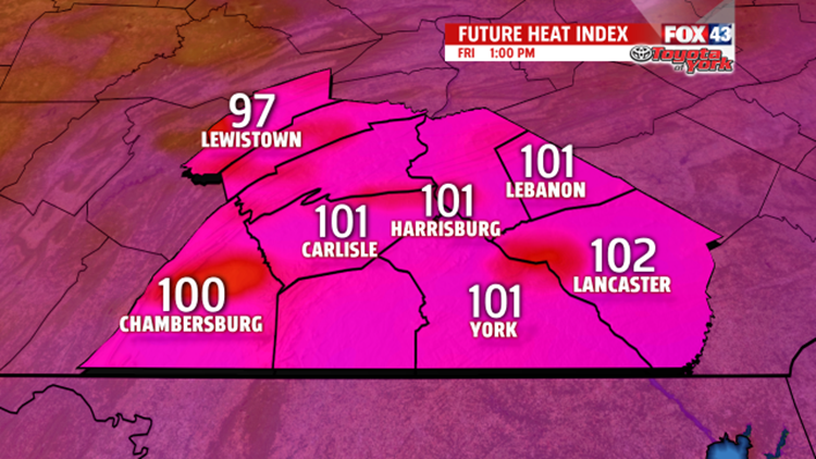
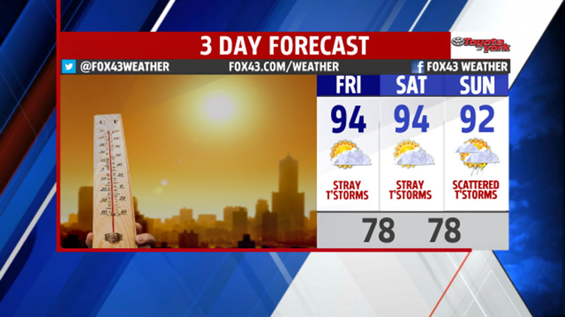
Friday, it is even hotter with highs in the lower to middle 90s. Heat indices approach 100 degrees or higher. If you work outside, or plan on being out for long periods of time, be sure to take breaks from the excessive conditions. Stay hydrated with plenty of water.

WEEKEND OUTLOOK:
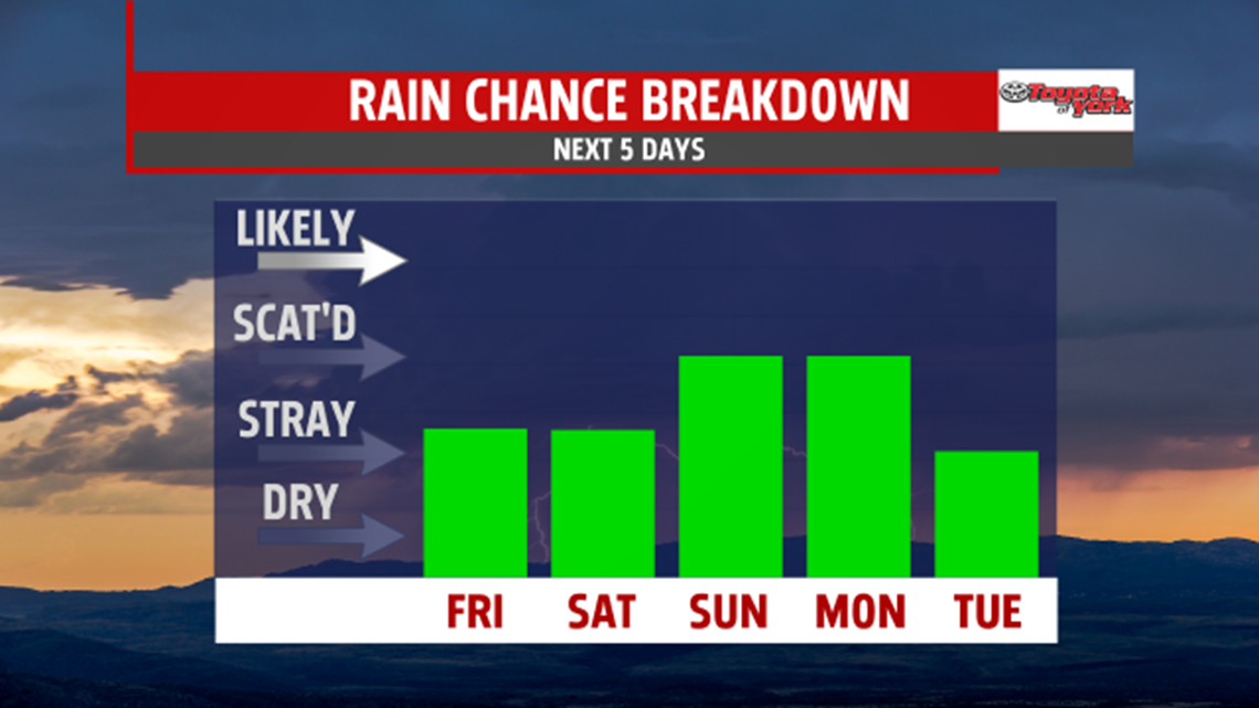
The extreme heat and humidity lingers into the weekend, especially Saturday. the hottest of the two days. A few showers and thunderstorms are possible, however, most remain dry under partly sunny skies. With an approaching cold front, more widespread showers and thunderstorms are likely Sunday. Highs still manage to reach 90 degrees.

NEXT WEEK:
The front is slowing down so the threat for showers and thunderstorms continues next week through Wednesday. Coverage is expected to be isolated to a few Monday through Wednesday. Highs are near 90 to begin the week but fall back to the 80s beyond Tuesday. The humidity is knocked down too.
Stay with FOX43 Weather for updated changes to the forecast through the rest of the week!
Have a good day!
MaryEllen Pann,
Chief Meteorologist