

WARM & HUMID A FEW MORE DAYS
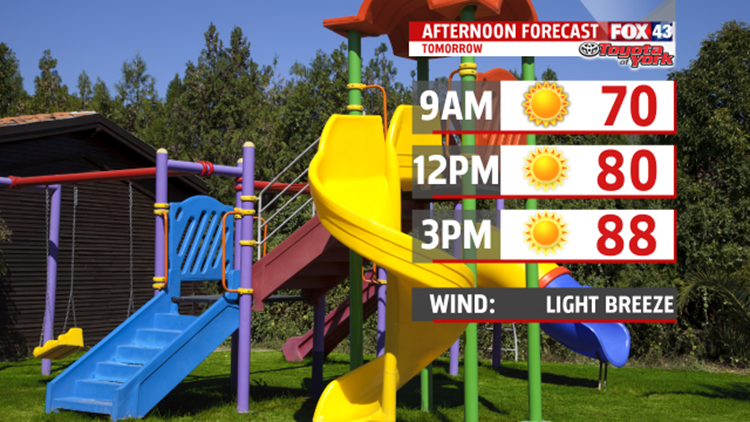
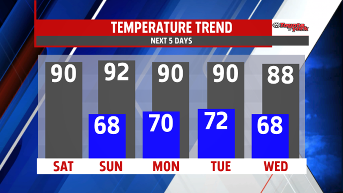
A couple of cold fronts will slowly knock temperatures and humidity down by the end of the week. The first front came through this afternoon. It has helped to knock the humidity down, and keeps temperatures in the 80s, under abundant sunshine for Tuesday. A stronger front followed by an upper-level pattern change Wednesday night will bring a much welcome change to the heat and humidity. Highs mid-week warm back up to near 90. An isolated shower or thunderstorm during the afternoon is possible but there is a better chance for a few showers and thunderstorms through the evening. Some showers may still be possible overnight until the front crosses the area in the early morning hours Thursday.

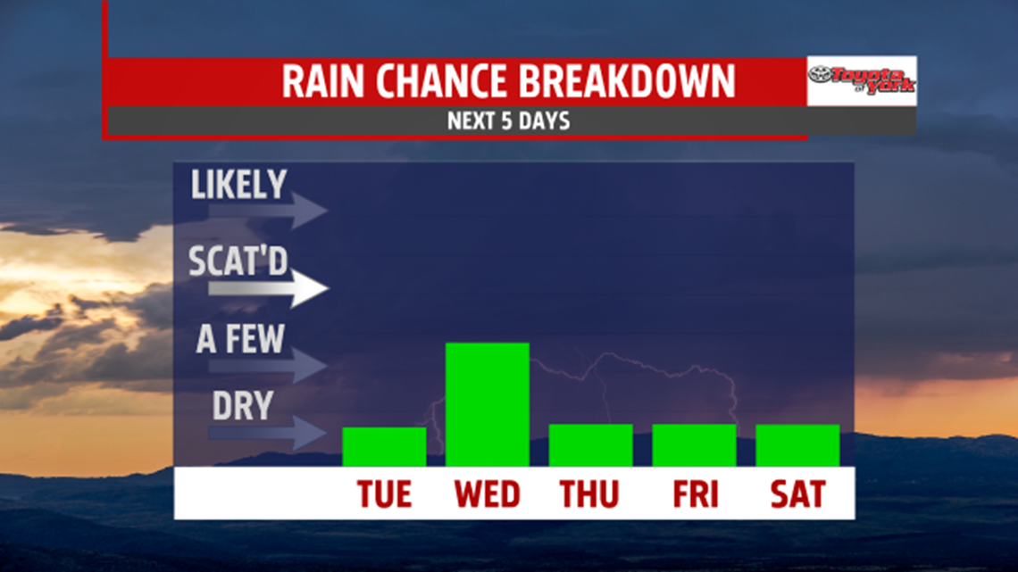
Heading into Thursday, and the first day of September, temperatures are noticeably cooler with partly sunny skies. The air is more comfortable too. Friday many spots see morning lows in the 50s with highs in the upper 70s to near 80 degrees. Plenty of sunshine expected too. Our cool down is brief as temperatures start to warm back up. The humidity sneaks back into the picture too.

LABOR DAY WEEKEND
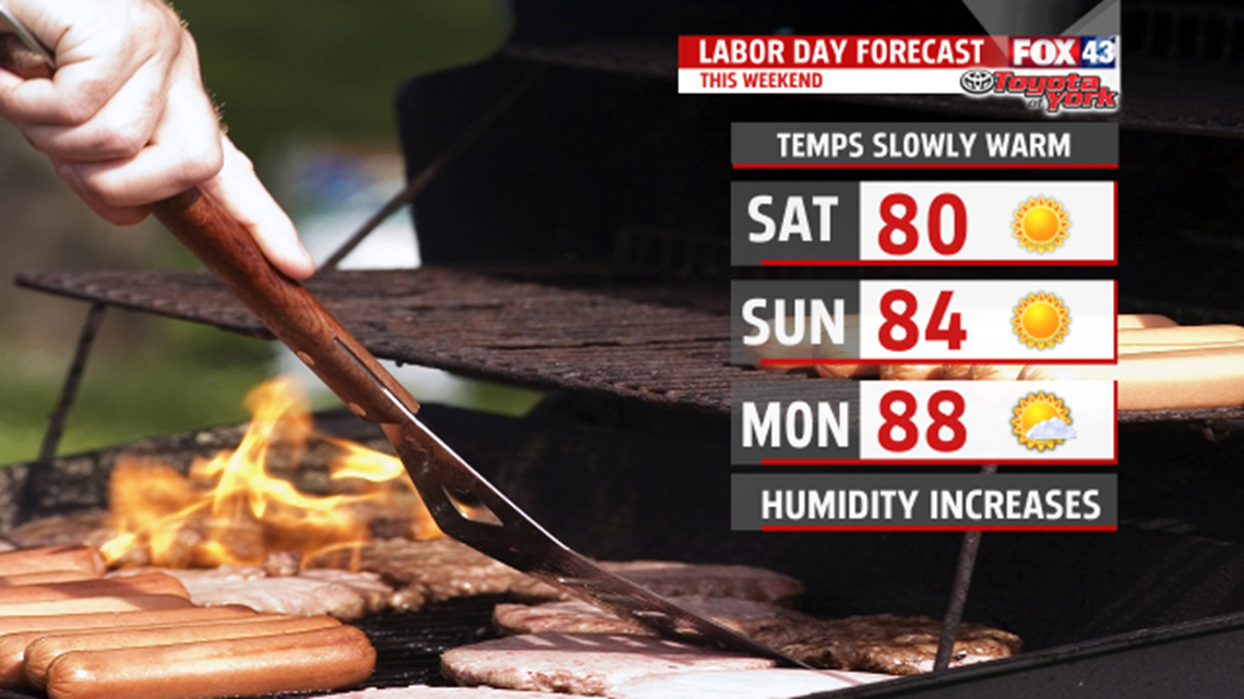
As of now, the weekend looks dry but we are keeping a close eye on the tropics. Models indicate a small chance something could ride up the coast late in the holiday weekend. For now, most models are on board with dry conditions. Highs are seasonable in the lower 80s Saturday under mostly sunny skies. Winds shift as high-pressure slides east. This means a warmer second half of the weekend in the middle 80s. Expect Upper 80s for Labor Day, and you’ll notice the humidity too.

WATCHING THE TROPICS
Some of the modeling is projecting tropical development along the U.S. Coastline. Where is still in question but indications are for a system to track out of the gulf coast region across the southeast states then up the northeast coast. Be sure to watch the forecast in the coming days. We’ll keep you posted with Facebook and Twitter updates.
Stay with FOX43 Weather for updated changes to the forecast through the rest of the week!
Have a good day!
MaryEllen Pann,
Chief Meteorologist
