SUNSHINE DECREASES AFTER TOMORROW

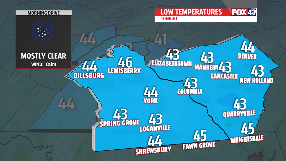
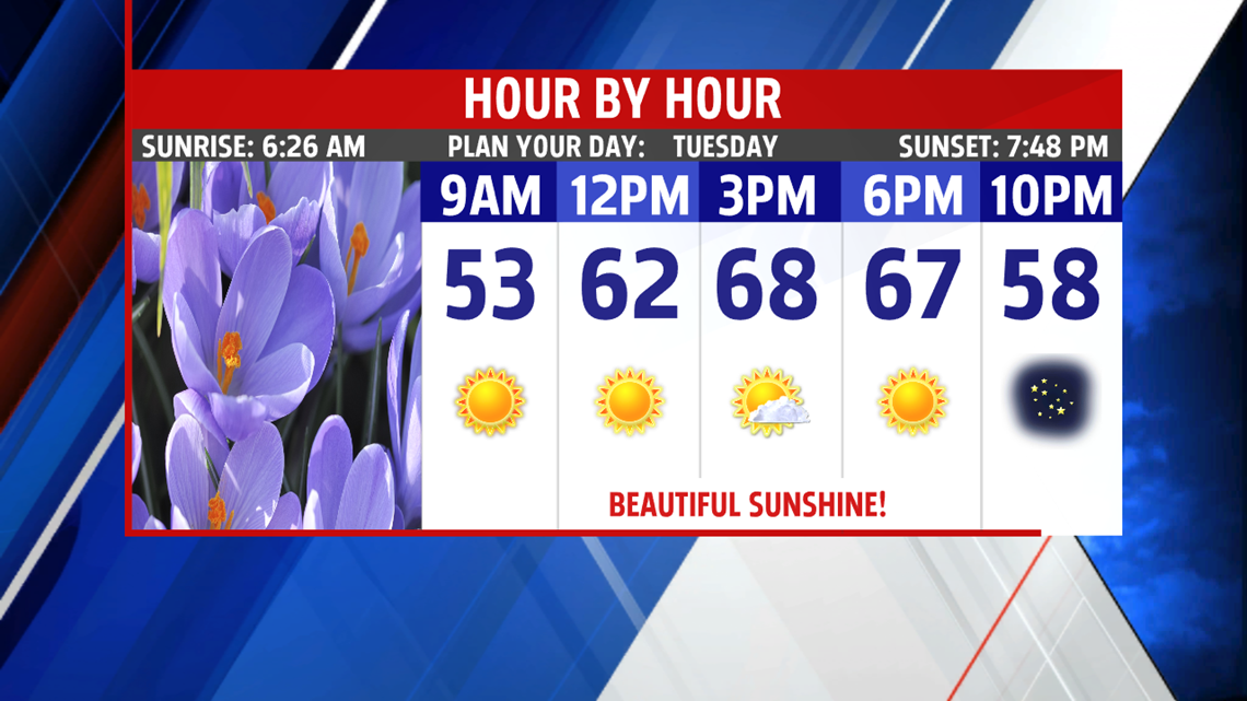
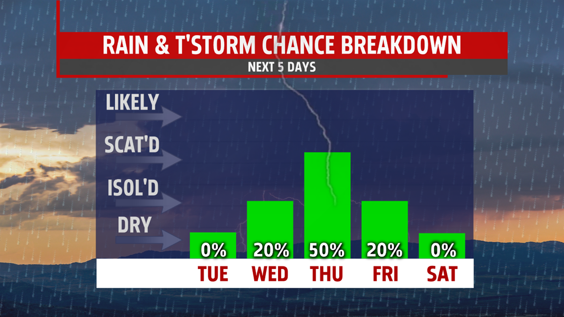
Tuesday is the best day of the next several days. Morning lows begin 20 degrees cooler in the 40s than Monday morning. Under mostly sunny skies, high temperatures are mild in the upper 60s to near 70 degrees. Clouds increase late and thicken and a few drops may fall as early as the late night hours. Few more showers are possible on and off through the day Wednesday. With the added clouds and easterly flow,

temperatures are held in the 50s to near 60 degrees. Morning lows the next couple of days are mild in the 50s. Showers are possible again Thursday but we get a break mid-day, which allows temperatures to jump into the lower and middle 70s, then wet weather returns during the evening. Rain picks up overnight into the rush hour Friday before exiting the area. We are drying out the rest of the day with breezy winds out of the northwest. Readings are mild in the lower 70s because of a warmer start . Clouds continue to clear leading to more seasonable lows in the 40s heading into the weekend.

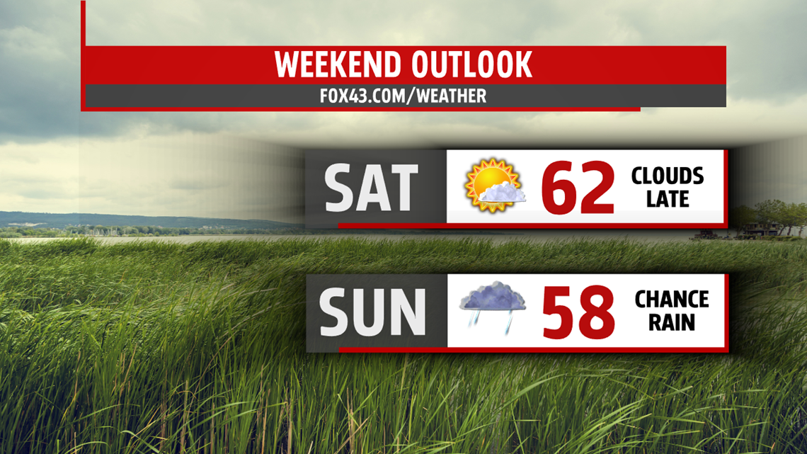
WEEKEND OUTLOOK
Saturday is the best of the two days with dry conditions. Skies are clouding up as the day wears on. After a cool morning, readings climb to the lower 60s. Rain ramps up overnight period. Sunday, rain continues on and off through the day. Temperatures are held in the 50s. Rain threat lingers into very early Monday but should exit by the morning drive time. The rest of the day, clouds are decreasing producing plenty of afternoon sunshine and highs in the lower 60s.

Be “Weather Smart” and watch FOX43 for all your weather and news updates.
MaryEllen Pann,
Chief Meteorologist