HAZY, HOT, AND HUMID

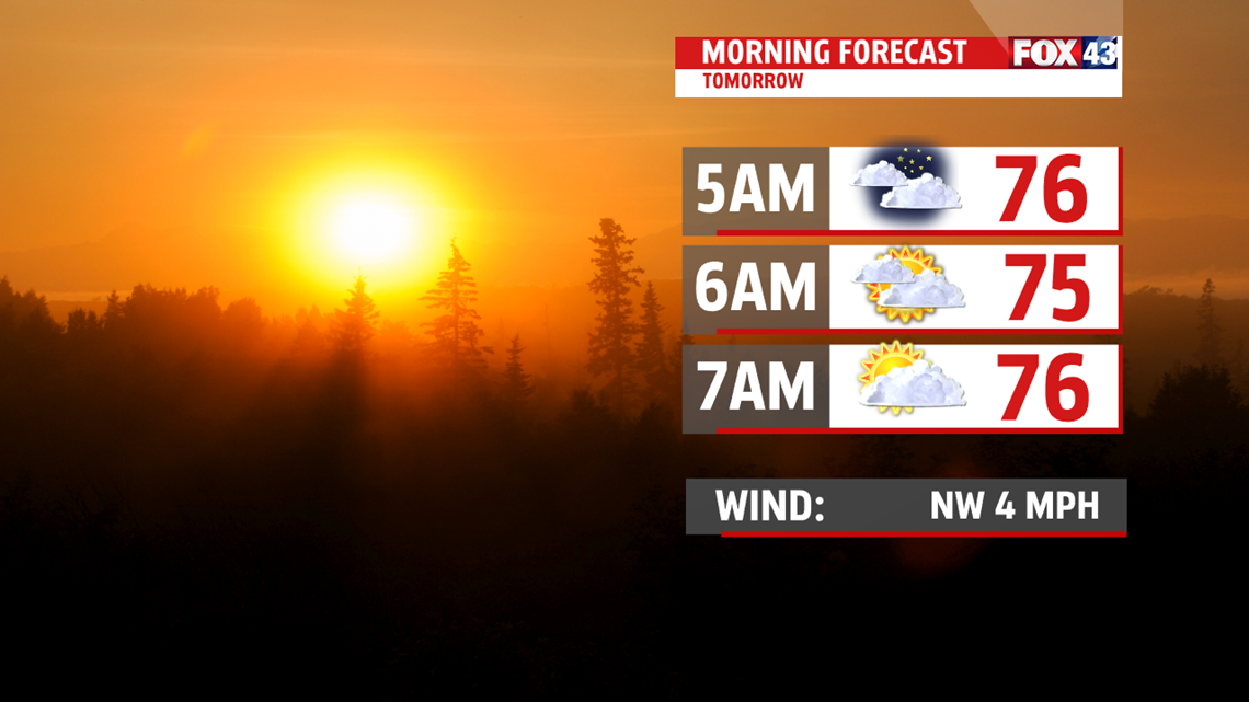
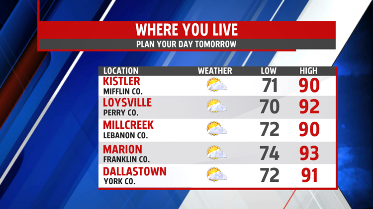
This evening, as a cold front drops in, an isolated shower or thunderstorm is possible. Temperatures are quite warm in the 80s before dropping overnight into the upper 60s and lower 70s. It’s another very hot day in the lower 90s, with heat indices in the middle and upper 90s. During the hottest part of the day, a few

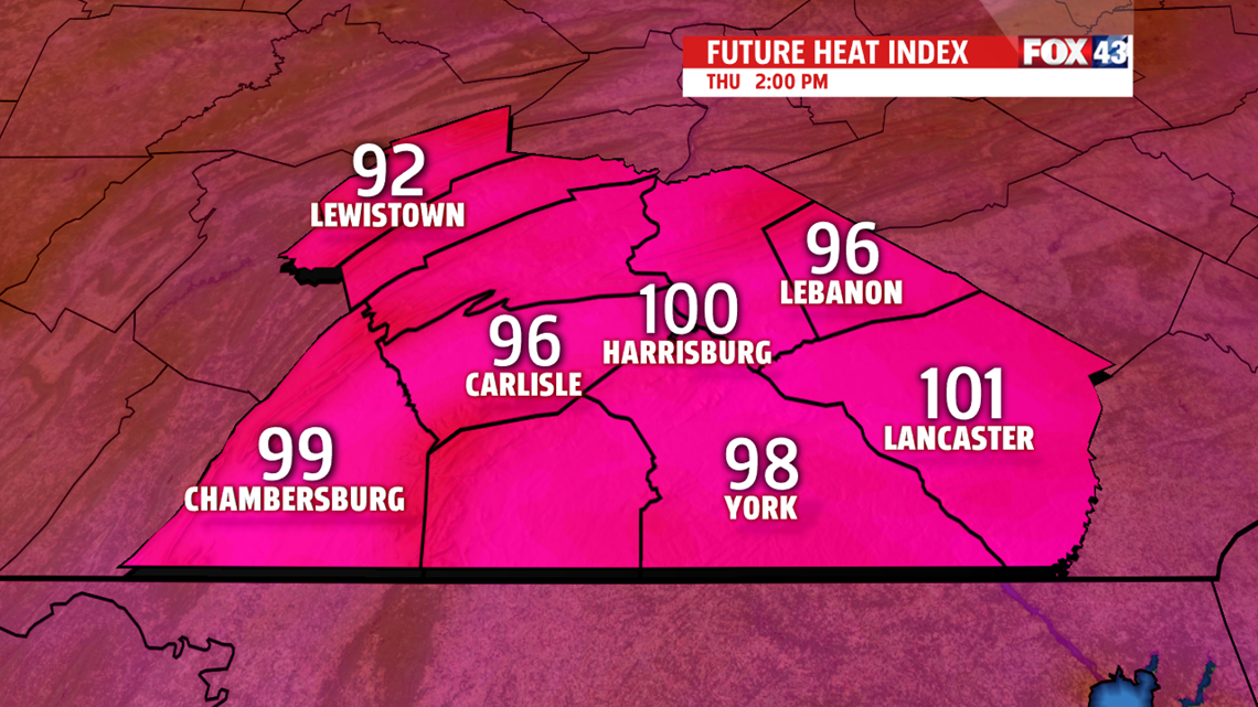
spots near 100 degrees. Be sure to keep an eye on children and the elderly. Remind them to drink plenty of water to keep them hydrated. Also, folks with pre-existing health issues need to take it easy if outdoors. A stray shower or thunderstorm remains too.
STRONG STORMS FOR THE WEEKEND

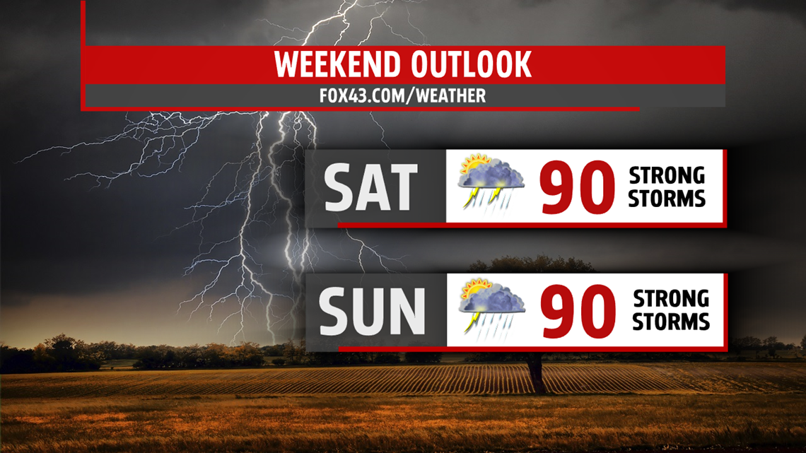
While not as hot, temperatures still flirt with 90 degrees both Saturday and Sunday. With a cold front inching closer, our threat for showers and thunderstorms increases. Right now we are outlooked Saturday in a SLIGHT risk, which is a 2 on a scale of 1-5. Main threats are damaging winds greater than 60mph, hail a quarter size or larger and torrential

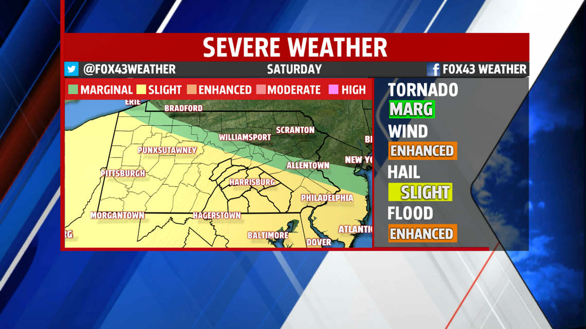
downpours, which may lead to flooding on small creeks or streams and low lying areas or roadways. While we are not outlooked just yet, the best chance for severe weather appears to be Sunday. Just be sure to keep a watchful eye on the forecast. We’ll have to watch for severe weather both days. Plan on the sweaty conditions to continue as our break from the humidity doesn’t arrive until after Monday.
NEXT WEEK
A few showers and thunderstorms are still likely to begin the week. You’ll feel the heat and humidity is still around too. Readings are warm in the upper 80s to near 90 degrees, however, by Tuesday, an area of high pressure brings a couple of nice days. Temperatures fall back to the lower and middle 80s, and drier air works in lowering the humidity.
Stay “Weather Smart” with the FOX43 Weather team!
Have a good day!
MaryEllen Pann,
Chief Meteorologist