

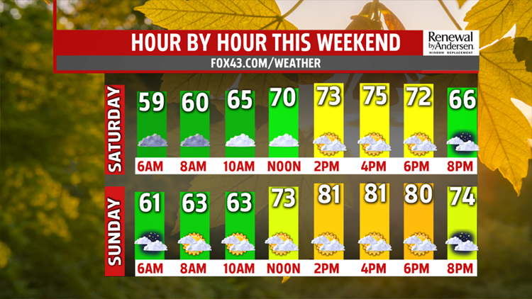


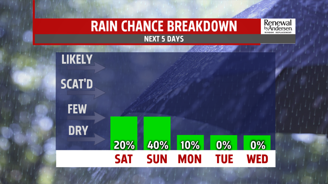
the southwest and pick up, pulling in a much warmer and more humid air mass. Readings jump to the upper 70s, with a few spots hitting the lower 80s, despite partly to mostly cloudy skies. A potent cold front comes rushing in late evening bringing a few showers. Most of the day is dry with a chunk of the showers falling in the overnight period. The system is followed by much cooler, more seasonable air.
FALL STRETCH
A beautiful looking week is ahead next week. Monday is breezy with partly sunny skies and falling temperatures. The high of the day is just after midnight in the middle 60s. By afternoon, readings are barely touching 60 degrees. Skies clear, winds relax leading to a chilly morning in the lower 40s Tuesday. Plenty of sunshine for several days is expected, as high pressure builds in, keeping dry weather around. Afternoon highs are in the lower 60s. They slowly warm back up, through the week, into the middle and upper 60s. By Thursday, we are in the lower 70s with sunshine and dry weather continuing into Friday.


Stay “Weather Smart” all week long with the FOX43 Weather team!
Have a good day!
MaryEllen Pann,
Chief Meteorologist
